
Asia According to the Sieur D'Anville Divided into its Empires, Kingdoms and States Showing the Eu...
- 人物
- 時間

Asia divided into its principall regions in which may be seen the extent of the empires, monarchies, kingdom...
イェール大学図書館
イェール大学図書館デジタルコレクション
Asia divided into its principall regions in which may be seen the extent of the empires, monarchies, kingdoms and states which at present divide Asia / described by Sanson ; corrected and amended by William Berry
オーストラリア国立図書館
オーストラリア国立図書館Trove
The empire of Japan divided into seven principal parts and subdivided into six kingdoms with the k...
ポルトガル国立図書館
ヨーロピアナAPI
Asia and its islands according to Danville : divided into empires, kingdoms, states, regions &ca. with the European possessions and settlements in the East Indies and an exact delineation of all the discoveries made in the Eastern parts by the English under Captn. Cook
ニューサウスウェールズ州立図書館
オーストラリア国立図書館Trove

The Empire of Japan divided into seven principal parts and subdivided into sixty-six kingdoms; wit...
スタンフォード大学図書館
スタンフォード大学図書館SearchWorks
The Empire of Japan : divided into seven principal parts and subdivided into sixty six Kingdoms : ...
Biblioteca Virtual del Ministerio de Defensa
ヨーロピアナAPI

The Empire of Japan Divided into Seven Principal Parts and Subdivided ino Sixty Six Kingdoms; with...
スタンフォード大学図書館
スタンフォード大学図書館SearchWorks
The Empire of Japan divided into seven principal parts and subdivided into sixty six kingdoms : wi...
アムステルダム自由大学図書館
ヨーロピアナAPI

ASIA Divided into its Principal STATES and REGIONS;with ALL THE ISLAND and THE NEW DISCOVERIES(アジア図)
福岡市博物館
福岡市博物館収蔵品データベース

China divided into its Great Provinces, and The Isle of Japan . . . 1774
スタンフォード大学図書館
スタンフォード大学図書館SearchWorks

China divided into its great provinces and the Isles of Japan by Samuel Dunn
イェール大学図書館
イェール大学図書館デジタルコレクション

China, divided into its great provinces, and the Isles of Japan
ニューヨーク公共図書館地図部門
DPLA API
China Divided into its Great Provinces and the Isles of Japan [Material cartográfico]
スペイン国立図書館
ヨーロピアナAPI
Asia with its islands and different regions : according to their modern divisions ; also the discoveries made by Capt. Cook
オーストラリア国立図書館
オーストラリア国立図書館Trove

Map Of Asia Showing its Gt. Political Divisions, and also the Various Routes of Travel Between Lon...
スタンフォード大学図書館
スタンフォード大学図書館SearchWorks

Map Of Asia Showing its Gt. Political Divisions, and also the Various Routes of Travel Between Lon...
スタンフォード大学図書館
スタンフォード大学図書館SearchWorks

Map of Asia showing its gt. political divisions, and also the various routes of travel between Lon...
スタンフォード大学図書館
スタンフォード大学図書館SearchWorks

Map of Asia showing its gt. political divisions, and also the various routes of travel between Lon...
スタンフォード大学図書館
スタンフォード大学図書館SearchWorks

Map of Asia showing its gt. political divisions, and also the various routes of travel between Lon...
スタンフォード大学図書館
スタンフォード大学図書館SearchWorks

Map of Asia Showing its Gt. Political Divisions, and, also, the Various routes of Travel Between L...
スタンフォード大学図書館
スタンフォード大学図書館SearchWorks

Northwestern America Showing The Territory Ceded By Russia To The United States Compiled For The D...
スタンフォード大学図書館
スタンフォード大学図書館SearchWorks
A new map of the empires, states, provinces &c of Asia : including also the Turkish & Russian dominions in Europe & New Holland / compiled from the most authentic observations by Robert Wilkinson ; Walsh script. ; W. Palmer sculpt
オーストラリア国立図書館
オーストラリア国立図書館Trove
To the Right Honourable William, Lord Cowper, Lord High Chancellor of Great Britain, this map of Asia : according to ye newest and most exact observations is most humbly dedicated / by your Lordship's most humble servant, Herman Moll, geographer
オーストラリア国立図書館
オーストラリア国立図書館Trove
A new mapp of y Empire of China : with its several provinces or kingdomes together w.th [i.e. with] the adjacent Isles of Iapon or Niphon, Formosa, Hainan, etc. / rendred into English & enlarged w.th the Isles of Iapon by Rich. [i.e. Richard] Blome by his Majesties command ; W. Hollar fecit 1669
オーストラリア国立図書館
オーストラリア国立図書館Trove

L'Asie ou sont exactement decrites toutes les Costes de la Mer, suivant les dernieres navigations,...
スタンフォード大学図書館
スタンフォード大学図書館SearchWorks

Mappemonde ou Carte Reduite Des Parties Connues Du Globe Pour servir au Voyage de La Perouse …. 17...
スタンフォード大学図書館
スタンフォード大学図書館SearchWorks

Seconde Partie De la Carte D'Asie Contenant La Chine et partie de la Tartarie, L'Inde au dela du G...
スタンフォード大学図書館
スタンフォード大学図書館SearchWorks

Paskaerte Zynde t'Oosterdeel Van Oost Indien, met alle de Eylanden daer ontrendt geleegen van C.Co...
スタンフォード大学図書館
スタンフォード大学図書館SearchWorks

Carte Reduite De L'Ocean Septentrional compris entre l'Asie et l'Amerique Suivant les Decouvertes ...
スタンフォード大学図書館
スタンフォード大学図書館SearchWorks
A new & accurate map of Asia : drawn from the most approved modern maps & charts / by Thos. Bowen ; engraved for Middletons complete system of geography
オーストラリア国立図書館
オーストラリア国立図書館Trove

Maris Pacifici quod vulgo Mar del Zud
スタンフォード大学図書館
スタンフォード大学図書館SearchWorks
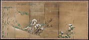
狩野山卜筆四季花鳥図屏風
メトロポリタン美術館
メトロポリタン美術館オープンアクセスCSV
A new map of the empires, states, provinces &c of Asia : including also the Turkish & Russian dominions in Europe & New Holland / compiled from the most authentic observations by Robert Wilkinson ; Walsh script. ; W. Palmer sculpt
オーストラリア国立図書館
オーストラリア国立図書館Trove

Carte Des Indes et de la Chine Dressee sur plusieurs Relations particulieres Rectifees par quelque...
スタンフォード大学図書館
スタンフォード大学図書館SearchWorks

Il Regno Della China detto presentamente Catay e Mangin . . . 1682
スタンフォード大学図書館
スタンフォード大学図書館SearchWorks

佐賀県管内全図(表)
佐賀県立図書館
IIIF Discovery in Japan

Carte Reduite De L'Ocean Septentrional compris entre l'Asie et l'Amerique Suivant les Decouvertes ...
スタンフォード大学図書館
スタンフォード大学図書館SearchWorks

Mer Orientale, où l'on trouve l'isle de Jedso, de laquelle on doutoit si c'étoit une isle ou non
フランス国立図書館
ヨーロピアナAPI
一蝶画譜 : 巻3
メトロポリタン美術館
メトロポリタン美術館デジタルコレクション
隅田川両岸一覧
メトロポリタン美術館
メトロポリタン美術館デジタルコレクション

L'Empire de la Chine d'après l'Atlas Chinois avec les Isles du Japon . .
スタンフォード大学図書館
スタンフォード大学図書館SearchWorks
![[Wolves and winter reeds]](https://tile.loc.gov/storage-services/service/pnp/jpd/02400/02418_150px.jpg)
[Wolves and winter reeds]
アメリカ議会図書館
米議会図書館デジタルコレクション

Tabula Indiae Orientalis et Regnorum Adjacentium J. Van Braam et G. onder de Linden . .
スタンフォード大学図書館
スタンフォード大学図書館SearchWorks

An Accurate Chart of the World, with the New Discoveries; Also a View of the General & Coasting Tr...
スタンフォード大学図書館
スタンフォード大学図書館SearchWorks

Tabula Indiae Orientalis et Regnorum Adjacentium J. Van Braam et G. onder de Linden . .
スタンフォード大学図書館
スタンフォード大学図書館SearchWorks

Carte Reduite De L'Ocean Septentrional compris entre l'Asie et l'Amerique Suivant les Decouvertes ...
スタンフォード大学図書館
スタンフォード大学図書館SearchWorks

A Chart of the Eastermost part of the East Indies and China from Cape Comarin to Japan with the Ad...
スタンフォード大学図書館
スタンフォード大学図書館SearchWorks

佐賀県管内図
佐賀県立図書館
IIIF Discovery in Japan
最終更新日: 2020-04-17
登録日: 2021-09-21