China Divided into its Great Provinces and the Isles of Japan [Material cartográfico]

China, divided into its great provinces, and the Isles of Japan

China divided into its great provinces and the Isles of Japan by Samuel Dunn

China divided into its Great Provinces, and The Isle of Japan . . . 1774
![China and Japan [cartographic material]](https://collections.library.yale.edu/iiif/2/15828553/full/!200,200/0/default.jpg)
China and Japan [cartographic material]
![China and Japan [cartographic material] / compiled from G.S.G.S. 4065 and 2957](https://collections.library.yale.edu/iiif/2/15510764/full/!200,200/0/default.jpg)
China and Japan [cartographic material] / compiled from G.S.G.S. 4065 and 2957
A Chart of the Eastern Ocean from C. Good Hope to the Islands of Japan [Material cartográfico]
The Empire of Japan : divided into seven principal parts and subdivided into sixty six Kingdoms : ...
The empire of Japan divided into seven principal parts and subdivided into six kingdoms with the k...
The Empire of Japan divided into seven principal parts and subdivided into sixty six kingdoms : wi...

The Empire of Japan divided into seven principal parts and subdivided into sixty-six kingdoms; wit...

Asia According to the Sieur D'Anville Divided into its Empires, Kingdoms and States Showing the Eu...

The Empire of Japan Divided into Seven Principal Parts and Subdivided ino Sixty Six Kingdoms; with...

The Sixty-odd Provinces of Japan, a Catalogue of Famous Sites Shown at a Single Glance and Divided into a Game Board

Asia divided into its principall regions in which may be seen the extent of the empires, monarchies, kingdom...
![Japan and adjacent regions of Asia and the Pacific Ocean [cartographic material] / compiled and drawn in the...](https://collections.library.yale.edu/iiif/2/15510875/full/!200,200/0/default.jpg)
Japan and adjacent regions of Asia and the Pacific Ocean [cartographic material] / compiled and drawn in the...
![Japan and adjacent regions of Asia and the Pacific Ocean [cartographic material] / compiled and drawn in the...](https://collections.library.yale.edu/iiif/2/15509964/full/!200,200/0/default.jpg)
Japan and adjacent regions of Asia and the Pacific Ocean [cartographic material] / compiled and drawn in the...
![[Railroads in China, Manchuria, Korea, Japan and the eastern U.S.S.R.] [cartographic material]](https://stacks.stanford.edu/image/iiif/pf710vm7134%2Fpf710vm7134_00_0001/full/!200,200/0/default.jpg)
[Railroads in China, Manchuria, Korea, Japan and the eastern U.S.S.R.] [cartographic material]
![Japan, radiotelephone and radiotelegraph stations [cartographic material] : 1941](https://stacks.stanford.edu/image/iiif/pp234mp0165%2Fpp234mp0165_00_0001/full/!200,200/0/default.jpg)
Japan, radiotelephone and radiotelegraph stations [cartographic material] : 1941
![Map of Manchuria, Corea & Japan [cartographic material]](https://collections.library.yale.edu/iiif/2/15828540/full/!200,200/0/default.jpg)
Map of Manchuria, Corea & Japan [cartographic material]
![Theater of operations, Japan-China War, 1894-5 [cartographic material] / Office of Naval Intelligence, Naval...](https://collections.library.yale.edu/iiif/2/15509952/full/!200,200/0/default.jpg)
Theater of operations, Japan-China War, 1894-5 [cartographic material] / Office of Naval Intelligence, Naval...
Asia and its islands according to Danville : divided into empires, kingdoms, states, regions &ca. with the European possessions and settlements in the East Indies and an exact delineation of all the discoveries made in the Eastern parts by the English under Captn. Cook

Dai Nihon zenzu (The picture of the Great Whole Map of Japan; Provinces in the Japanese Empire, in...
![Iapan I [cartographic material]](https://collections.library.yale.edu/iiif/2/16708254/full/!200,200/0/default.jpg)
Iapan I [cartographic material]
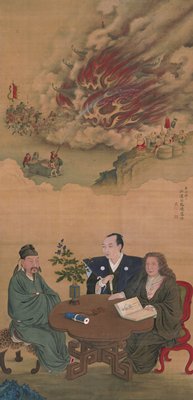
A Meeting of Japan, China, and the West

Nieuwe Kaart van't Keizerryk. Japan na de Nieuste ontdekkingen
![Carte De L'Empire De La Chine . . . An XII [Shows Formosa]](https://stacks.stanford.edu/image/iiif/qv486bn8087%2F18739/full/!200,200/0/default.jpg)
Carte De L'Empire De La Chine . . . An XII [Shows Formosa]
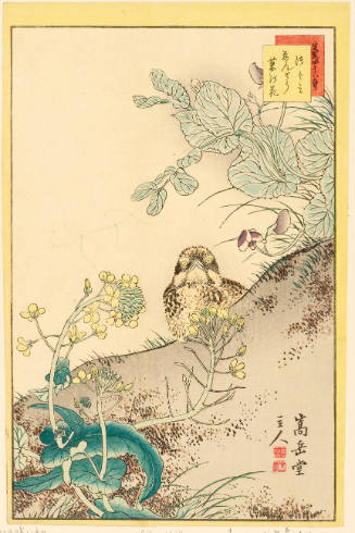
Japanse schildering van roofvogel op tak

L'Empire Du Japon, Tire Des Cartes Des Japonais

China, Contains 15 Subject Provinces, including the 2 Islands of Hainan Formosa and the Tributary ...
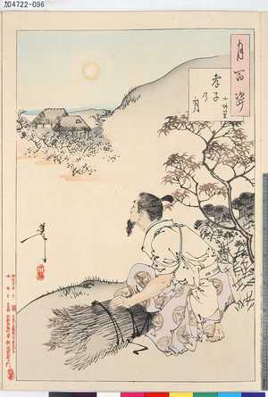
「月百姿」
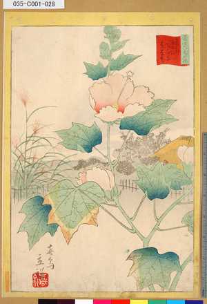
「三十六花撰」「東都隅田川花屋敷芙蓉花」 「廿七」
Charte von JAPAN mit seinen VII Provinzen

Nagasaki
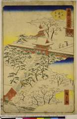
「東都三十六景」「山王権現雪中」

Japan and it's relation to the territory bordering on the Pacific ocean
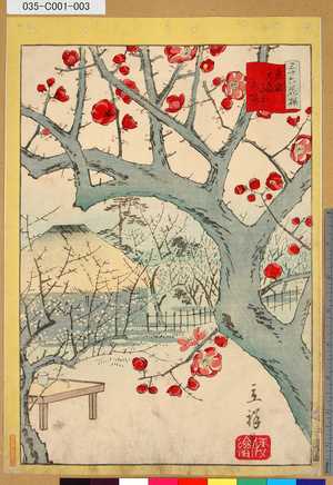
「三十六花撰」 「東京大森山本紅梅」「二」
Thrush, Pea Flowers and Rape Blossoms (Tsugumi Endō Nanohana), series Forty-eight Lifelike Pictures of Birds (生写四十八鷹)
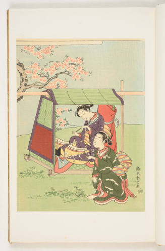
Modern Reproduction of "A Beauty Resting in a Palanquin beneath Cherry Blossoms" (浮世風俗やまと錦絵 錦絵初期時代)

桜花問答; 日本花図絵
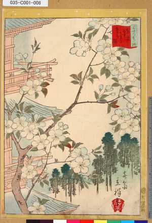
Rekiishi, series Famous Views of Owari Province (尾張名所)

Courtiers and attendants crossing bridge from 36 immortal women poets in printed brocades (Nishikizuri onna sanjūrokkasen)
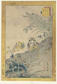
Jonge lijster, bloeiende erwt en koolzaad

Ise monogatari (Series)

Nouvelle Representation Des Cotes Nord et Est De L'Asie, pour servir ... Articles du Supplement de...
![Eastern Asia 1:1,000,000 [cartographic material] : AAF cloth chart. Hakodate. NK54](https://collections.library.yale.edu/iiif/2/15509966/full/!200,200/0/default.jpg)
Eastern Asia 1:1,000,000 [cartographic material] : AAF cloth chart. Hakodate. NK54

佐賀縣管内全圖
「三十六花撰」「東京谷中天王寺あさぎ桜」 「七」
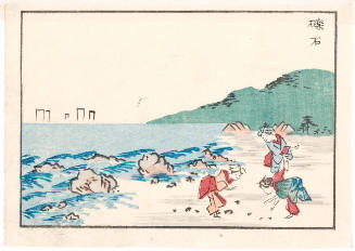
「庄野」
最終更新日:
登録日: 2021-07-27