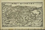
Asia divided into its principall regions in which may be seen the extent of the empires, monarchies, kingdoms and states which at present divide Asia / described by Sanson ; corrected and amended by William Berry
- Time
- Owner Organization

Asia distinguished into its principall parts

Asia According to the Sieur D'Anville Divided into its Empires, Kingdoms and States Showing the Eu...
Asia and its islands according to Danville : divided into empires, kingdoms, states, regions &ca. with the European possessions and settlements in the East Indies and an exact delineation of all the discoveries made in the Eastern parts by the English under Captn. Cook

The Empire of Japan Divided into Seven Principal Parts and Subdivided ino Sixty Six Kingdoms; with...
The empire of Japan divided into seven principal parts and subdivided into six kingdoms with the k...

The Empire of Japan divided into seven principal parts and subdivided into sixty-six kingdoms; wit...

China divided into its great provinces and the Isles of Japan by Samuel Dunn
[East Asia 1:8,000,000] / drawn and reproduced by 512 (A. Fd. Svy.) Coy

Sharpe's Corresponding Maps. South Eastern Asia. Birmah - China - Japan London - Published by Chap...
Asia with its islands and different regions : according to their modern divisions ; also the discoveries made by Capt. Cook

The Kingdoms of Laputa, Balnibarbi, Glubbdubdrib, Luggnagg and Japan. Visited A.D. 1707-1709 by Captain Lemuel Gulliver

Historical atlas of Northeast Asia, 1590-2010 : Korea, Manchuria, Mongolia, Eastern Siberia / by Li Narangoa + Robert Cribb
A new map of the empires, states, provinces &c of Asia : including also the Turkish & Russian dominions in Europe & New Holland / compiled from the most authentic observations by Robert Wilkinson ; Walsh script. ; W. Palmer sculpt
Asia and its several islands and regions : according to their most approved divisions with Captain Cooks new discoveries / by Thomas Kitchin, Hydrographer to His Majesty
The three tanks, attached to the 3rd Company at La Romola, which were captured by the Germans
Trade in goods by partner countries and regions [electronic resource]: As a percentage of total OE...

THE RUSSIAN CRUISER RURIK, ONE OF THE VLADIVOSTOK SQUADRON, WHICH WAS RECENTLY SUNK BY THE JAPANESE
The De Havilland express airliner Delia, which is alleged to have been fired upon by Japanese warships. (Eve...

AN ISE CLASS BATTLESHIP (RIGHT) TURNS AWAY FROM A SINKING JAPANESE CARRIER WHICH WAS SENT TO THE BOTTOM BY B...
The United States hos/u'/ui'i'ship Cum for', which was damaged by a Japanese suicide attach near Okinawa. Th...
A new & accurate map of Asia : drawn from the most approved modern maps & charts / by Thos. Bowen ; engraved for Middletons complete system of geography
Chart of the coast of China and of the Japan Islands including the Marianes and a part of the Philippines / compiled by order of Commodore M.C. Perry U.S.N. from the latest authorities with additions and corrections by the U.S. Japan Expedition by Lieuts. W.L. Maury and S. Bent U.S.N. ; drawn by Edw. Sels ; engr. by S. Siebert
East Asia and North Pacific 1:4,350,000 / prepared under the direction of the Chief of Engineers by the Army Map Service (AM) ; U.S. Army, Washington, D.C
A new plaine and exact map of Asia / described by N.I. Vischer and rendered into English with habits of the countries and manner of the chiefe citties
L' Asie divisʹee en ses principales regions, et ou se peut voir l'estendüe des empires, monarchies, royaumes et estats qui partagent prʹesentement l'Asie : recueilli de divers memoires et sur les relations les plo. nouvelles / par le Sr. Sanson, Geographe ordinaire du Roy

「成田」「香取」「鹿島下総道中細見記」
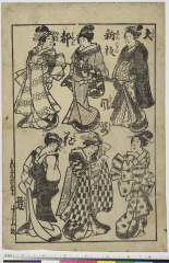
Taishinhanmiyakofuuzokuhanakurabe

「安房国鋸山日本寺図」

「華頂山知恩院雪中景」
歌舞伎絵尽表紙集
Accuratissima totius Asiae tabula : in omnes partes divisa, de nova correcta, ac in lucem edita / per Fredericum de Witt Amstelodami cum privilegio D.D. ordinum Hollandiae Westristacqs ; F. de Wit excudit

「安房国鋸山日本寺図」

Tartariae Imperium
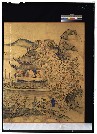
楼閣山水図屏風

「忠臣蔵 六段目」

Shinpanchuushingurajuuichidantsuzukijuudanme
.jpg)
「風流養老滝」

Kawa de no sentaku

「東☆銀閣寺」
A new map of India & China from the latest observations / by I. Senex

「上野草津温泉之図」
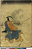
「石井源之丞 尾上菊五郎」
「新撰五畿内一覧 道法附」
「猪の子餅の由来」
![[Lovers in an autumn meadow]](https://tile.loc.gov/storage-services/service/pnp/jpd/02100/02139_150px.jpg)
[Lovers in an autumn meadow]

Indiae Orientalis, Insularumque Adiacentium Typus. Cum Privilegio
Asia with the islands adioyning described, the atire of the people & townes of importance, all of them newly augmented by I.S. Ano dom. 1626 / Sculptum apud Abrahamum Goos

(Covers to) Picture map of China. Designed by Frank Randolph Southard. Printed in United States of...
Last Updated: 2020-06-05
Uploaded: 2021-07-22