
Map Of Asia Showing its Gt. Political Divisions, and also the Various Routes of Travel Between Lon...
- Time
- Owner Organization

Map of Asia showing its gt. political divisions, and also various routes of travel between London ...
Stanford University Libraries
Stanford Libraries SearchWorks

Map of Asia showing its gt. political divisions, and also various routes of travel between London ...
Stanford University Libraries
Stanford Libraries SearchWorks

Map of Asia showing its gt. political divisions, and also various routes of travel between London ...
Stanford University Libraries
Stanford Libraries SearchWorks

Map Of Asia Showing its Gt. Political Divisions, and also the Various Routes of Travel Between Lon...
Stanford University Libraries
Stanford Libraries SearchWorks

Map of Asia Showing its Gt. Political Divisions, and, also, the Various routes of Travel Between L...
Stanford University Libraries
Stanford Libraries SearchWorks

Map of Asia showing its gt. political divisions, and also the various routes of travel between Lon...
Stanford University Libraries
Stanford Libraries SearchWorks

Map of Asia showing its Gt. Political Divisions, and, also, the Various routes of travel between L...
Stanford University Libraries
Stanford Libraries SearchWorks

Map of Asia Showing its Gt. Political Divisions and...Routes of Trade between London & India, Chin...
Stanford University Libraries
Stanford Libraries SearchWorks

Map of Asia Showing its Gt. Political Divisions and...Routes of Trade between London & India, Chin...
Stanford University Libraries
Stanford Libraries SearchWorks
![Tokyo : [base map showing political divisions]](https://stacks.stanford.edu/image/iiif/jw443fg4075%2Fjw443fg4075_00_0001/full/!200,200/0/default.jpg)
Tokyo : [base map showing political divisions]
Stanford University Libraries
Stanford Libraries SearchWorks
![Osaka : [base map showing political divisions]](https://stacks.stanford.edu/image/iiif/rk252rh2515%2Frk252rh2515_00_0001/full/!200,200/0/default.jpg)
Osaka : [base map showing political divisions]
Stanford University Libraries
Stanford Libraries SearchWorks
Stanford's London atlas of universal geography exhibiting the physical and political divisions of the various countries of the world
National Library of Australia
Trove: National Library of Australia

Welfare map of Peiping : also showing other points if interest. (Drawn by) Atterburt
Stanford University Libraries
Stanford Libraries SearchWorks
Asia with its islands and different regions : according to their modern divisions ; also the discoveries made by Capt. Cook
National Library of Australia
Trove: National Library of Australia

Illustration showing various kinds of discoloration of the lips due to smallpox
Wellcome Collection
Europeana API
Map showing Pelew Island, immediately north of Dutch New Guinea, and Dili, in Portuguese Timor, between whic...
National Library of New Zealand
DigitalNZ New Zealand API

Eastern Asia, showing Japan, Korea, Manchuria and adjoining parts of Siberia and China. 185 miles ...
Bibliothèque nationale de France
Europeana API
A new map of the empires, states, provinces &c of Asia : including also the Turkish & Russian dominions in Europe & New Holland / compiled from the most authentic observations by Robert Wilkinson ; Walsh script. ; W. Palmer sculpt
National Library of Australia
Trove: National Library of Australia
Asia and its islands according to Danville : divided into empires, kingdoms, states, regions &ca. with the European possessions and settlements in the East Indies and an exact delineation of all the discoveries made in the Eastern parts by the English under Captn. Cook
State Library of New South Wales
Trove: National Library of Australia

China, Engraved Expressly for the Standard World Atlas. (inset) Japan or Nippon
Stanford University Libraries
Stanford Libraries SearchWorks
Map of Asia showing its gt. political divisions, and also the various routes of travel between Lon...
Stanford University Libraries
Stanford Libraries SearchWorks
Map of Asia showing its gt. political divisions, and also various routes of travel between London ...
Stanford University Libraries
Stanford Libraries SearchWorks
Map of Asia showing its gt. political divisions, and also various routes of travel between London ...
Stanford University Libraries
Stanford Libraries SearchWorks

China, Contains 15 Subject Provinces, including the 2 Islands of Hainan Formosa and the Tributary ...
Stanford University Libraries
Stanford Libraries SearchWorks

Colton's Japan, Nippon, Kiusiu, Sikok, Yesso and the Japanese Kuriles. (insets) Yesso and the Japa...
Stanford University Libraries
Stanford Libraries SearchWorks

「新板植木つくし」
National Diet Library, Japan
ARC Ukiyo-e Portal Database

Chinese Empire And Japan
Stanford University Libraries
Stanford Libraries SearchWorks
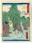
「諸国六十八景」 「土佐龍串五十七」
Museum of Fine Arts, Boston
ARC Ukiyo-e Portal Database

Tartariae Sive Magni Chami Regni typus
Stanford University Libraries
Stanford Libraries SearchWorks

Japan. Edited by John Bartholomew, M.C., LL.D. The Geographical Institute Edinburgh Copyright, Joh...
Stanford University Libraries
Stanford Libraries SearchWorks

Insularum Japoniae
Stanford University Libraries
Stanford Libraries SearchWorks

Japanese Empire - political. The Edinburgh Geographical Institute, John Bartholomew & Son, Ltd. "T...
Stanford University Libraries
Stanford Libraries SearchWorks

Indiae Orientalis Insularumque Adiacientium Typus
Stanford University Libraries
Stanford Libraries SearchWorks

Chinese Empire & Japan
Stanford University Libraries
Stanford Libraries SearchWorks

Johnson's Japan, Nippon, Kiusiu, Sikok, Yesso and the Japanese Kuriles. By Johnson And Ward. (inse...
Stanford University Libraries
Stanford Libraries SearchWorks

Japan Nippon, Kiusiu, Sikok, Yesso And The Japanese Kuriles. (with) two inset maps: Yesso And The ...
Stanford University Libraries
Stanford Libraries SearchWorks
Last Updated: 2020-04-17
Uploaded: 2021-09-21