Estrecho de Simonoseki. H. 106a :entrada occidentral del Seto-Uchi tomados de los trabajos verific...


五万分一千島列島陸海編合圖

戦争の惨禍(72)《結末はこれだ》

平 兼盛; 百人一首姥がゑとき (Series)
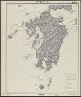
Kyushu

伊勢国之図 2

十万分一圖北樺太及黑龍江下流
Karte VON CHINA UND JAPAN

日本本州北西岸能登七尾湾= Japan Honshū, N. W. coast, Nanao Bay : north bay from survey of Lieutt. K. Kimotski, I. J. N. 12th. Year of Meiji (1879), South Bay, West Bay and the Soundings at outer part of the Bays from survey of commr. K. Isono

painting

Rand, McNally & Co.'s 1904 war map of Japan, Korea, and China ; Rand, McNally & Co.'s 1904 war map of Russia...

Japan, Honshu - South Coast : Iseno Umi or Ise Wan and Mikawa Wan with approaches, from Japanese surveys to ...

日本北州西岸後志小樽港 = Japan Hokusyū, west coast, Shiribeshi, Otaru Kō

Sanmai-zuzuki Yodo-gawa tsutsumi Hachiman yo no zu (Object)

Strategical map of part of Korea and Manchuria / prepared by the Second Division, General Staff (Military In...

Nara, Yamada, Koyasan, and environs

厳島神社の細図 全

Tartariae Maioris sive Asiaticae Tabula . . . . Tartarium Russicam, Tartariam Sinensem et Tar4tari...
![Novae Insulae XVII Nova Tabula [First State!]](https://stacks.stanford.edu/image/iiif/sw590fs2648%2F23067/full/!200,200/0/default.jpg)
Novae Insulae XVII Nova Tabula [First State!]
![Novae Insulae XVII Nova Tabula [First State!]](https://stacks.stanford.edu/image/iiif/vz186mx1354%2F22284/full/!200,200/0/default.jpg)
Novae Insulae XVII Nova Tabula [First State!]
![Theater of operations, Japan-China War, 1894-5 [cartographic material] / Office of Naval Intelligence, Naval...](https://collections.library.yale.edu/iiif/2/15509952/full/!200,200/0/default.jpg)
Theater of operations, Japan-China War, 1894-5 [cartographic material] / Office of Naval Intelligence, Naval...

Mandchourie et Coree de Kharbine a Seoul de Port-Arthur a Vladivostok Traduction de la Carte d'Eta...

The Japanese empire : with central and southern Manchukuo (Manchuria)

満州十万分一圖中部大興安嶺

painting
最終更新日:
登録日: 2021-07-27