
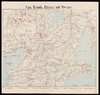
Strategical map of part of Korea and Manchuria / prepared by the Second Division, General Staff (Military In...
- Time
- Owner Organization
![[Manchuria] (7 sheet US Military Information Division Map of Manchuria)](https://stacks.stanford.edu/image/iiif/yr430hp5690%2F41524/full/!200,200/0/default.jpg)
[Manchuria] (7 sheet US Military Information Division Map of Manchuria)
Stanford University Libraries
Stanford Libraries SearchWorks

Strategical Map of Part of Korea and Manchuria . . . 1906
Stanford University Libraries
Stanford Libraries SearchWorks
Sketch map Darwin / prepared by Australian Section, Imperial General Staff
National Library of Australia
Trove: National Library of Australia
Map of Korea / prepared by Angus Hamilton F.R.G.S. 1904
National Library of Australia
Trove: National Library of Australia

The latest map of Manchuria, Korea, Formosa, and Saghalien
Stanford University Libraries
Stanford Libraries SearchWorks
JAPAN'S MILITARY LEADERS IN MANCHURIA.—GeneraI Kan-, aya, Chief of the General Staff (riglit) -with General ...
National Library of New Zealand
DigitalNZ New Zealand API
Korea / prepared ... by the Army Map Service, U.S. Army
National Library of Australia
Trove: National Library of Australia

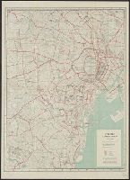
Bilingual map of Greater Tokyo. Prepared by the Cartographic Division of King Associates. Publishe...
Stanford University Libraries
Stanford Libraries SearchWorks

Military Map of South-Eastern Virginia
Stanford University Libraries
Stanford Libraries SearchWorks
Caroline Islands 1:25,000 : Yap / prepared under the direction of Engineer, Hq AFFE/BA, by the Military Geology Branch, Intelligence Division ; map compiled by C. G. Johnson, geologist, Military Geology Branch, U.S. Geological Survey, for the Intelligence Division, Office of the Engineer, Hq. U.S. Army Japan
National Library of Australia
Trove: National Library of Australia
Special Report No. 54, Railroads on the Korea - Manchuria Border Eastern Sector" (GHQ, Far East Command, Military Intelligence Section, General Staff, Theater Intelligence Division, Geographic Branch, 20 Jun 1951)
NDL Digital Collections
NDL Digital Collections
![[Map of Korea] Karta Korei, nyne Yaponskago General-Gubernatorstva Tsiosen, s Yaponskimi Geografic...](https://stacks.stanford.edu/image/iiif/wm529gv6020%2F36877/full/!200,200/0/default.jpg)
[Map of Korea] Karta Korei, nyne Yaponskago General-Gubernatorstva Tsiosen, s Yaponskimi Geografic...
Stanford University Libraries
Stanford Libraries SearchWorks
Japan / prepared by the Army Map Service, (GD) Corps of Engineers, U.S. Army
National Library of Australia
Trove: National Library of Australia

Japan, Manchuria, and Korea : principal languages needed by interpreters in these areas
Stanford University Libraries
Stanford Libraries SearchWorks

The New War Map of Maryland Part of Virginia & Pennsylvania. Published by B.B. Russell . .
Stanford University Libraries
Stanford Libraries SearchWorks
Historical atlas of Northeast Asia, 1590-2010 : Korea, Manchuria, Mongolia, Eastern Siberia / by Li Narangoa + Robert Cribb
National Library of Australia
Trove: National Library of Australia

VICE-ADMIRAL SIR G. IJUIN, Assistant Director of the Japanese Naval General Staff
Auckland Libraries
DigitalNZ New Zealand API
![Professor [James] Ricalton, with Japanese officers of 11th Division, at foot of Takushan, Port Arthur [Manchuria]](https://tile.loc.gov/storage-services/service/pnp/cph/3b10000/3b14000/3b14900/3b14926r.jpg)
Professor [James] Ricalton, with Japanese officers of 11th Division, at foot of Takushan, Port Arthur [Manchuria]
Library of Congress
Digital Collections, Library of Congress
Order of Battle information, Chinese Communist Forces in Korea, Table of Organization and Equipment" (GHQ, Far East Command, Military Intelligence Section, General Staff, Theater Intelligence Division, Order of Battle Branch)
NDL Digital Collections
NDL Digital Collections

General Railway Map of Japan and Manchuria : Showing lines open and under construction on March 31...
Stanford University Libraries
Stanford Libraries SearchWorks
A military display held by the units of the New Zealand Division in New Caledonia during World War II, enemy...
Alexander Turnbull Library
DigitalNZ New Zealand API
City map, central Tokyo. December 1946 / prepared under direction of the chief engineer, general headquarter...
Yale University Library
Yale University Library Digital Collections
General Douglas Mac Arthur (second from left), accompanied by members of the Allied invasion forces, examine...
National Library of New Zealand
DigitalNZ New Zealand API
Map of Hiroshima atomic-bomb damage (prepared by Hiroshima railway division office). Report No. 3t(13), USSBS Index Section 2
NDL Digital Collections
NDL Digital Collections

Nagasaki
Yale University Library
Yale University Library Digital Collections
Nara, Yamada, Koyasan, & environs
Yale University Library
Yale University Library Digital Collections
Strategical Map of Part of Korea and Manchuria . . . 1906
Stanford University Libraries
Stanford Libraries SearchWorks
![Indo oyobi Seia [cartographic material] : Roppyakmanbun no ichi](https://stacks.stanford.edu/image/iiif/dx650yf2686%2Fdx650yf2686_00_0001/full/!200,200/0/default.jpg)
Indo oyobi Seia [cartographic material] : Roppyakmanbun no ichi
Stanford University Libraries
Stanford Libraries SearchWorks

La guerre en Extrême-Orient
Bibliothèque nationale de France
Europeana API

Central Tokyo : city map.
Stanford University Libraries
Stanford Libraries SearchWorks

Nara, Yamada, Koyasan, & environs
Yale University Library
Yale University Library Digital Collections

Nagasaki harbor
Stanford University Libraries
Stanford Libraries SearchWorks

Jūmanbun no ichizu Kita Karafuto oyobi Kokuryūkō karyū
Stanford University Libraries
Stanford Libraries SearchWorks

佐賀県管内図
Saga Prefectual Library
IIIF Discovery in Japan

佐賀県管内図
Saga Prefectual Library
IIIF Discovery in Japan

Carte Des Indes et de la Chine Dressee sur plusieurs Rectifees par quelques Observations Par Guill...
Stanford University Libraries
Stanford Libraries SearchWorks

大日本帝國西南部地形圖
Yoshida-South Library, Kyoto University
IIIF Discovery in Japan

飛騨交通地図(飛濃自働車株式会社定期運転道路)
Takayamashi Kyoiku Iinkai
ADEAC: A System of Digitalization and Exhibition for Archive Collections

亜細亜東部略図
Saga Prefectual Library
IIIF Discovery in Japan

Hyakumanbun no ichi Nanpō kōkūzu
Stanford University Libraries
Stanford Libraries SearchWorks

Mandchourie et Coree de Kharbine a Seoul de Port-Arthur a Vladivostok Traduction de la Carte d'Eta...
Stanford University Libraries
Stanford Libraries SearchWorks
Kūchū shashin yōzu Sanman Gosen bun no ichi Bisumaruku Guntō (sheet 1)
National Library of Australia
Trove: National Library of Australia

China divided into its Great Provinces, and The Isle of Japan . . . 1774
Stanford University Libraries
Stanford Libraries SearchWorks

Gojūmanbun no ichi Gobaikaru hōmen sozu
Stanford University Libraries
Stanford Libraries SearchWorks
[Paisaje nevado] [Material gráfico]
Biblioteca Nacional de España
Europeana API

Japan : to illustrate the paper by Ellen Churchill Semple.
Yale University Library
Yale University Library Digital Collections

The Japanese empire : with central and southern Manchukuo (Manchuria)
Yale University Library
Yale University Library Digital Collections

The Japanese empire : with central and southern Manchukuo (Manchuria)
Yale University Library
Yale University Library Digital Collections
Last Updated: 2021-01-30
Uploaded: 2021-07-29