
Ise Bay - North :
- Time
- Owner Organization

Japan, Hokushu - South Coast. Uchiura Wan or Iburi Wan (Volcano Bay)
Stanford University Libraries
Stanford Libraries SearchWorks

New Guinea - South-East Coast. Approaches to Dedele
Stanford University Libraries
Stanford Libraries SearchWorks

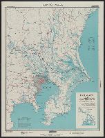
Japan : South coast of Honshu : Gulf of Tokyo or Yedo. Compiled from Japanese Government, and Brit...
Stanford University Libraries
Stanford Libraries SearchWorks

New Guinea - South Coast. Freshwater Bay to C. Blackwood
Stanford University Libraries
Stanford Libraries SearchWorks

China - east coast : Hangchow Wan - southeast portion : including the approaches to the Yung Kiang
Stanford University Libraries
Stanford Libraries SearchWorks

Oshima, south coast of Japan
Royal Museums Greenwich
Europeana API

Japan, Hokkaido (Yezo) West Coast. Furubira Wan to Aikappu Misaki
Stanford University Libraries
Stanford Libraries SearchWorks
Part of Japan or Nippon [east coast of Honshu Island, Japan] / T. Bowen, sct
National Library of Australia
Trove: National Library of Australia

Asia, Japan--South Korea, Korea Strait to Tōkyō-Wan, including Shikoku and Kyūshū [electronic reso...
Stanford University Libraries
Stanford Libraries SearchWorks

Samezu Coast in South Shinagawa (Minami-Shinagawa Samezu kaigan), from the series "One Hundred Famous Views of Edo (Meisho Edo hyakkei)"
Art Institute of Chicago
Art Institute of Chicago API

STATED TO HAVE COMPLETELY DISAPPEARED: ENOSHIMA. THE ISLAND OFF THE JAPANESE COAST
Auckland Libraries
DigitalNZ New Zealand API
Allied planes bombing a Japanese battleship of the he class off the North Kure area of Honshu, Japan. (Eveni...
National Library of New Zealand
DigitalNZ New Zealand API
AN INCIDENT OF THE LATE WAX: RUSSIAN SAILORS FROM THE BALTIC FLEET STRANDED ON THE JAPANESE COAST. After ti...
National Library of New Zealand
DigitalNZ New Zealand API

LEFT: A small patrol from a South Island battalion under Captain R. Adams captured this Japanese coastal bar...
Auckland Libraries
DigitalNZ New Zealand API
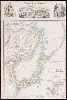
A new chart of the Pacific Ocean : exhibiting the western coast of America, from Cape Horn to Beerings Strait, the eastern shores of Asia including Japan, China and Australia and all the numerous islands and known dangers situated in Polynesia and Australasia / correctly drawn and regulated according to the most approved and modern surveys and astronomical observations by J.W. Norie
State Library of New South Wales
Trove: National Library of Australia
![Map of Manchuria, Corea & Japan [cartographic material]](https://collections.library.yale.edu/iiif/2/15828540/full/!200,200/0/default.jpg)
Map of Manchuria, Corea & Japan [cartographic material]
Yale University Library
Yale University Library Digital Collections

Nara, Yamada, Koyasan, & environs
Yale University Library
Yale University Library Digital Collections
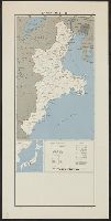
Japan, Mie-ken
Yale University Library
Yale University Library Digital Collections

Nagasaki
Yale University Library
Yale University Library Digital Collections
Kantō area : highways and waterways
Yale University Library
Yale University Library Digital Collections
Islands of Japan
Yale University Library
Yale University Library Digital Collections
Japan, Wakayama-ken
Yale University Library
Yale University Library Digital Collections

Rand, McNally & Co.'s 1904 war map of Russia and the continent of Asia
Yale University Library
Yale University Library Digital Collections
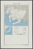
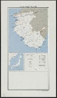
Japan, Aichi-ken
Yale University Library
Yale University Library Digital Collections
![Far East, Japanese occupied area, major railroads [cartographic material] / Board of Economic Warfare, Enemy...](https://collections.library.yale.edu/iiif/2/15510697/full/!200,200/0/default.jpg)
Far East, Japanese occupied area, major railroads [cartographic material] / Board of Economic Warfare, Enemy...
Yale University Library
Yale University Library Digital Collections
![Japan and adjacent regions of Asia and the Pacific Ocean [cartographic material] / compiled and drawn in the...](https://collections.library.yale.edu/iiif/2/15510875/full/!200,200/0/default.jpg)
Japan and adjacent regions of Asia and the Pacific Ocean [cartographic material] / compiled and drawn in the...
Yale University Library
Yale University Library Digital Collections
Last Updated: 2021-01-30
Uploaded: 2021-07-29