
Geologic map of the eastern part of Hakone Volcano
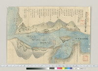
Map of Hakone and neighbourhood

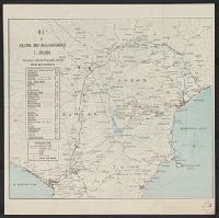
Map of Eastern U.S.S.R. Missile Bases

Military Map of South-Eastern Virginia

Eastern Archipelago : Eastern Part of Celebes
![[Map of part of Samar, Philippines, in Japanese.]](https://collections.library.yale.edu/iiif/2/15251561/full/!200,200/0/default.jpg)
[Map of part of Samar, Philippines, in Japanese.]

Plans in the south-eastern part of New Guinea
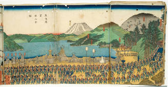
Mountains of Hakone on the Tōkaidō

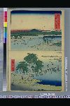
Hakone: View of the lake (Hakone, kosui no zu)

The village of Hakone
Keifu Testudō senro ryakuzu = Map of the Seoul-Pusan Railway ; Fu Tōyō Tetsudō senro ryakuzu = Map of the Eastern Railways

Strategical Map of Part of Korea and Manchuria . . . 1906
View of the Lake, Hakone

Hakone: View of the Lake

Hakone--View of the Lake

Karta Aziatskoi Rossii . . . [Map of the Asian part of Russia and Possessions Adjacent, with the R...
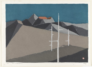
Remains of a Volcano
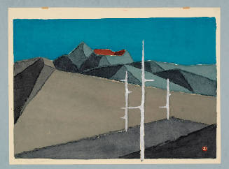
Remains of a Volcano

Remains of a Volcano
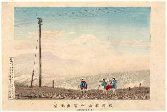
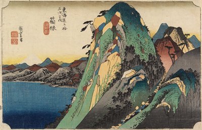
View of Mt. Fuji from the Hakone mountains

Plans in south eastern part of New Guinea

Map of the Empire of Japan

Map of the Pacific Ocean
View of the Fujiya Hotel, Hakone

North Pacific Ocean : Eastern Part of Hawaiin Islands

Hitoyoshi, Japan, Kumamoto Ken, Kyushu

Southwest Japan (Kyūshū, Shikoku, and southwest Honshū), cotton spinning, silk and rayon production

Isahaya, Japan, Nagasaki-ken, Kyushū.
!["Roti"-tō heiyō chishi shiryōzu [cartographic material]](https://stacks.stanford.edu/image/iiif/gk414rt9197%2Fgk414rt9197_00_0001/full/!200,200/0/default.jpg)
"Roti"-tō heiyō chishi shiryōzu [cartographic material]

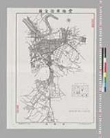
酒田市最新明細地図

City plan of Kōbe.

Kajiki, Japan, Kagoshima-ken, Kyushu

二郡縮図(写)

Southwest Japan (Kyūshū, Shikoku, and southwest Honshū), telecommunications

Takanabe, Japan, Miyazaki-ken, Kyushu

Sheet 9. Hakode
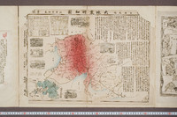
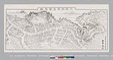
美濃尾張大地震明細図
赤間関源平合戦之図

近世水滸伝
「富士三十六景」 「武蔵たま川」
豊橋市街全図 縮尺壱萬弐千分之一
![Kure [cartographic material] : plan of port and naval establishments](https://stacks.stanford.edu/image/iiif/rk636yd7844%2Frk636yd7844_0001/full/!200,200/0/default.jpg)
Kure [cartographic material] : plan of port and naval establishments
大江山酒呑童子図

Southwest Japan (Kyūshū, Shikoku, and southwest Honshū), non-metallic mineral production

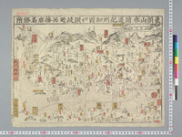
万国名勝尽競
象頭山参詣道紀州加田ヨリ讃岐廻并播磨名勝附
東金町鳥瞰図
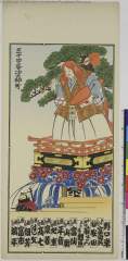
「三十四番」「塗師町」 (神田祭礼山車)(猩々)

Sheet 12. Fukuoka
最終更新日: 2020-04-17
登録日: 2021-09-21