
Plans in south eastern part of New Guinea
- Time
- Owner Organization

Plans in the south-eastern part of New Guinea
Stanford University Libraries
Stanford Libraries SearchWorks

Plans on the north-eastern coast of New Guinea
Stanford University Libraries
Stanford Libraries SearchWorks

New Guinea - South-East Coast. Approaches to Dedele
Stanford University Libraries
Stanford Libraries SearchWorks

New Guinea - South Coast. Freshwater Bay to C. Blackwood
Stanford University Libraries
Stanford Libraries SearchWorks

JAPANESE TRAPPED IN MILNE BAY AREA: ALLIES' SOUTH-EAST NEW GUINEA SUCCESS
Auckland Libraries
DigitalNZ New Zealand API

Plans of Anchorages in Witu Islands
Stanford University Libraries
Stanford Libraries SearchWorks

New Year (Part of Triptych)
Freer and Sackler
DPLA API

Geologic map of the eastern part of Hakone Volcano
Stanford University Libraries
Stanford Libraries SearchWorks

North Pacific Ocean : Eastern Part of Hawaiin Islands
Stanford University Libraries
Stanford Libraries SearchWorks
Soldiers of the 2nd New Zealand Expeditionary Force (in the Pacific), on Nissan Island, New Guinea, World Wa...
Alexander Turnbull Library
DigitalNZ New Zealand API
Soldiers of the 2nd New Zealand Expeditionary Force (in the Pacific), on Nissan Island, New Guinea, during W...
Alexander Turnbull Library
DigitalNZ New Zealand API

Nippon, Naikai. Plans in Harima
Stanford University Libraries
Stanford Libraries SearchWorks

Plans of Anchorages in Tomori Gulf and Adjacent Coast
Stanford University Libraries
Stanford Libraries SearchWorks
Well armed partisans in Florence, south of the Arno, on the day this part of the city fell to the Allies
Alexander Turnbull Library
DigitalNZ New Zealand API

WITH THE AUSTRALIANS IN TARAKAN AND NEW GUINEA: JAPANESE GARRISONS BEING REDUCED
Auckland Libraries
DigitalNZ New Zealand API
Map showing Pelew Island, immediately north of Dutch New Guinea, and Dili, in Portuguese Timor, between whic...
National Library of New Zealand
DigitalNZ New Zealand API
![[Map of part of Samar, Philippines, in Japanese.]](https://collections.library.yale.edu/iiif/2/15251561/full/!200,200/0/default.jpg)
[Map of part of Samar, Philippines, in Japanese.]
Yale University Library
Yale University Library Digital Collections

Picture of the Country of New Holland South Wales
Freer and Sackler
DPLA API

No Amida in the South
Minneapolis Institute of Arts
Minneapolis Institute of Art API
[Jørn Utzon collection of architectural plans]
National Library of Australia
Trove: National Library of Australia

New Guinea - N. E. Coast. C. Ward Hunt to C. Nelson
Stanford University Libraries
Stanford Libraries SearchWorks
Men of the New Zealand Home Guard, Christchurch South Battalion, marching
Alexander Turnbull Library
DigitalNZ New Zealand API
Cook's map of the tourist districts of New South Wales
National Library of Australia
Trove: National Library of Australia

Lower part of Shoji, Fusuma and the column of the New Goten
Museum of Fine Arts, Houston
Museum of Fine Arts, Houston
New Guinea - South-East Coast. Approaches to Dedele
Stanford University Libraries
Stanford Libraries SearchWorks
Plans on the north-eastern coast of New Guinea
Stanford University Libraries
Stanford Libraries SearchWorks

Carte De L'Oceanie Contenant L'Australe, La Polynesie et Les Iles Asiatique [Australia called Nota...
Stanford University Libraries
Stanford Libraries SearchWorks
Plans of Anchorages in Witu Islands
Stanford University Libraries
Stanford Libraries SearchWorks
「通☆茶屋」 「都名勝 三拾景 初編」
Art Research Center, Ritsumeikan University
ARC Ukiyo-e Portal Database
![Tsuruga-shi Kōkū shashin sokuryōzu [cartographic material]](https://stacks.stanford.edu/image/iiif/yn152cf5419%2Fyn152cf5419_00_0001/full/!200,200/0/default.jpg)
Tsuruga-shi Kōkū shashin sokuryōzu [cartographic material]
Stanford University Libraries
Stanford Libraries SearchWorks
New Guinea - N. E. Coast. C. Ward Hunt to C. Nelson
Stanford University Libraries
Stanford Libraries SearchWorks

Population densities in Japan
Stanford University Libraries
Stanford Libraries SearchWorks
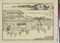
柴又經榮山題經寺之圖
Funabashi-shi Western Library
ADEAC: A System of Digitalization and Exhibition for Archive Collections
Plans in the south-eastern part of New Guinea
Stanford University Libraries
Stanford Libraries SearchWorks

「尾陽熱田駅亀足山正覚寺境内図」
C. V. Starr East Asian Library, University of California, Berkeley
ARC Ukiyo-e Portal Database

Japan, acreage of rice by prefectures, 1939. Japan, acreage of wheat by prefectures, 1939
Stanford University Libraries
Stanford Libraries SearchWorks

Eastern Archipelago. Flores and Timor Seas
Stanford University Libraries
Stanford Libraries SearchWorks
![Shiberia Gomanbunnoichi Zu [cartographic material]](https://stacks.stanford.edu/image/iiif/qj959dg6677%2Fqj959dg6677_00_0001/full/!200,200/0/default.jpg)
Shiberia Gomanbunnoichi Zu [cartographic material]
Stanford University Libraries
Stanford Libraries SearchWorks

Central Japan (central and northern Honshū) distribution of population
Stanford University Libraries
Stanford Libraries SearchWorks

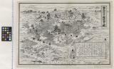
「信濃国刈萱堂往生寺略図」
Tokyo Metropolitan Central Library
ARC Ukiyo-e Portal Database

Japan, Manchuria, and Korea : principal languages needed by interpreters in these areas
Stanford University Libraries
Stanford Libraries SearchWorks
Last Updated: 2020-04-17
Uploaded: 2021-09-21