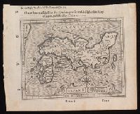
Japan I
- People
- Time
- Owner Organization
![Map of Manchuria, Corea & Japan [cartographic material]](https://collections.library.yale.edu/iiif/2/15828540/full/!200,200/0/default.jpg)
Map of Manchuria, Corea & Japan [cartographic material]
Yale University Library
Yale University Library Digital Collections
![[Map of Kyoto] [cartographic material]](https://collections.library.yale.edu/iiif/2/16683048/full/!200,200/0/default.jpg)
[Map of Kyoto] [cartographic material]
Yale University Library
Yale University Library Digital Collections
![China and Japan [cartographic material]](https://collections.library.yale.edu/iiif/2/15828553/full/!200,200/0/default.jpg)
China and Japan [cartographic material]
Yale University Library
Yale University Library Digital Collections

Eastern Asia
Yale University Library
Yale University Library Digital Collections
![(A Set of Landform and Outline Maps by Erwin Raisz) [cartographic material].](https://stacks.stanford.edu/image/iiif/vf022zq3993%2F7943001/full/!200,200/0/default.jpg)
(A Set of Landform and Outline Maps by Erwin Raisz) [cartographic material].
Stanford University Libraries
Stanford Libraries SearchWorks
![Map of Chosen (Korea) [cartographic material].](https://stacks.stanford.edu/image/iiif/fx184cf7591%2Ffx184cf7591_0001/full/!200,200/0/default.jpg)
Map of Chosen (Korea) [cartographic material].
Stanford University Libraries
Stanford Libraries SearchWorks
![Government railroads of Japan [cartographic material].](https://stacks.stanford.edu/image/iiif/kn953gw3179%2Fkn953gw3179_0001/full/!200,200/0/default.jpg)
Government railroads of Japan [cartographic material].
Stanford University Libraries
Stanford Libraries SearchWorks
![Panoramic map of Osaka [cartographic material].](https://stacks.stanford.edu/image/iiif/jv491xw9549%2Fjv491xw9549_0001/full/!200,200/0/default.jpg)
Panoramic map of Osaka [cartographic material].
Stanford University Libraries
Stanford Libraries SearchWorks
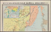
Русско-японская война 1904-1905 гг. / карта составлена Научно-редакционной картосоставительской частью ГУГК ...
Yale University Library
Yale University Library Digital Collections
![Nagoya [cartographic material] : municipal water supply, distribution](https://stacks.stanford.edu/image/iiif/cx861js2541%2Fcx861js2541_00_0001/full/!200,200/0/default.jpg)
Nagoya [cartographic material] : municipal water supply, distribution
Stanford University Libraries
Stanford Libraries SearchWorks
![Japan, radiotelephone and radiotelegraph stations [cartographic material] : 1941](https://stacks.stanford.edu/image/iiif/pp234mp0165%2Fpp234mp0165_00_0001/full/!200,200/0/default.jpg)
Japan, radiotelephone and radiotelegraph stations [cartographic material] : 1941
Stanford University Libraries
Stanford Libraries SearchWorks

Nemuro
Yale University Library
Yale University Library Digital Collections
![Exactissima Asiae delineatio, in praecipuas regiones, ceterasq [cartographic material] : partes divisa, et d...](https://collections.library.yale.edu/iiif/2/16618498/full/!200,200/0/default.jpg)
Exactissima Asiae delineatio, in praecipuas regiones, ceterasq [cartographic material] : partes divisa, et d...
Yale University Library
Yale University Library Digital Collections
![City map, central Tokyo, advance edition [cartographic material].](https://stacks.stanford.edu/image/iiif/rr820wk0562%2Frr820wk0562_0001/full/!200,200/0/default.jpg)
City map, central Tokyo, advance edition [cartographic material].
Stanford University Libraries
Stanford Libraries SearchWorks
![Far East, Japanese occupied area, major railroads [cartographic material]](https://stacks.stanford.edu/image/iiif/zm881nj6799%2Fzm881nj6799_00_0001/full/!200,200/0/default.jpg)
Far East, Japanese occupied area, major railroads [cartographic material]
Stanford University Libraries
Stanford Libraries SearchWorks
![Pascaerte vande Zuyd-Zee tussche California, en Ilhas de Ladrones [cartographic material] / by Pieter Goos, ...](https://collections.library.yale.edu/iiif/2/15825821/full/!200,200/0/default.jpg)
Pascaerte vande Zuyd-Zee tussche California, en Ilhas de Ladrones [cartographic material] / by Pieter Goos, ...
Yale University Library
Yale University Library Digital Collections
![Sketch map of Sendai area [cartographic material] : Honshu-Japan](https://stacks.stanford.edu/image/iiif/vt543dv4637%2Fvt543dv4637_00_0001/full/!200,200/0/default.jpg)
Sketch map of Sendai area [cartographic material] : Honshu-Japan
Stanford University Libraries
Stanford Libraries SearchWorks
![Accuratissima totius Asiae tabula [cartographic material] : in omnes partes divisa, de nova correcta, ac in ...](https://collections.library.yale.edu/iiif/2/16669381/full/!200,200/0/default.jpg)
Accuratissima totius Asiae tabula [cartographic material] : in omnes partes divisa, de nova correcta, ac in ...
Yale University Library
Yale University Library Digital Collections
![Bering Sea, Japanese fishing and associated activities, 1930-1941 [cartographic material]](https://stacks.stanford.edu/image/iiif/kb473nj6517%2Fkb473nj6517_00_0001/full/!200,200/0/default.jpg)
Bering Sea, Japanese fishing and associated activities, 1930-1941 [cartographic material]
Stanford University Libraries
Stanford Libraries SearchWorks
![Japan [cartographic material] : industrial concentration by prefectures](https://stacks.stanford.edu/image/iiif/zh931gv1396%2Fzh931gv1396_00_0001/full/!200,200/0/default.jpg)
Japan [cartographic material] : industrial concentration by prefectures
Stanford University Libraries
Stanford Libraries SearchWorks

Bilingual map of Greater Tokyo. Prepared by the Cartographic Division of King Associates. Publishe...
Stanford University Libraries
Stanford Libraries SearchWorks
![China and Japan [cartographic material] / compiled from G.S.G.S. 4065 and 2957](https://collections.library.yale.edu/iiif/2/15510764/full/!200,200/0/default.jpg)
China and Japan [cartographic material] / compiled from G.S.G.S. 4065 and 2957
Yale University Library
Yale University Library Digital Collections
![Tokyo and vicinity, showing bombed-out areas [cartographic material]](https://stacks.stanford.edu/image/iiif/jx217xm7539%2Fjx217xm7539_00_0001/full/!200,200/0/default.jpg)
Tokyo and vicinity, showing bombed-out areas [cartographic material]
Stanford University Libraries
Stanford Libraries SearchWorks
![Far East, Japanese occupied area, major railroads [cartographic material] / Board of Economic Warfare, Enemy...](https://collections.library.yale.edu/iiif/2/15510697/full/!200,200/0/default.jpg)
Far East, Japanese occupied area, major railroads [cartographic material] / Board of Economic Warfare, Enemy...
Yale University Library
Yale University Library Digital Collections

Indiae Orientalis, Insularumque Adiacentium Typus. Cum Privilegio
Stanford University Libraries
Stanford Libraries SearchWorks

冨士山禅定図
Mt.Fuji World Heritage Center, Shizuoka
ADEAC: A System of Digitalization and Exhibition for Archive Collections

India Orientalis
Stanford University Libraries
Stanford Libraries SearchWorks

Chinae : olim Sinarum regionis, nova descriptio
Stanford University Libraries
Stanford Libraries SearchWorks

India Orientalis . . . 1600
Stanford University Libraries
Stanford Libraries SearchWorks

Beschryving van de stad Jedo, hoofdstad van't japansche ryk, en zetel van den opper monarch van Ja...
Bibliothèque nationale de France
Europeana API

China, Contains 15 Subject Provinces, including the 2 Islands of Hainan Formosa and the Tributary ...
Stanford University Libraries
Stanford Libraries SearchWorks

(Covers to) Picture map of China. Designed by Frank Randolph Southard. Printed in United States of...
Stanford University Libraries
Stanford Libraries SearchWorks

Aki Itsukushima onjinja zu
Stanford University Libraries
Stanford Libraries SearchWorks

Map of Asia Showing its Gt. Political Divisions and...Routes of Trade between London & India, Chin...
Stanford University Libraries
Stanford Libraries SearchWorks

Map of Asia Showing its Gt. Political Divisions, and, also, the Various routes of Travel Between L...
Stanford University Libraries
Stanford Libraries SearchWorks

Map of Asia showing its gt. political divisions, and also the various routes of travel between Lon...
Stanford University Libraries
Stanford Libraries SearchWorks

Le Japon divisé en soissante et six provinces / ... tirée des cartes des japonois par monsieur Rel...
Bibliothèque nationale de France
Europeana API

Map Of Asia Showing its Gt. Political Divisions, and also the Various Routes of Travel Between Lon...
Stanford University Libraries
Stanford Libraries SearchWorks

Nieuwe Kaart van het Eyland Japan verbeterd door Froncois Valentyn . .
Stanford University Libraries
Stanford Libraries SearchWorks

Map of Asia showing its Gt. Political Divisions, and, also, the Various routes of travel between L...
Stanford University Libraries
Stanford Libraries SearchWorks

India : quae orientalis dicitur et insulae adiacentes
Stanford University Libraries
Stanford Libraries SearchWorks

Map of Asia showing its gt. political divisions, and also the various routes of travel between Lon...
Stanford University Libraries
Stanford Libraries SearchWorks
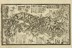
「新鐫大日本諸国御城之図」 「寅百三十五番」
Art Research Center, Ritsumeikan University
ARC Ukiyo-e Portal Database
Yoshitsunesenbonzakura
University of Tokyo Graduate School of Arts and Sciences / College of Liberal Arts
UTokyo Academic Archives Portal

Imperium Japonicum in sexaginta et octo provincias divisum ex ipsorum japonensium mappis & observa...
Bibliothèque nationale de France
Europeana API

Tartariae Imperium
Stanford University Libraries
Stanford Libraries SearchWorks

Koinyoubousomewaketazuna
Museum of Fine Arts, Boston
ARC Banzuke (Playbills) Portal Database
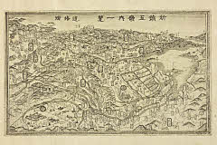
「新鐫五畿内一覧」
Art Research Center, Ritsumeikan University
ARC Ukiyo-e Portal Database
Last Updated: 2021-01-30
Uploaded: 2021-07-29