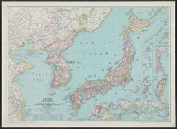
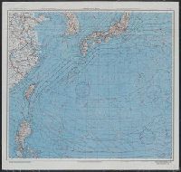
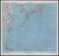
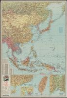
![Japan and adjacent regions of Asia and the Pacific Ocean [cartographic material] / compiled and drawn in the...](https://collections.library.yale.edu/iiif/2/15509964/full/!200,200/0/default.jpg)
Japan and adjacent regions of Asia and the Pacific Ocean [cartographic material] / compiled and drawn in the...
- People
- Time
- Owner Organization
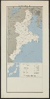
![Japan and adjacent regions of Asia and the Pacific Ocean [cartographic material] / compiled and drawn in the...](https://collections.library.yale.edu/iiif/2/15510875/full/!200,200/0/default.jpg)
Japan and adjacent regions of Asia and the Pacific Ocean [cartographic material] / compiled and drawn in the...
Yale University Library
Yale University Library Digital Collections
Japan and adjacent regions of Asia and the Pacific Ocean / compiled and drawn in the Cartographic Section of the National Geographic Society
National Library of Australia
Trove: National Library of Australia

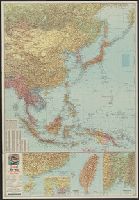
Japan, Manchuria, and adjacent regions
Stanford University Libraries
Stanford Libraries SearchWorks
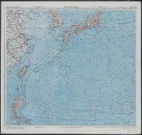
![The Northwestern Pacific [cartographic material].](https://stacks.stanford.edu/image/iiif/hk776rv6776%2Fhk776rv6776_00_0001/full/!200,200/0/default.jpg)
The Northwestern Pacific [cartographic material].
Stanford University Libraries
Stanford Libraries SearchWorks
Theater of war in the Pacific Ocean / compiled and drawn in the Cartographic Section of the National Geographic Society for the National Geographic Magazine
National Library of Australia
Trove: National Library of Australia

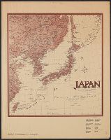
Japan and Korea / compiled and drawn in the Cartographic Section of the National Geographic Society ; James ...
Yale University Library
Yale University Library Digital Collections
Japan and Korea / compiled and drawn in the Cartographic Section of the National Geographic Society ; James ...
Yale University Library
Yale University Library Digital Collections
Japan and adjacent regions of Asia and Pacific Ocean, 1944. Report No. 37-a(32), USSBS Index Section 6
NDL Digital Collections
NDL Digital Collections

Eastern Asia
Yale University Library
Yale University Library Digital Collections
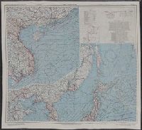
![China and Japan [cartographic material] / compiled from G.S.G.S. 4065 and 2957](https://collections.library.yale.edu/iiif/2/15510764/full/!200,200/0/default.jpg)
China and Japan [cartographic material] / compiled from G.S.G.S. 4065 and 2957
Yale University Library
Yale University Library Digital Collections
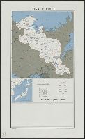
![China and Japan [cartographic material]](https://collections.library.yale.edu/iiif/2/15828553/full/!200,200/0/default.jpg)
China and Japan [cartographic material]
Yale University Library
Yale University Library Digital Collections
North Pacific Ocean / compiled & drawn by J.W. Appleton ; engraved by Homewood & Son
National Library of Australia
Trove: National Library of Australia

Ten leading trends in Asia & the Pacific. (travel trends) (Focus: Asia & the Pacific)
Trove: National Library of Australia

Japan and its relation to the territory bordering on the Pacific Ocean
Boston Public Library
DPLA API
![Japan, radiotelephone and radiotelegraph stations [cartographic material] : 1941](https://stacks.stanford.edu/image/iiif/pp234mp0165%2Fpp234mp0165_00_0001/full/!200,200/0/default.jpg)
Japan, radiotelephone and radiotelegraph stations [cartographic material] : 1941
Stanford University Libraries
Stanford Libraries SearchWorks
Japan and adjacent regions / prepared and distributed by Army Information Branch, Army Service Forces
Yale University Library
Yale University Library Digital Collections
![Map of Manchuria, Corea & Japan [cartographic material]](https://collections.library.yale.edu/iiif/2/15828540/full/!200,200/0/default.jpg)
Map of Manchuria, Corea & Japan [cartographic material]
Yale University Library
Yale University Library Digital Collections

Japan and it's relation to the territory bordering on the Pacific ocean
Yale University Library
Yale University Library Digital Collections

Charts, etc
Yale University Library
Yale University Library Digital Collections

Asia, Japan and Korea : with the surrounding seas and the adjacent coastal region of China / published at Wa...
Yale University Library
Yale University Library Digital Collections

The Japan –US Military Alliance and the Asia-Pacific Challenges: Prospects for Deep Changes
Complutense University Library of Madrid
Europeana API
Military presence in the Asia-Pacific region
Auckland War Memorial Museum
DigitalNZ New Zealand API
Atlas of isotope hydrology - Asia and the Pacific
National Library of Australia
Trove: National Library of Australia
Pacific Ocean / compiled and drawn in the Cartographic Section of the National Geographic Society for the National geographic magazine ; Gilbert Grosvenor, editor ; Albert H. Bumstead, chief cartographer ; culture by James M. Darley ; physiography by Charles E. Riddiford
National Library of Australia
Trove: National Library of Australia
Japan and adjacent regions of Asia and the Pacific Ocean [cartographic material] / compiled and drawn in the...
Yale University Library
Yale University Library Digital Collections
Japan and Korea / compiled and drawn in the Cartographic Section of the National Geographic Society ; James ...
Yale University Library
Yale University Library Digital Collections
Japan and Korea / compiled and drawn in the Cartographic Section of the National Geographic Society ; James ...
Yale University Library
Yale University Library Digital Collections
![Far East, Japanese occupied area, major railroads [cartographic material] / Board of Economic Warfare, Enemy...](https://collections.library.yale.edu/iiif/2/15510697/full/!200,200/0/default.jpg)
Far East, Japanese occupied area, major railroads [cartographic material] / Board of Economic Warfare, Enemy...
Yale University Library
Yale University Library Digital Collections

Russisch-japanischer Kriegsschauplatz. Karte II, Süd-Mandschurei, Korea, Nordost-China
Stanford University Libraries
Stanford Libraries SearchWorks
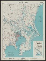
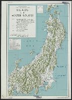
Kantō area : highways and waterways
Yale University Library
Yale University Library Digital Collections

Japan, spring areas
Yale University Library
Yale University Library Digital Collections
AAF cloth chart ; no. C-52, C-53
Yale University Library
Yale University Library Digital Collections

East China Sea
Yale University Library
Yale University Library Digital Collections
Esso war map III featuring the Pacific Theater : a third war map / edited, drafted and printed by the makers...
Yale University Library
Yale University Library Digital Collections

The Japanese empire : with central and southern Manchukuo (Manchuria)
Yale University Library
Yale University Library Digital Collections

The topographic map of Manchoukuo
Stanford University Libraries
Stanford Libraries SearchWorks
East China Sea
Yale University Library
Yale University Library Digital Collections

Tokushima, Tokushima Prefecture, Shikoku, Japan
Stanford University Libraries
Stanford Libraries SearchWorks
Japan and it's relation to the territory bordering on the Pacific ocean
Yale University Library
Yale University Library Digital Collections
Central Japan :
Yale University Library
Yale University Library Digital Collections
Japan and South China Seas / prepared at the direction of the commanding general, Army Air Forces, for the A...
Yale University Library
Yale University Library Digital Collections
Japan, Mie-ken
Yale University Library
Yale University Library Digital Collections
![Manshūkoku yochizu [cartographic material] : hyakumanbun no ichi](https://stacks.stanford.edu/image/iiif/dc116hp3130%2Fdc116hp3130_00_0001/full/!200,200/0/default.jpg)
Manshūkoku yochizu [cartographic material] : hyakumanbun no ichi
Stanford University Libraries
Stanford Libraries SearchWorks
Japan and South China Seas / prepared at the direction of the commanding general, Army Air Forces, for the A...
Yale University Library
Yale University Library Digital Collections
Japan : Kyoto-Fu
Yale University Library
Yale University Library Digital Collections

Rand, McNally & Co.'s 1904 war map of Russia and the continent of Asia
Yale University Library
Yale University Library Digital Collections
War map III featuring the Pacific Theater
Yale University Library
Yale University Library Digital Collections
Japan, Hiroshima-ken
Yale University Library
Yale University Library Digital Collections
Last Updated: 2021-01-30
Uploaded: 2021-07-29