![China and Japan [cartographic material]](https://collections.library.yale.edu/iiif/2/15828553/full/!200,200/0/default.jpg)
China and Japan [cartographic material]
- People
- Time
- Owner Organization
![Map of Manchuria, Corea & Japan [cartographic material]](https://collections.library.yale.edu/iiif/2/15828540/full/!200,200/0/default.jpg)
Map of Manchuria, Corea & Japan [cartographic material]
Yale University Library
Yale University Library Digital Collections
![China [cartographic material].](https://stacks.stanford.edu/image/iiif/dd136ct3616%2Fdd136ct3616_00_0001/full/!200,200/0/default.jpg)
China [cartographic material].
Stanford University Libraries
Stanford Libraries SearchWorks
![China and Japan [cartographic material] / compiled from G.S.G.S. 4065 and 2957](https://collections.library.yale.edu/iiif/2/15510764/full/!200,200/0/default.jpg)
China and Japan [cartographic material] / compiled from G.S.G.S. 4065 and 2957
Yale University Library
Yale University Library Digital Collections
![Government railroads of Japan [cartographic material].](https://stacks.stanford.edu/image/iiif/kn953gw3179%2Fkn953gw3179_0001/full/!200,200/0/default.jpg)
Government railroads of Japan [cartographic material].
Stanford University Libraries
Stanford Libraries SearchWorks
![[Map of Kyoto] [cartographic material]](https://collections.library.yale.edu/iiif/2/16683048/full/!200,200/0/default.jpg)
[Map of Kyoto] [cartographic material]
Yale University Library
Yale University Library Digital Collections
![Japan, radiotelephone and radiotelegraph stations [cartographic material] : 1941](https://stacks.stanford.edu/image/iiif/pp234mp0165%2Fpp234mp0165_00_0001/full/!200,200/0/default.jpg)
Japan, radiotelephone and radiotelegraph stations [cartographic material] : 1941
Stanford University Libraries
Stanford Libraries SearchWorks
![[Railroads in China, Manchuria, Korea, Japan and the eastern U.S.S.R.] [cartographic material]](https://stacks.stanford.edu/image/iiif/pf710vm7134%2Fpf710vm7134_00_0001/full/!200,200/0/default.jpg)
[Railroads in China, Manchuria, Korea, Japan and the eastern U.S.S.R.] [cartographic material]
Stanford University Libraries
Stanford Libraries SearchWorks
Japan I
Yale University Library
Yale University Library Digital Collections
![Japan [cartographic material] : railroads and railroad facilities](https://stacks.stanford.edu/image/iiif/yv242dj2410%2Fyv242dj2410_00_0001/full/!200,200/0/default.jpg)
Japan [cartographic material] : railroads and railroad facilities
Stanford University Libraries
Stanford Libraries SearchWorks
Japan-China War, 1894-5
Yale University Library
Yale University Library Digital Collections
![(A Set of Landform and Outline Maps by Erwin Raisz) [cartographic material].](https://stacks.stanford.edu/image/iiif/vf022zq3993%2F7943001/full/!200,200/0/default.jpg)
(A Set of Landform and Outline Maps by Erwin Raisz) [cartographic material].
Stanford University Libraries
Stanford Libraries SearchWorks
![Sketch map of Sendai area [cartographic material] : Honshu-Japan](https://stacks.stanford.edu/image/iiif/vt543dv4637%2Fvt543dv4637_00_0001/full/!200,200/0/default.jpg)
Sketch map of Sendai area [cartographic material] : Honshu-Japan
Stanford University Libraries
Stanford Libraries SearchWorks
![Japan and adjacent regions of Asia and the Pacific Ocean [cartographic material] / compiled and drawn in the...](https://collections.library.yale.edu/iiif/2/15510875/full/!200,200/0/default.jpg)
Japan and adjacent regions of Asia and the Pacific Ocean [cartographic material] / compiled and drawn in the...
Yale University Library
Yale University Library Digital Collections
![Japan and adjacent regions of Asia and the Pacific Ocean [cartographic material] / compiled and drawn in the...](https://collections.library.yale.edu/iiif/2/15509964/full/!200,200/0/default.jpg)
Japan and adjacent regions of Asia and the Pacific Ocean [cartographic material] / compiled and drawn in the...
Yale University Library
Yale University Library Digital Collections
China Divided into its Great Provinces and the Isles of Japan [Material cartográfico]
Biblioteca Nacional de España
Europeana API
![Japan, spring areas [cartographic material].](https://stacks.stanford.edu/image/iiif/gp763ck4840%2Fgp763ck4840_00_0001/full/!200,200/0/default.jpg)
Japan, spring areas [cartographic material].
Stanford University Libraries
Stanford Libraries SearchWorks
![Japan, Hyogo-ken [cartographic material].](https://stacks.stanford.edu/image/iiif/wx264qs8747%2Fwx264qs8747_00_0001/full/!200,200/0/default.jpg)
Japan, Hyogo-ken [cartographic material].
Stanford University Libraries
Stanford Libraries SearchWorks
![Japan : Kyoto-Fu [cartographic material].](https://stacks.stanford.edu/image/iiif/sb905zv4061%2Fsb905zv4061_00_0001/full/!200,200/0/default.jpg)
Japan : Kyoto-Fu [cartographic material].
Stanford University Libraries
Stanford Libraries SearchWorks
![Japan : Okayama-ken [cartographic material]](https://stacks.stanford.edu/image/iiif/hd851zq5001%2Fhd851zq5001_00_0001/full/!200,200/0/default.jpg)
Japan : Okayama-ken [cartographic material]
Stanford University Libraries
Stanford Libraries SearchWorks
![Japan, Yamaguchi-ken [cartographic material]](https://stacks.stanford.edu/image/iiif/zc849tw9296%2Fzc849tw9296_00_0001/full/!200,200/0/default.jpg)
Japan, Yamaguchi-ken [cartographic material]
Stanford University Libraries
Stanford Libraries SearchWorks
![Japan, Saga-ken [cartographic material]](https://stacks.stanford.edu/image/iiif/gb444bq4459%2Fgb444bq4459_00_0001/full/!200,200/0/default.jpg)
Japan, Saga-ken [cartographic material]
Stanford University Libraries
Stanford Libraries SearchWorks
![Japan, Nagasaki-ken [cartographic material]](https://stacks.stanford.edu/image/iiif/mr952zz4202%2Fmr952zz4202_00_0001/full/!200,200/0/default.jpg)
Japan, Nagasaki-ken [cartographic material]
Stanford University Libraries
Stanford Libraries SearchWorks
![Japan, Oita-ken [cartographic material]](https://stacks.stanford.edu/image/iiif/qg228fy6190%2Fqg228fy6190_00_0001/full/!200,200/0/default.jpg)
Japan, Oita-ken [cartographic material]
Stanford University Libraries
Stanford Libraries SearchWorks
![Japan, Aichi-ken [cartographic material]](https://stacks.stanford.edu/image/iiif/cs241wy6535%2Fcs241wy6535_00_0001/full/!200,200/0/default.jpg)
Japan, Aichi-ken [cartographic material]
Stanford University Libraries
Stanford Libraries SearchWorks

Hyakumanbunnoichi manso kokkyō hōmen kōkūzu
Stanford University Libraries
Stanford Libraries SearchWorks
Riviergezicht met zeiljonken
Royal Library of the Netherlands
Europeana API
![Il conflitto Russo-Giappanese : [map of the region]](https://collections.library.yale.edu/iiif/2/15828541/full/!200,200/0/default.jpg)
Il conflitto Russo-Giappanese : [map of the region]
Yale University Library
Yale University Library Digital Collections

1904 war map of Russia and the continent of Asia
Yale University Library
Yale University Library Digital Collections

Gojūmanbun no ichi Gobaikaru hōmen sozu
Stanford University Libraries
Stanford Libraries SearchWorks

1904 war map of Japan, Korea, and China
Yale University Library
Yale University Library Digital Collections

Hyakumanbunnoichi zu
Stanford University Libraries
Stanford Libraries SearchWorks

Cannon's Map of the Mineral Belt of Colorado Taken from the Records of the Surveyor General's Offi...
Stanford University Libraries
Stanford Libraries SearchWorks

The Japanese empire : with central and southern Manchukuo (Manchuria)
Yale University Library
Yale University Library Digital Collections

Carte Generale De La Tartarie Chinoise Dressee sur les Cartes Particulieres Faits Sur Les Lieux Pa...
Stanford University Libraries
Stanford Libraries SearchWorks

Rand, McNally & Co.'s 1904 war map of Russia and the continent of Asia
Yale University Library
Yale University Library Digital Collections
Esso war map III featuring the Pacific Theater : a third war map / edited, drafted and printed by the makers...
Yale University Library
Yale University Library Digital Collections

Gojūmanbun no ichi chishizu
Stanford University Libraries
Stanford Libraries SearchWorks
War map III featuring the Pacific Theater
Yale University Library
Yale University Library Digital Collections

Gojūmanbun no ichi Kokuga chihō sozu
Stanford University Libraries
Stanford Libraries SearchWorks

百万分一満州國輿地圖
Yoshida-South Library, Kyoto University
IIIF Discovery in Japan
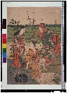
野路三美人
Tokyo National Museum
ARC Ukiyo-e Portal Database
洛中洛外図(模本)
Tokyo National Museum
ARC Ukiyo-e Portal Database

Stieler's Hand-Atlas No. 65. China (Ostl. Theil.), Korea und Japan. (insets) Schang-hai. Tokyo. Ca...
Stanford University Libraries
Stanford Libraries SearchWorks

Jūmanbun no ichizu Kita Karafuto oyobi Kokuryūkō karyū
Stanford University Libraries
Stanford Libraries SearchWorks
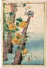
「生写四十八鷹」 「かはせみ」「山ぶき」
Museum of Fine Arts, Boston
ARC Ukiyo-e Portal Database

China, Contains 15 Subject Provinces, including the 2 Islands of Hainan Formosa and the Tributary ...
Stanford University Libraries
Stanford Libraries SearchWorks

China (Ostl. Theil), Korea Und Japan Im Maassstabe Von 1:7.500.000. Von A Petermann. Bearbeitet vo...
Stanford University Libraries
Stanford Libraries SearchWorks
"Pagoda at Uyeno"
Royal Library of the Netherlands
Europeana API
Last Updated: 2021-01-30
Uploaded: 2021-07-29