

Asia, China--South Korea--Japan, Yellow Sea, including the East China Sea and Korea Strait [electr...

Rand, McNally & Co.'s China. Chinese Empire with Japan and Korea

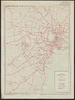
China. Japan. Korea

China (East) and Korea. Scale 1: 7,500,000. Japan. Scale 1:5,000,000 (Published at the office of "...
![[Railroads in China, Manchuria, Korea, Japan and the eastern U.S.S.R.] [cartographic material]](https://stacks.stanford.edu/image/iiif/pf710vm7134%2Fpf710vm7134_00_0001/full/!200,200/0/default.jpg)
[Railroads in China, Manchuria, Korea, Japan and the eastern U.S.S.R.] [cartographic material]

Bartholomew's special Map of China, Japan and Korea

Special war map of China, Korea, and Japan

Bartholomew's Special Map of China, Japan and Korea
[Album of 46 Views of China, Korea, and Japan]
Korea, Nordost-China und Süd-Japan
Stanford's map of eastern China, Japan and Korea : the seat of war in 1894

Rand, McNally & Co.'s 1904 war map of Japan, Korea, and China ; Rand, McNally & Co.'s 1904 war map of Russia...

Rand, McNally & Co.'s 1904 war map of Japan, Korea, and China ; Rand, McNally & Co.'s 1904 war map of Russia...

Rand, McNally & Co.'s 1904 war map of Japan, Korea, and China ; Rand, McNally & Co.'s 1904 war map of Russia...

Japan and Korea
Japan and Korea

Korea, Nordost-China und Süd-Japan / Carl Flemming
Innovativeness and development in the economies of Japan, Korea and China. A comparative approach....
China--Japan, North Korea--South Korea--Russia, Sea of Japan [electronic resource]
![Japan [and Korea]](https://stacks.stanford.edu/image/iiif/xv761my3964%2F41979/full/!200,200/0/default.jpg)
Japan [and Korea]
![Japan [and Korea]](https://stacks.stanford.edu/image/iiif/cf983jp9605%2F17619/full/!200,200/0/default.jpg)
Japan [and Korea]

The dragon in China and Japan
The dragon in China and Japan
China and Japan

The Japanese empire : with central and southern Manchukuo (Manchuria)
City map, central Tokyo. October 1947 / prepared under direction of the chief engineer, GHQ, FEC, byt the 64...

Japan, political divisions

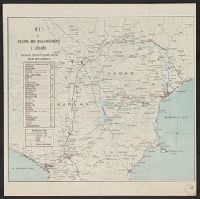
Map of Chosen (Korea)
Korea, Nordost-China und Süd-Japan
Ankarejji--Datch Hābā / Rikuchi Sokuryōbu, Sanbō Honbu
Map of Hakone and neighbourhood

Japan and it's relation to the territory bordering on the Pacific ocean
A New Chart of the Indian and Pacific Oceans Between the Cape of Good Hope, New Holland, and Japan...

Japan. (with) Kurile Islands. Letts's popular atlas. Letts, Son & Co Limited, London. (1883)

Japan. Copyright, J.W. Clement Co., Matthews-Northrup Works, Buffalo, N.Y

Nagasaki

蒙古ニ十万分一烏得地方.

『石見実業時報』第100号

海拉爾付近圖

Asia : Coast of China : Ryōtō Kaiwan. Approaches to Ryō Ga Entrance

Carte des Isles du Japon et la Presqu Isle de Coree Avec les Costes de la Chine. Depuis Pekin Jusqu'a Canton...

Carte réduite de l'océan septentrional compris entre l'Asie et l'Amérique ... Par le Sr. Bellin ..
Japan and adjacent regions / prepared and distributed by Army Information Branch, Army Service Forces

Tabula Indiae Orientalis et Regnorum Adjacentium J. Van Braam et G. onder de Linden . .
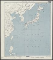
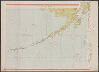
Approaches to Japan
Kaart van Japan : behoorende tot de, door het Provinciaal Utrechtsch Genootschap bekroonde verhandeling
Kaart van Japan ... Van R.G. Bennet en J. Van Wyk R. ... R Van Wyk Jx del

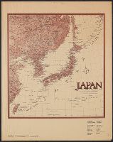
Map of Japan
最終更新日: 2021-01-30
登録日: 2021-07-29