
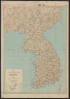
Map of Chosen (Korea)
- Owner Organization
![Map of Chosen (Korea) [cartographic material].](https://stacks.stanford.edu/image/iiif/fx184cf7591%2Ffx184cf7591_0001/full/!200,200/0/default.jpg)
Map of Chosen (Korea) [cartographic material].
Stanford University Libraries
Stanford Libraries SearchWorks

朝鮮總圖 = General map of Chosen (Korea)
Yoshida-South Library, Kyoto University
IIIF Discovery in Japan

Bartholomew's special Map of China, Japan and Korea
Bibliothèque nationale de France
Europeana API

Special war map of China, Korea, and Japan
Stanford University Libraries
Stanford Libraries SearchWorks

Bartholomew's Special Map of China, Japan and Korea
Bibliothèque nationale de France
Europeana API

Strategical Map of Part of Korea and Manchuria . . . 1906
Stanford University Libraries
Stanford Libraries SearchWorks
![[Russian Map of Northeastern Asia, Japan, Korea, China, Alaska, etc.] ( Summary map of hydrographi...](https://stacks.stanford.edu/image/iiif/pj697kr2558%2F35405/full/!200,200/0/default.jpg)
[Russian Map of Northeastern Asia, Japan, Korea, China, Alaska, etc.] ( Summary map of hydrographi...
Stanford University Libraries
Stanford Libraries SearchWorks
![[Map of Korea] Karta Korei, nyne Yaponskago General-Gubernatorstva Tsiosen, s Yaponskimi Geografic...](https://stacks.stanford.edu/image/iiif/wm529gv6020%2F36877/full/!200,200/0/default.jpg)
[Map of Korea] Karta Korei, nyne Yaponskago General-Gubernatorstva Tsiosen, s Yaponskimi Geografic...
Stanford University Libraries
Stanford Libraries SearchWorks

The latest map of Manchuria, Korea, Formosa, and Saghalien
Stanford University Libraries
Stanford Libraries SearchWorks

朝鮮地質総圖 = General geological map of Chosen (Korea)
Yoshida-South Library, Kyoto University
IIIF Discovery in Japan
Map of Korea / prepared by Angus Hamilton F.R.G.S. 1904
National Library of Australia
Trove: National Library of Australia

Telegram from Korea (Chosen denpo)
Art Institute of Chicago
Art Institute of Chicago API
![[Taisho Japanese map of the world. Taisho Japanese map of Japan and Korea]. [9 insets].](https://stacks.stanford.edu/image/iiif/yj892bp5625%2F11670000/full/!200,200/0/default.jpg)
[Taisho Japanese map of the world. Taisho Japanese map of Japan and Korea]. [9 insets].
Stanford University Libraries
Stanford Libraries SearchWorks
CHOSEN NO HOSHI (Star of Korea)
NDL Digital Collections
NDL Digital Collections
Travelers' map of Japan : including Chosen (Korea) and Taiwan (Formosa) : with brief descriptions of the principal tourist points in Japan, 1935
National Library of Australia
Trove: National Library of Australia
Travelers' map of Japan, Chosen (Korea), Taiwan (Formosa) : with brief descriptions of the principal tourist points in Japan (front)
National Library of Australia
Trove: National Library of Australia

Map of Asia
Yale University Library
Yale University Library Digital Collections

Kaesong, Korea (Chosen Kaijo), from the series "Korean Views Supplement (Zoku Chosen fukei)"
Art Institute of Chicago
Art Institute of Chicago API

Kaesong, Korea, from the series "Korean Views Supplement" (Zoku Chosen fukei, Chosen Kaijo)
Art Institute of Chicago
Art Institute of Chicago API

Sanggye Pavilion, Baekyong Temple (Hakuyoji Sokeiro), from the series "Eight Views of Korea (Chosen hakkei)"
Art Institute of Chicago
Art Institute of Chicago API
KAIHO CHOSEN (Liberated Korea)
NDL Digital Collections
NDL Digital Collections
SHIN CHOSEN (New Korea)
NDL Digital Collections
NDL Digital Collections
Travelers' map of Japan, Chosen (Korea), Taiwan (Formosa) : with brief descriptions of the principal tourist points in Japan / Japanese Government Railways
National Library of Australia
Trove: National Library of Australia

1904 war map of Japan, Korea, and China
Yale University Library
Yale University Library Digital Collections

Nagasaki
Yale University Library
Yale University Library Digital Collections

The Japanese empire : with central and southern Manchukuo (Manchuria)
Yale University Library
Yale University Library Digital Collections
Japan and adjacent regions / prepared and distributed by Army Information Branch, Army Service Forces
Yale University Library
Yale University Library Digital Collections
![Map of Manchuria, Corea & Japan [cartographic material]](https://collections.library.yale.edu/iiif/2/15828540/full/!200,200/0/default.jpg)
Map of Manchuria, Corea & Japan [cartographic material]
Yale University Library
Yale University Library Digital Collections

The Japanese empire : with central and southern Manchukuo (Manchuria)
Yale University Library
Yale University Library Digital Collections

China, Contains 15 Subject Provinces, including the 2 Islands of Hainan Formosa and the Tributary ...
Stanford University Libraries
Stanford Libraries SearchWorks
Korea / prepared ... by the Army Map Service, U.S. Army
National Library of Australia
Trove: National Library of Australia

Japan : to illustrate the paper by Ellen Churchill Semple.
Yale University Library
Yale University Library Digital Collections

Asia According to the best Authorities
Stanford University Libraries
Stanford Libraries SearchWorks

Carte Du Kamtchatka . .
Stanford University Libraries
Stanford Libraries SearchWorks

Korea, East China and Japan / The Norris Peters Co., photo-lith
Yale University Library
Yale University Library Digital Collections
![[4 maps of Luzon, Philippines, in Japanese.]](https://collections.library.yale.edu/iiif/2/15251546/full/!200,200/0/default.jpg)
[4 maps of Luzon, Philippines, in Japanese.]
Yale University Library
Yale University Library Digital Collections

佐賀県管内図
Saga Prefectual Library
IIIF Discovery in Japan

China, Contains 15 Subject Provinces, including the 2 Islands of Hainan Formosa and the Tributary ...
Stanford University Libraries
Stanford Libraries SearchWorks
Dai ichi-gun shotai no ichi
National Library of Australia
Trove: National Library of Australia

Descripcion De Las Yndias Ocidentales
Stanford University Libraries
Stanford Libraries SearchWorks

Tabula Tartariae et majoris partis regni Chinae / edita a F. de Wit ; Lhuilier fecit
Yale University Library
Yale University Library Digital Collections
Japan road map 1:1,000,000. sheet 4, Korea / prepared under the direction of the Chief of Engineers, U.S. Ar...
Yale University Library
Yale University Library Digital Collections

1904 war map of Russia and the continent of Asia
Yale University Library
Yale University Library Digital Collections

Carte de la Presqu'Ile De Coree Dressee Mr. J. de la Roche Poncie . . . 1848 (with added pasted do...
Stanford University Libraries
Stanford Libraries SearchWorks
![[Japan] (Published in Manila!)](https://stacks.stanford.edu/image/iiif/gv355sq3352%2F37869hs/full/!200,200/0/default.jpg)
[Japan] (Published in Manila!)
Stanford University Libraries
Stanford Libraries SearchWorks
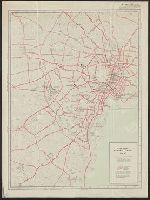
City map, central Tokyo. October 1947 / prepared under direction of the chief engineer, GHQ, FEC, byt the 64...
Yale University Library
Yale University Library Digital Collections

Hyakumanbun no ichi Nanpō kōkūzu
Stanford University Libraries
Stanford Libraries SearchWorks
Stanford's map of eastern China, Japan and Korea : the seat of war in 1894
National Library of Australia
Trove: National Library of Australia
Last Updated: 2021-01-30
Uploaded: 2021-07-29