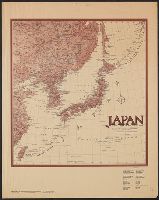
Japan and adjacent regions / prepared and distributed by Army Information Branch, Army Service Forces
- Time
- Owner Organization
Target Tokyo / prepared and distributed by Army Orientation Course, Morale Services Division, Army Service Forces, War Dept

Japan, Manchuria, and adjacent regions

Target Tokyo. Newsmap. Prepared and Distributed by the Army Orientation Course. Special Service Di...
Korea / prepared ... by the Army Map Service, U.S. Army
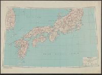
Japan / prepared by the Army Map Service, (GD) Corps of Engineers, U.S. Army
General map of China and adjacent regions, showing treaty ports and railways / prepared for the Department of State, by the Topographic Branch, U.S. Geological Survey
Formosa (Taiwan) 1:250,000 / prepared ... by the Army Map Service (cv) U.S. Army

General map of China and adjacent regions showing treaty ports and railroads / prepared for the Department o...

Japan from Siberia.. Newsmap. Monday, May 7, 1945. ... Vol. IV No. 3F. Prepared and Distributed by...
Japan from Siberia. Newsmap. Monday, May 7, 1945. ... Vol. IV No. 3F. Prepared and Distributed by ...
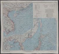
![Japan and adjacent regions of Asia and the Pacific Ocean [cartographic material] / compiled and drawn in the...](https://collections.library.yale.edu/iiif/2/15510875/full/!200,200/0/default.jpg)
Japan and adjacent regions of Asia and the Pacific Ocean [cartographic material] / compiled and drawn in the...
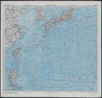
![Japan and adjacent regions of Asia and the Pacific Ocean [cartographic material] / compiled and drawn in the...](https://collections.library.yale.edu/iiif/2/15509964/full/!200,200/0/default.jpg)
Japan and adjacent regions of Asia and the Pacific Ocean [cartographic material] / compiled and drawn in the...
Japan (North) special strategic map / compiled by the Army Map Service
Japan (South) special strategic map / compiled by the Army Map Service
Military Service, World War II; Japan; General headquarters, U. S. Army forces, Pacific

Map of China And the Surrounding Regions. Compiled from the latest information by E. Bretscheider....
Japan and adjacent regions of Asia and the Pacific Ocean / compiled and drawn in the Cartographic Section of the National Geographic Society
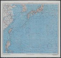
East Asia and North Pacific 1:4,350,000 / prepared under the direction of the Chief of Engineers by the Army Map Service (AM) ; U.S. Army, Washington, D.C
Target Tokyo. Newsmap. Monday, October 18, 1943. ... Vol. II No. 26. Prepared and Distributed by t...
Japan (North) :
AAF cloth chart ; no. C-52, C-53
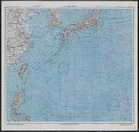
Japan and South China Seas / prepared at the direction of the commanding general, Army Air Forces, for the A...
Japan and South China Seas / prepared at the direction of the commanding general, Army Air Forces, for the A...
East China Sea

Map of Chosen (Korea)
![Map of Manchuria, Corea & Japan [cartographic material]](https://collections.library.yale.edu/iiif/2/15828540/full/!200,200/0/default.jpg)
Map of Manchuria, Corea & Japan [cartographic material]

Nagasaki
![Nimangosenbun no ichi chikeizu Parao Rettō [cartographic material]](https://stacks.stanford.edu/image/iiif/dx617ts1787%2Fdx617ts1787_00_0001/full/!200,200/0/default.jpg)
Nimangosenbun no ichi chikeizu Parao Rettō [cartographic material]

L'Empire Du Japon devisé en sept principales parties, et subdivisè en soixante et six Royaumes, Par le Sr....

Asia According to the best Authorities

The Japanese empire : with central and southern Manchukuo (Manchuria)
![Tokyo : [base map showing political divisions]](https://stacks.stanford.edu/image/iiif/jw443fg4075%2Fjw443fg4075_00_0001/full/!200,200/0/default.jpg)
Tokyo : [base map showing political divisions]

Mōko Nijūmanbunnoichi Utoku chihō
![Sketch map of Sendai area [cartographic material] : Honshu-Japan](https://stacks.stanford.edu/image/iiif/vt543dv4637%2Fvt543dv4637_00_0001/full/!200,200/0/default.jpg)
Sketch map of Sendai area [cartographic material] : Honshu-Japan

Nyūjōjiatō fukin sozu

The Japanese empire : with central and southern Manchukuo (Manchuria)

Japan : to illustrate the paper by Ellen Churchill Semple.
General map of China and adjacent regions showing treaty ports and railroads / prepared for the Department o...

Provinces of Kansu and Ninghsia : Board of Economic Warfare / drawn in R. and A., O.S.S
![[Pictorial envelope for Hokusai's 36 views of Mount Fuji series]](https://tile.loc.gov/storage-services/service/pnp/jpd/02400/02465_150px.jpg)
[Pictorial envelope for Hokusai's 36 views of Mount Fuji series]
Kaart van Japan ... Van R.G. Bennet en J. Van Wyk R. ... R Van Wyk Jx del

Korea, East China and Japan / The Norris Peters Co., photo-lith
Karte vom Japanischen Reiche, nach Original-karten und astronomischen Beobachtungen der Japaner : ...

Ise Bay - North :

Tetsudō senro ryakuzu
![Indo oyobi Seia [cartographic material] : Roppyakmanbun no ichi](https://stacks.stanford.edu/image/iiif/dx650yf2686%2Fdx650yf2686_00_0001/full/!200,200/0/default.jpg)
Indo oyobi Seia [cartographic material] : Roppyakmanbun no ichi
Eis van de opperburgermeester

China, Contains 15 Subject Provinces, including the 2 Islands of Hainan Formosa and the Tributary ...
Last Updated: 2021-01-30
Uploaded: 2021-07-29