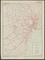
City map, central Tokyo. October 1947 / prepared under direction of the chief engineer, GHQ, FEC, byt the 64...
- People
- Time
- Owner Organization
City map, central Tokyo / prepared under the direction of the Engineer, GHQ, FEC ; by the 64th Engineer Base Topographic Battalion
National Library of Australia
Trove: National Library of Australia
City map, central Tokyo. December 1946 / prepared under direction of the chief engineer, general headquarter...
Yale University Library
Yale University Library Digital Collections
City map, central Tokyo / prepared under the direction of Office of the Engineer, HQ, AFFE, by the 64th Engineer Battalion (Base Topographic)
National Library of Australia
Trove: National Library of Australia
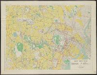
Map of central Tokyo / prepared for the 64th Engineer Topographic Battalion for GHQ Visitors Bureau
Yale University Library
Yale University Library Digital Collections
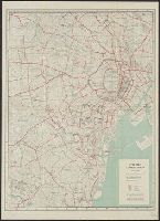
Yokohama city map : corrected to May 1954 / prepared under the direction of Office of the Engineer, AFFE, by the 29th Engineer Battalion (Base Topographic)
National Library of Australia
Trove: National Library of Australia
Central Japan 1:500,000 / prepared under the direction of the Engineer, U.S. Sixth Army, AFPAC, by the 650th Engineer TOP. BN., August 1945
National Library of Australia
Trove: National Library of Australia
600.1: "Status Report, Okinawa Construction Program" (Prepared by the Engineer, GHQ, FEC, 28 Feb 1950)
NDL Digital Collections
NDL Digital Collections

Japan road map, 1:1,000,000 / prepared under the direction of the Chief of Engineers, U.S. Army by the Army ...
Yale University Library
Yale University Library Digital Collections
Japan 1:500,000 / prepared under the direction of the Engineer, U.S. Sixth Army by the 69th EngineerTopo. Co., July 1945 ; reproduced by BMP no 1, GHQ. AFPAC, U.S. Army
National Library of Australia
Trove: National Library of Australia
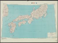
East Asia and North Pacific 1:4,350,000 / prepared under the direction of the Chief of Engineers by the Army Map Service (AM) ; U.S. Army, Washington, D.C
National Library of Australia
Trove: National Library of Australia
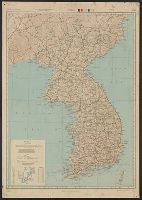
Japan road map 1:1,000,000. sheet 4, Korea / prepared under the direction of the Chief of Engineers, U.S. Ar...
Yale University Library
Yale University Library Digital Collections
Series ; 5207
Yale University Library
Yale University Library Digital Collections
Handbook to the colony of Victoria / prepared under the direction of the Victorian Government by Henry Heylyn Hayter
National Library of Australia
Trove: National Library of Australia
The story of Japanese farming in California. Prepared under the direction of Emil T. H. Bunje. Ber...
University of California Libraries
Europeana API
The story of Japanese farming in California. Prepared under the direction of Emil T. H. Bunje. Ber...
University of California Libraries
Europeana API
Caroline Islands 1:25,000 : Yap / prepared under the direction of Engineer, Hq AFFE/BA, by the Military Geology Branch, Intelligence Division ; map compiled by C. G. Johnson, geologist, Military Geology Branch, U.S. Geological Survey, for the Intelligence Division, Office of the Engineer, Hq. U.S. Army Japan
National Library of Australia
Trove: National Library of Australia
AAF cloth chart ; no. C-52, C-53
Yale University Library
Yale University Library Digital Collections
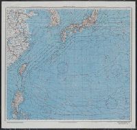
Japan and South China Seas / prepared at the direction of the commanding general, Army Air Forces, for the A...
Yale University Library
Yale University Library Digital Collections
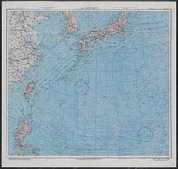
Japan and South China Seas / prepared at the direction of the commanding general, Army Air Forces, for the A...
Yale University Library
Yale University Library Digital Collections
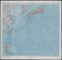
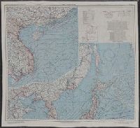
East China Sea
Yale University Library
Yale University Library Digital Collections

East China Sea
Yale University Library
Yale University Library Digital Collections
City map, central Tokyo. December 1946 / prepared under direction of the chief engineer, general headquarter...
Yale University Library
Yale University Library Digital Collections

Japan, political divisions
Stanford University Libraries
Stanford Libraries SearchWorks

Korea, East China and Japan / The Norris Peters Co., photo-lith
Yale University Library
Yale University Library Digital Collections

Kita Karafuto niman-gosenbun no ichizu
Stanford University Libraries
Stanford Libraries SearchWorks
![Hailaerh fukin zu [cartographic material]](https://stacks.stanford.edu/image/iiif/nc103dh1915%2Fnc103dh1915_00_0001/full/!200,200/0/default.jpg)
Hailaerh fukin zu [cartographic material]
Stanford University Libraries
Stanford Libraries SearchWorks
![旧保谷市域 大絵図 -北多摩郡保谷町役場備 保谷町原図(下保谷) [1:北町_下保谷_栄町_東町] : 旧保谷市域 北多摩郡保谷町役場備 保谷町原図(下保谷)](https://adeac.jp/items/nishitokyo-lib/catalog/mp000011-200070/t.jpg)
旧保谷市域 大絵図 -北多摩郡保谷町役場備 保谷町原図(下保谷) [1:北町_下保谷_栄町_東町] : 旧保谷市域 北多摩郡保谷町役場備 保谷町原図(下保谷)
Nishitokyo City Library
ADEAC: A System of Digitalization and Exhibition for Archive Collections

The Japanese empire : with central and southern Manchukuo (Manchuria)
Yale University Library
Yale University Library Digital Collections

Map of Chosen (Korea)
Yale University Library
Yale University Library Digital Collections

Provinces of Kansu and Ninghsia : Board of Economic Warfare / drawn in R. and A., O.S.S
Yale University Library
Yale University Library Digital Collections

Nagasaki
Yale University Library
Yale University Library Digital Collections

Niman gosenbun no ichi tōbu So-ryō shigaizu
Stanford University Libraries
Stanford Libraries SearchWorks

Carte des Isles du Japon et la Presqu Isle de Coree Avec les Costes de la Chine. Depuis Pekin Jusqu'a Canton...
Yale University Library
Yale University Library Digital Collections
![旧保谷市域 大絵図 -北多摩郡保谷町役場備 保谷町原図(上保谷) [2:ひばり丘北_住吉町_泉町_保谷町_中町_富士町] : 旧保谷市域 北多摩郡保谷町役場備 保谷町原図(上保谷)](https://adeac.jp/items/nishitokyo-lib/catalog/mp000012-200070/t.jpg)
旧保谷市域 大絵図 -北多摩郡保谷町役場備 保谷町原図(上保谷) [2:ひばり丘北_住吉町_泉町_保谷町_中町_富士町] : 旧保谷市域 北多摩郡保谷町役場備 保谷町原図(上保谷)
Nishitokyo City Library
ADEAC: A System of Digitalization and Exhibition for Archive Collections
A new & correct chart of the Indian Sea from Cabo Bonea Esperanca to Japan according to Mr. Edward Wrights projection vulgarly called Mercators chart
National Library of Australia
Trove: National Library of Australia

Carte réduite de l'océan septentrional compris entre l'Asie et l'Amérique ... Par le Sr. Bellin ..
Yale University Library
Yale University Library Digital Collections

Japan and it's relation to the territory bordering on the Pacific ocean
Yale University Library
Yale University Library Digital Collections

[Carte de la Tartarie chinoise et des îles du Japon pour servir à la lettre de Mr. d'Anville au Mr...
Bibliothèque nationale de France
Europeana API
Japan. 陸軍. 参謀本部
Yale University Library
Yale University Library Digital Collections

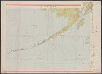
Japan, Hokushu _ West Coast. Iwanai Byochi and Approaches
Stanford University Libraries
Stanford Libraries SearchWorks
![[Spanish Chart of the Philippines, China, Japan, Korea, Kamtchatka, Western Pacific]](https://stacks.stanford.edu/image/iiif/nk348cb2252%2F42187sh/full/!200,200/0/default.jpg)
[Spanish Chart of the Philippines, China, Japan, Korea, Kamtchatka, Western Pacific]
Stanford University Libraries
Stanford Libraries SearchWorks

Plan of Hong Kong City of Victoria . . .
Stanford University Libraries
Stanford Libraries SearchWorks

Tokyo
Yale University Library
Yale University Library Digital Collections
Dai ichi-gun no heitan : Meiji sanjūnana-nen hachi-gatsu nijūgo nichi
National Library of Australia
Trove: National Library of Australia

Indische Oceaan >> Kaart van de Indische Zee, van de Kaap de Goede Hoop tot Japan
Nationaal Archief
Europeana API
Last Updated: 2021-01-30
Uploaded: 2021-07-29