
Special war map of China, Korea, and Japan
- People
- Time
- Owner Organization

Bartholomew's special Map of China, Japan and Korea

Bartholomew's Special Map of China, Japan and Korea

1904 war map of Japan, Korea, and China

1904 war map of Russia and the continent of Asia

Rand, McNally & Co.'s 1904 war map of Russia and the continent of Asia
Stanford's map of eastern China, Japan and Korea : the seat of war in 1894

Korean War 1950-1953 -- Asia, North Korea, South Korea, China, Manchuria, Japan Map / Maps.com(CR)
![[Russian Map of Northeastern Asia, Japan, Korea, China, Alaska, etc.] ( Summary map of hydrographi...](https://stacks.stanford.edu/image/iiif/pj697kr2558%2F35405/full/!200,200/0/default.jpg)
[Russian Map of Northeastern Asia, Japan, Korea, China, Alaska, etc.] ( Summary map of hydrographi...

CHINA AND JAPAN AT WAR

The war against Japan (Map USSR, China & Australia)
MAP, OF THE SEAT OF WAR BETWEEN CHINA AND JAPAN; (Auckland Star, 22 September 1894)
[Album of 46 Views of China, Korea, and Japan]

China. Japan. Korea
![[Taisho Japanese map of the world. Taisho Japanese map of Japan and Korea]. [9 insets].](https://stacks.stanford.edu/image/iiif/yj892bp5625%2F11670000/full/!200,200/0/default.jpg)
[Taisho Japanese map of the world. Taisho Japanese map of Japan and Korea]. [9 insets].
War map : Australia, China, Japan, and the South Pacific / Cyril Dillon
Japan (South) special strategic map / compiled by the Army Map Service
![[Map of China]](https://collections.library.yale.edu/iiif/2/16189150/full/!200,200/0/default.jpg)
[Map of China]
China--Japan, North Korea--South Korea--Russia, Sea of Japan [electronic resource]

Strategical Map of Part of Korea and Manchuria . . . 1906

Map of Asia

Album of the Japan-China war 1

Album of the Japan-China War 2
![China and Japan [cartographic material]](https://collections.library.yale.edu/iiif/2/15828553/full/!200,200/0/default.jpg)
China and Japan [cartographic material]

Map of Chosen (Korea)

New Map of Japan

China and Japan

China, Contains 15 Subject Provinces, including the 2 Islands of Hainan Formosa and the Tributary ...

「諸職吾沢銭」

滿洲歴史地理. : 第壹巻附図 : 前漢時代満洲図 西紀二〇二-西紀二五年

China, Contains 15 Subject Provinces, including the 2 Islands of Hainan Formosa and the Tributary ...

China, Contains 15 Subject Provinces, including the 2 Islands of Hainan Formosa and the Tributary ...
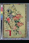
Baireikachougafu

Carte du théâtre de la guerre Russo-Japonaise

Chinese Empire & Japan

Japan. Edited by John Bartholomew, M.C., LL.D. The Geographical Institute Edinburgh Copyright, Joh...

「教訓いろはたとへ」

Baireikachougafu

Empire of Japan. (with) Nagasaki Harbour. Engraved by J. & C. Walker. Published under the superint...

滿洲歴史地理. : 第壹巻附図 : 前燕時代満洲図 (337-370)

China and Japan. (with) Islands of Japan. By Keith Johnston, F.R.S.E. Keith Johnston's General Atl...

滿洲歴史地理. : 第壹巻附図 : 後漢時代満洲図(西紀二五-二二〇年)

Asia According to the best Authorities
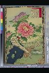
Baireikachougafu

「三芝居役者芸競」 「八百蔵」「福助」「鶴助」「現十郎」「しうか」「芝翫」「薪水」

Plum Garden at Kameido (Kameido Umeyashiki), from the series "Famous Places in Edo (Edo meisho)"

Carte du théâtre de la guerre Russo-Japonaise : prime gratuite du Petit Parisien

「俤けんじ五十四帖」 「御法」

125. Tokyo and Yokohama. Kobe and Osaka. The World Atlas
Last Updated: 2020-04-17
Uploaded: 2021-09-21