
A Correct Sea Chart of the Whole World, According to Wright's, Commonly Called Mercator's, Project...
- People
- Time
- Owner Organization

A Correct Sea Chart of the Whole World, According to Wright's, Commonly Called Mercator's, Project...

A New and Correct Chart of all the Known World Laid down according to Mercator's Projection

A New and Correct Chart of all the Known World Laid down according to Mercator's Projection

A New and Correct Chart of all the Known World Laid down according to Mercator's Projection
A new & correct chart of the Indian Sea from Cabo Bonea Esperanca to Japan according to Mr. Edward Wrights projection vulgarly called Mercators chart

A new & correct chart of the Indian sea from Cabo Bonea Esperanca to Japan : according to Mr Edwar...

A New Map of the Whole World According To The New Observations by Moll Geographer
A New & Correct Chart of the Indian Sea From Cabo Bonea Esperanca to Japan [Material cartográfico]...

A chart of the Tartarian Sea from Nova Zemla to Japan

Zee-atlassen, wereldkaarten enz. >> "A new and correct outline chart intended for the use of...

Teachers of the World. Eating : A Way to Understanding (Japan)

An Accurate Chart of the World, with the New Discoveries; Also a View of the General & Coasting Tr...
World War II New Zealand soldiers from Rest Camp near Ancona, Italy, on their way to the sea for a swim - Ph...
A chart of the northern part of the China Sea shewing the passage from Formosa to Japan : with the eastern coast of China and the Lekeyo Islands
New Zealand Divisional Provost, I A Walker, directs NZ transport on way to Arezzo, Italy, World War II - Pho...
A Graham and R J Richardson watch passing nuns on steps leading to Campobasso castle, Italy, during World Wa...
A chart of the northern part of the China Sea shewing the passage from Formosa to Japan with the eastern coast of China and the Lekeyo islands / by Van Kuelen ; improved from the maps drawn in China by Father Gaubil in 1752
A new chart of the Pacific Ocean : exhibiting the western coast of America, from Cape Horn to Beerings Strait, the eastern shores of Asia including Japan, China and Australia and all the numerous islands and known dangers situated in Polynesia and Australasia / correctly drawn and regulated according to the most approved and modern surveys and astronomical observations by J.W. Norie
A map of the N.E. parts of Asia, and N.W. parts of America, shewing their situation with respect to Japan taken from a Japanese map of the world, brought over by Kempfer and late in the Museum of Sr. Hans Sloane
Tsunamis in the Pacific Basin, 1900-1983 / map produced by Patricia A. Lockridge, National Geophysical Data Center and Ronald H. Smith, Cooperative Institute for Research in Environmental Sciences ; published by National Geophysical Data Center and World Data Center A for Solid Earth Geophysics with support from Office of U.S. Foreign Disaster Assistance, Agency for International Development in cooperation with Circum-Pacific Council for Energy and Mineral Resources, Map Project
![Tokyo city proper [cartographic material]](https://stacks.stanford.edu/image/iiif/vj067cj0650%2Fvj067cj0650_00_0001/full/!200,200/0/default.jpg)
Tokyo city proper [cartographic material]

Carte réduite de l'Océan Oriental depuis le Cap de Bonne Esperance, jusqu'au Japon : dédiée à l'Ac...
A new & correct chart of the Indian Sea from Cabo Bonea Esperanca to Japan according to Mr. Edward Wrights projection vulgarly called Mercators chart

Imizugunnakagawamuraheizaemongumihayakawamuranaikenchiryoushitaezu

A Chart of the Coast of China From Cambodia to Nanquam with Part of Japan

Carte réduite de l'océan septentrional compris entre l'Asie et l'Amérique ... Par le Sr. Bellin ..

The Kanda Myojin Shrine
![[Spanish Chart of the Philippines, China, Japan, Korea, Kamtchatka, Western Pacific]](https://stacks.stanford.edu/image/iiif/nk348cb2252%2F42187sh/full/!200,200/0/default.jpg)
[Spanish Chart of the Philippines, China, Japan, Korea, Kamtchatka, Western Pacific]
![旧保谷市域 大絵図 -北多摩郡保谷町役場備 保谷町原図(上保谷) [2:ひばり丘北_住吉町_泉町_保谷町_中町_富士町] : 旧保谷市域 北多摩郡保谷町役場備 保谷町原図(上保谷)](https://adeac.jp/items/nishitokyo-lib/catalog/mp000012-200070/t.jpg)
旧保谷市域 大絵図 -北多摩郡保谷町役場備 保谷町原図(上保谷) [2:ひばり丘北_住吉町_泉町_保谷町_中町_富士町] : 旧保谷市域 北多摩郡保谷町役場備 保谷町原図(上保谷)

Soudakasenhachijuugokokumenyottsuimizugunimaimurasoutakamawarinaikenchiryouezushitagaki
Zeekaart van Straat Formosa tussen Japan en Taiwan, met een deel van de kust van China

習志野演習場

Chart of the S.W. Part of Japan from a dutch MS / by A. Dalrymple ; W. Harrison sc
A New and Correct Chart of all the Known World Laid down according to Mercator's Projection

Map of Colorado Territory, Compiled from Government Maps & Actual Surveys. Made In 1861
![旧保谷市域 大絵図 -北多摩郡保谷町役場備 保谷町原図(下保谷) [1:北町_下保谷_栄町_東町] : 旧保谷市域 北多摩郡保谷町役場備 保谷町原図(下保谷)](https://adeac.jp/items/nishitokyo-lib/catalog/mp000011-200070/t.jpg)
旧保谷市域 大絵図 -北多摩郡保谷町役場備 保谷町原図(下保谷) [1:北町_下保谷_栄町_東町] : 旧保谷市域 北多摩郡保谷町役場備 保谷町原図(下保谷)
![Keijō Kinbō [cartographic material]](https://stacks.stanford.edu/image/iiif/jk515ck5320%2Fjk515ck5320_00_0001/full/!200,200/0/default.jpg)
Keijō Kinbō [cartographic material]
弘前惣御絵図 : 延宝5~元禄15

Kanazawa, Ishikawa Prefecture, Honshu, Japan
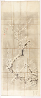
守金/梅図
![Hailaerh fukin zu [cartographic material]](https://stacks.stanford.edu/image/iiif/nc103dh1915%2Fnc103dh1915_00_0001/full/!200,200/0/default.jpg)
Hailaerh fukin zu [cartographic material]
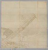
![高師原地図 五千分一 [大正13年測図]](https://adeac.jp/items/toyohashi-city/catalog/mp000080-200030/t.jpg)
高師原地図 五千分一 [大正13年測図]
![[Carte hollandaise des îles de Gotto et partie de Cicoco]](https://api.europeana.eu/api/v2/thumbnail-by-url.json?uri=http%3A%2F%2Fgallica.bnf.fr%2Fark%3A%2F12148%2Fbtv1b53069761r.thumbnail.jpg&type=IMAGE)
[Carte hollandaise des îles de Gotto et partie de Cicoco]
![Asia carta di ciasete piu moderna / A[ntonio] F[rancesco] Lucini fecit](https://api.europeana.eu/api/v2/thumbnail-by-url.json?uri=http%3A%2F%2Fgallica.bnf.fr%2Fark%3A%2F12148%2Fbtv1b530697660.thumbnail.jpg&type=IMAGE)
Asia carta di ciasete piu moderna / A[ntonio] F[rancesco] Lucini fecit
Last Updated: 2020-04-17
Uploaded: 2021-09-21