A New & Correct Chart of the Indian Sea From Cabo Bonea Esperanca to Japan [Material cartográfico]...
- People
- Time
- Owner Organization

A new & correct chart of the Indian sea from Cabo Bonea Esperanca to Japan : according to Mr Edwar...
A new & correct chart of the Indian Sea from Cabo Bonea Esperanca to Japan according to Mr. Edward Wrights projection vulgarly called Mercators chart
A Chart of the Northern Part of the China Sea [Material cartográfico] : shewing the Passage from F...
A Chart of the Eastern Ocean from C. Good Hope to the Islands of Japan [Material cartográfico]

A New and Correct Chart of all the Known World Laid down according to Mercator's Projection

A New and Correct Chart of all the Known World Laid down according to Mercator's Projection

A New and Correct Chart of all the Known World Laid down according to Mercator's Projection

A chart of the Tartarian Sea from Nova Zemla to Japan
A New Chart of the Indian and Pacific Oceans Between the Cape of Good Hope, New Holland, and Japan...

A Correct Sea Chart of the Whole World, According to Wright's, Commonly Called Mercator's, Project...

A Correct Sea Chart of the Whole World, According to Wright's, Commonly Called Mercator's, Project...

A Generall Chart of the South Sea from the River of Plate to Dampiers Streights on ye Coast of New...
![Orientation, Philippines to Japan [cartographic material]](https://stacks.stanford.edu/image/iiif/nh916xd2027%2Fnh916xd2027_00_0001/full/!200,200/0/default.jpg)
Orientation, Philippines to Japan [cartographic material]
![Approaches to Japan [cartographic material].](https://stacks.stanford.edu/image/iiif/zs924cb7981%2Fzs924cb7981_00_0001/full/!200,200/0/default.jpg)
Approaches to Japan [cartographic material].
![[Untitled Sea Chart of Australia, Indian Ocean, China, Japan, SE Asia, &c] (First Printed Map to S...](https://stacks.stanford.edu/image/iiif/cv359wv2441%2F22989/full/!200,200/0/default.jpg)
[Untitled Sea Chart of Australia, Indian Ocean, China, Japan, SE Asia, &c] (First Printed Map to S...

A New Chart of The Pacific Ocean, Exhibiting The Western Coast of America from Cape Horn to Beerin...

Laurie and Whittle's New Chart of the Indian and Pacific Oceans Between the Cape of Good Hope, New...

Laurie and Whittle's New Chart of the Indian and Pacific Oceans Between the Cape of Good Hope, New...

Zee-atlassen, wereldkaarten enz. >> "A new and correct outline chart intended for the use of...

A New Chart of The Pacific Ocean, Exhibiting The Western Coast of America, From Cape Horn To Beeri...

A New Chart of The Pacific Ocean, Exhibiting The Western Coast of America, From Cape Horn To Beeri...
A New Chart of The Pacific Ocean, Exhibiting The Western Coast of America, From Cape Horn To Beeri...
![Southern Islands (Nanpo Shoto), Hachijo Jima to Kazan Retto, Japan [cartographic material] : from ...](https://stacks.stanford.edu/image/iiif/mj508ym1651%2Fmj508ym1651_0001/full/!200,200/0/default.jpg)
Southern Islands (Nanpo Shoto), Hachijo Jima to Kazan Retto, Japan [cartographic material] : from ...

(Composite of) A New Chart of The Pacific Ocean, Exhibiting The Western Coast of America, From Cap...
A Chart of the Eastern Ocean from C. Good Hope to the Islands of Japan [Material cartográfico]

「大橋村 行事村 宮市村見取図」
![Fuji-mi jūsan-shū yochi zenzu [Map of the 13 provinces around Mt. Fuji]](https://collections.library.yale.edu/iiif/2/15510837/full/!200,200/0/default.jpg)
Fuji-mi jūsan-shū yochi zenzu [Map of the 13 provinces around Mt. Fuji]
A New Chart of the Indian and Pacific Oceans Between the Cape of Good Hope, New Holland, and Japan...

Nijūmanbun no ichi Chishizu
Japan. 陸軍. 参謀本部

Korea, East China and Japan / The Norris Peters Co., photo-lith
Graffiti

Tabula Indiae Orientalis et Regnorum Adjacentium J. Van Braam et G. onder de Linden . .

Amazing invasion map : Jap plan to seize the West Coast : Pictorial review. Seattle Post - Intelli...
Stanford's map of eastern China, Japan and Korea : the seat of war in 1894

Akashi, Hyogo-Ken, Honshu, Japan

Pascaart vertoonende de zeecusten van Chili, Peru, Hispania Nova, Nova Granada, en California . .

Tabula Indiae Orientalis et Regnorum Adjacentium J. Van Braam et G. onder de Linden . .

Jūmanbun no ichizu Chamusu oyobi Birobiddyan

Australia, Constructed & Engraved

Cannon's Map of the Mineral Belt of Colorado Taken from the Records of the Surveyor General's Offi...
Das Chinesische Reich und das Kaiserthum Japan /
Stencil

Lloyd's Official Map of the State of Tennessee Compiled From Actual Sureys and Official Documents ...
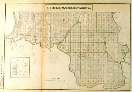
石狩国空知郡幌向原野区画図 第三

Map of Kyoto and vicinity

Nieuwe Pascaert van Oost Indien Verthoonende hen van C. de Bona Esperanca tot aen het Landt van Eſ...

大佐賀最新市街全図
Last Updated:
Uploaded: 2021-07-27