
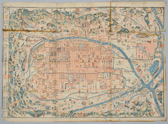
Map of Kyoto and vicinity / Miyako Hotel
オーストラリア国立図書館
オーストラリア国立図書館Trove
Map of Kyoto
ホノルル美術館
ホノルル美術館コレクション
[Map of Kyoto]
オーストラリア国立図書館
オーストラリア国立図書館Trove
![[Map of Kyoto]](https://collections.library.yale.edu/iiif/2/15510884/full/!200,200/0/default.jpg)
[Map of Kyoto]
イェール大学図書館
イェール大学図書館デジタルコレクション

Map of Kyoto
フィラデルフィア美術館
フィラデルフィア美術館コレクション
![[Map of Kyoto]](https://collections.library.yale.edu/iiif/2/15510886/full/!200,200/0/default.jpg)
[Map of Kyoto]
イェール大学図書館
イェール大学図書館デジタルコレクション

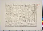
Map of Kyoto and its Suburbs
ミネアポリス美術館
ミネアポリス美術館API
![[Map of Kyoto] [cartographic material]](https://collections.library.yale.edu/iiif/2/16683048/full/!200,200/0/default.jpg)
[Map of Kyoto] [cartographic material]
イェール大学図書館
イェール大学図書館デジタルコレクション
New railway map of Tokyo and vicinity. Published by Japan Guide Map Co., Ltd. Compiled and printed...
スタンフォード大学図書館
スタンフォード大学図書館SearchWorks
Railway Map of Tokyo and Vicinity
国立国会図書館デジタルコレクション
国立国会図書館デジタルコレクション
Railway map of Tokyo & vicinity. U.S. Army Map Service, Far East -58-102 - 10/57.1M.
スタンフォード大学図書館
スタンフォード大学図書館SearchWorks
Map of Hakone and neighbourhood
イェール大学図書館
イェール大学図書館デジタルコレクション
Tokyo and vicinity, showing bombed-out areas. (Regional map on verso)
スタンフォード大学図書館
スタンフォード大学図書館SearchWorks
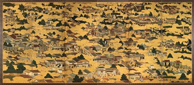
Map of Edo and Its Environs
シカゴ美術館
シカゴ美術館API
Bird's-eye-view of Kyoto and its environs. (Cover title) Kyoto. Kyoto chokan zue.
スタンフォード大学図書館
スタンフォード大学図書館SearchWorks
Tokyo and vicinity : showing bombed-out areas / prepared ... by Nippon Map Co
オーストラリア国立図書館
オーストラリア国立図書館Trove

Erie Railway and connections. (inset) Map of New York City & vicinity issued by N.Y.L.E. & W. R.R....
スタンフォード大学図書館
スタンフォード大学図書館SearchWorks

Yokohama and Vicinity
スタンフォード大学図書館
スタンフォード大学図書館SearchWorks

Map of Tokyo and Yokohama
フリーア・サックラー
DPLA API

Manchuria. Korea. Japan. (insets) (Vicinity of Osaka and Tokyo)
スタンフォード大学図書館
スタンフォード大学図書館SearchWorks
Map of the missionary districts of north Tokyo & Kyoto : under the jurisdiction of the Bishop of Tokyo 1895
イェール大学図書館
イェール大学図書館デジタルコレクション
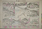
Scenes in and around Kyoto
ミネアポリス美術館
ミネアポリス美術館API

Pilgrims' map of Mount Fuji and surrounding temples
フリーア・サックラー
DPLA API

Bird's-eye-view Kyoto and its environs. (Cover title) Kyoto. Kyoto chokan zue
スタンフォード大学図書館
スタンフォード大学図書館SearchWorks

古川組南吉田村絵図
酒田市立光丘文庫
ADEAC:デジタルアーカイブシステム
Riben / Di tu chu ban she bian zhi
オーストラリア国立図書館
オーストラリア国立図書館Trove

Plans of Anchorages in Tomori Gulf and Adjacent Coast
スタンフォード大学図書館
スタンフォード大学図書館SearchWorks

Japan distribution of waterworks
スタンフォード大学図書館
スタンフォード大学図書館SearchWorks

Map of Tōkyō : city communications / printed by the Tokyo Printing Co., Ltd
イェール大学図書館
イェール大学図書館デジタルコレクション

Japan : distribution of waterworks
イェール大学図書館
イェール大学図書館デジタルコレクション

Plans in Admiralty Islands : (Usiei) (Manus)
スタンフォード大学図書館
スタンフォード大学図書館SearchWorks

假製北支那十万分一圖. 許州
スタンフォード大学図書館
スタンフォード大学図書館SearchWorks

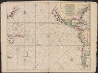
Mar Del Zur Hispanis Mare Pacificum (Rare 2nd State with Tasman's Discoveries)
スタンフォード大学図書館
スタンフォード大学図書館SearchWorks
「紫式部 けんじかるた」」
Nationaal Museum van Wereldculturen (Rijksmuseum Volkenkunde, Leiden)
ARC浮世絵ポータルデータベース

A Chart of the SOUTH=SEA
スタンフォード大学図書館
スタンフォード大学図書館SearchWorks

Map of Tokyo : city communications
スタンフォード大学図書館
スタンフォード大学図書館SearchWorks
赤城火山地方地質図 : 震災予防調査会報告
群馬県立図書館
群馬県立図書館デジタルライブラリー
Mer de Sud ou Pacifique ..
イェール大学図書館
イェール大学図書館デジタルコレクション

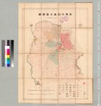
佐賀県管内図
佐賀県立図書館
IIIF Discovery in Japan

Plans on the north-eastern coast of New Guinea
スタンフォード大学図書館
スタンフォード大学図書館SearchWorks

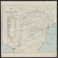
Japan, political divisions
スタンフォード大学図書館
スタンフォード大学図書館SearchWorks
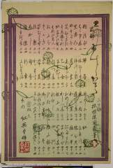
「宇治之真景」
カリフォルニア大学バークレー校C. V. スター東アジア図書館
ARC浮世絵ポータルデータベース

Ryukyu Islands roads, railroads and cables
スタンフォード大学図書館
スタンフォード大学図書館SearchWorks

Carte des découvertes au Nord du Japon faites en 1643 par les vaisseaux hollandais le Kastrikum et...
フランス国立図書館
ヨーロピアナAPI

New Guinea - South Coast. Freshwater Bay to C. Blackwood
スタンフォード大学図書館
スタンフォード大学図書館SearchWorks

冨士登山案内之図
静岡県富士山世界遺産センター
ADEAC:デジタルアーカイブシステム

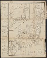
Empire of Japan . .
スタンフォード大学図書館
スタンフォード大学図書館SearchWorks
新板蝦夷土産道中寿五六
カリフォルニア大学バークレー校
ARC浮世絵ポータルデータベース
最終更新日: 2020-04-17
登録日: 2021-09-21