
Empire of Japan . .
- People
- Time
- Owner Organization

Empire of Japan
Landkarte des: Empire of Japan/Kaiserreich Japan

Map of the Empire of Japan

Chinese Empire & Japan
![Empire of Japan [C & J Favre Brandt, Yokohama]](https://stacks.stanford.edu/image/iiif/sf796wm2159%2F25128/full/!200,200/0/default.jpg)
Empire of Japan [C & J Favre Brandt, Yokohama]

Map of the Empire of Japan in 1914

Chinese Empire And Japan

Chinese Empire And Japan

Chinese Empire and Japan
1 1/2 sen Map of the Empire of Japan
Chinese Empire, and Japan

The Chinese Empire and Japan
![Japan [electronic resource] : memoirs of a secret empire](https://www.gumtree.com/static/1/resources/assets/rwd/images/orphans/a37b37d99e7cef805f354d47.noimage_thumbnail.png)
Japan [electronic resource] : memoirs of a secret empire
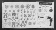
Mirror of Decorative Medals for the Empire of Japan (Dainippon Teikoku gunshō kagami)

The Empire of China and Island of Japan, Agreeable to Modern History

Das Chinesische Reich und das Kaiserthum Japan. (Chinese Empire and Japan.)
Chinese Empire and Japan / George Philip & Son

The birds of the Japanese Empire
The birds of the Japanese Empire
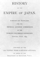
History of the Empire of Japan.
Stanford's map of the empires of China and Japan : with the adjacent parts of the Russian Empire, ...
[Australian soldiers celebrate Empire Day in Japan]

A map of the Empire of Japan, made by Dr. Kaempfer [with maps of Kamchatka, Northern coast of Japan, as well...
Dau Nihon Teikoku kōsanzu : Mineral distribution of Japanese empire

Empire of Japan. (with) Nagasaki Harbour. Engraved by J. & C. Walker. Published under the superint...

New Guinea - South Coast. Freshwater Bay to C. Blackwood

Carte des Isles du Japon et la Presqu Isle de Coree Avec les Costes de la Chine. Depuis Pekin Jusqu'a Canton...

Partie Septentrionale De L'Ocean Pacifique ou L'on Marque Les Decouvertes Et Les Routes De Mrs. De...

Isole Del Giappone e la Corea . . . 1797

Chart of Discoveries made in 1787, in the Seas of China and Tartary, by the Boussole and Astrolabe...
Empire of Japan / published under the superintendence of the Society for the Diffusion of Useful Knowledge

Carta General Para Las Navegaciones a la India Oriental Por El Mar Del Sur Y el grande Oceano que ...
Carta General Para Las Navegaciones a la India Oriental Por El Mar Del Sur Y el grande Oceano que ...

Central Portion of Sumbawa with Pulo Tenga Islands

Hermit Islands

North West Pacific Ocean : Including Yellow, Japan & Okhotsk Seas, the Kuril Islands and Kamchatka

Durville Island and Approaches

Empire of Japan ... Published under the Supervision of the Society for the Diffusion of Useful Kno...

Australien gezeichnet vom Professor J.M.F. Schmidt . . . 1820

Carta General para las Navegaciones a la India Oriental por el Mar del Sur y el Grande Oceano que ...

Ryōtō Kaiwan : Daitzu Shan to Fuchou Chao

Eastern Portion of Flores to Lomblem
![Hailaerh fukin zu [cartographic material]](https://stacks.stanford.edu/image/iiif/nc103dh1915%2Fnc103dh1915_00_0001/full/!200,200/0/default.jpg)
Hailaerh fukin zu [cartographic material]

Empire of Japan, Yedo ... Meaco. (insets) Nagasaki Harbour. Eastern Point of Yeso

Partie Septentrionale De L'Ocean Pacifique ou L'on Marque Les Decouvertes Et Les Routes De Mrs. De...

Map of Japan

Carta General Para Las Navegaciones a la India Oriental Por El Mar Del Sur Y el grande Oceano que ...

Karta Morskykh Otkrytii Rossiiskimi Moreplavatelimi na Tikhom ... [transliterated from the Cyrilli...
Last Updated: 2020-04-17
Uploaded: 2021-09-21