
A chart of the South Sea / by J. Seller, J. Colson, W. Fisher, J. Atkinson & J. Thornton ; Dundee, sculp
National Library of Australia
Trove: National Library of Australia
A Chart of the Northern Part of the China Sea [Material cartográfico] : shewing the Passage from F...
Biblioteca Nacional de España
Europeana API

Maritime territorial disputes in East Asia: a comparative analysis of the South China Sea and the ...
GESIS - Leibniz-Institut für Sozialwissenschaften. Bibliothek Köln
Europeana API

A Correct Sea Chart of the Whole World, According to Wright's, Commonly Called Mercator's, Project...
Stanford University Libraries
Stanford Libraries SearchWorks

A new & correct chart of the Indian sea from Cabo Bonea Esperanca to Japan : according to Mr Edwar...
Bibliothèque nationale de France
Europeana API

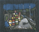
A Peep of the Inland Sea, near Onomichi
General Research Division. The New York Public Library
DPLA API
A great big story. Superfood of the sea
Stanford University Libraries
Stanford Libraries SearchWorks
Map - South China Sea
NDL Digital Collections
NDL Digital Collections

Fishes of the Sea of Japan and the adjacent areas of the Sea of Okhotsk and the Yellow Sea / G.U. ...
スミソニアン図書館
Europeana API
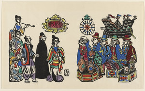
The Arrival of the South Savages
Museum of Modern Art, New York
The Museum of Modern Art (MoMA) Collection
A chart of ye eastermost part of the East Indies / by Iohn Seller
National Library of Australia
Trove: National Library of Australia

The Roar of the Sea
Seattle Art Museum
Seattle Art Museum Collection

Complete Picture of a Steamship: Scenery of Uraga from the Sea
Freer and Sackler
DPLA API

(Composite of) A New Chart of The Pacific Ocean, Exhibiting The Western Coast of America, From Cap...
Stanford University Libraries
Stanford Libraries SearchWorks
Poem of the Sea
Los Angeles County Museum of Art
Norton Simon Museum Collection

Spirit of the Sea
Freer and Sackler
DPLA API

Objects of the sea
Library of Congress
Digital Collections, Library of Congress
God of the sea
National Gallery of Victoria
Trove: National Library of Australia
In a Sea of Clouds
Minneapolis Institute of Arts
Minneapolis Institute of Art API

A Chart of the Coast of China From Cambodia to Nanquam with Part of Japan
Stanford University Libraries
Stanford Libraries SearchWorks

A chart of the easternmost part of the East Indies with all the adjacent islands from Cape Comorin...
Royal Museums Greenwich
Europeana API

A chart of the tradeing part of the East Indies and China, with the adjacent islands, from Surrat ...
Royal Museums Greenwich
Europeana API
AAF cloth chart ; no. C-52, C-53
Yale University Library
Yale University Library Digital Collections
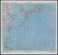
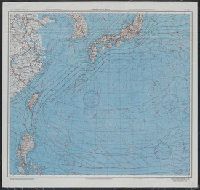
Japan and South China Seas / prepared at the direction of the commanding general, Army Air Forces, for the A...
Yale University Library
Yale University Library Digital Collections
![Pascaerte vande Zuyd-Zee tussche California, en Ilhas de Ladrones [cartographic material] / by Pieter Goos, ...](https://collections.library.yale.edu/iiif/2/15825821/full/!200,200/0/default.jpg)
Pascaerte vande Zuyd-Zee tussche California, en Ilhas de Ladrones [cartographic material] / by Pieter Goos, ...
Yale University Library
Yale University Library Digital Collections

Mar Del Zur Hispanis Mare Pacificum (Rare 2nd State with Tasman's Discoveries)
Stanford University Libraries
Stanford Libraries SearchWorks
A chart of the South Sea / by J. Seller, J. Colson, W. Fisher, J. Atkinson & J. Thornton ; Dundee, sculp
National Library of Australia
Trove: National Library of Australia

New map of Shanghai. (on verso) A map of China : Published by K. Saito. Osaka Japan Sole agent T. ...
Stanford University Libraries
Stanford Libraries SearchWorks

Carte réduite de l'océan septentrional compris entre l'Asie et l'Amérique ... Par le Sr. Bellin ..
Yale University Library
Yale University Library Digital Collections

Map of Kyoto and vicinity
Stanford University Libraries
Stanford Libraries SearchWorks
The entrance of Nangasacqui the chief port of the island of Kiusiu in the Kingdom of Japan from the manuscript chart of the Dutch East India Company
National Library of Australia
Trove: National Library of Australia

Guide to Tokyo City
Yale University Library
Yale University Library Digital Collections

Ishikawagunbungenezu
Imizu City Shinminato Museum
ADEAC: A System of Digitalization and Exhibition for Archive Collections

Pas-caart van Zuyd-Zee, tusschen California en ilhas de Ladrones
Stanford University Libraries
Stanford Libraries SearchWorks

Carte des Costes de L'Asie Sur L'Ocean Contenant les Bancs Isle et Costes &c. (Indian Ocean, South...
Stanford University Libraries
Stanford Libraries SearchWorks

Noordoost Cust van Asia : van Iapan tot Nova Zemla
Stanford University Libraries
Stanford Libraries SearchWorks

Tō "So" jūmanbun no ichizu
Stanford University Libraries
Stanford Libraries SearchWorks

A New and Correct Chart of all the Known World Laid down according to Mercator's Projection
Stanford University Libraries
Stanford Libraries SearchWorks

Japan distribution of waterworks
Stanford University Libraries
Stanford Libraries SearchWorks

Imizugunfutagamigumiawarabunryouezu
Imizu City Shinminato Museum
ADEAC: A System of Digitalization and Exhibition for Archive Collections
Last Updated: 2020-04-17
Uploaded: 2021-09-21