
Bartholomew's Special Map of China, Japan and Korea
- Owner Organization

Bartholomew's special Map of China, Japan and Korea

Special war map of China, Korea, and Japan
![[Russian Map of Northeastern Asia, Japan, Korea, China, Alaska, etc.] ( Summary map of hydrographi...](https://stacks.stanford.edu/image/iiif/pj697kr2558%2F35405/full/!200,200/0/default.jpg)
[Russian Map of Northeastern Asia, Japan, Korea, China, Alaska, etc.] ( Summary map of hydrographi...
![[Album of 46 Views of China, Korea, and Japan]](https://www.gumtree.com/static/1/resources/assets/rwd/images/orphans/a37b37d99e7cef805f354d47.noimage_thumbnail.png)
[Album of 46 Views of China, Korea, and Japan]
Stanford's map of eastern China, Japan and Korea : the seat of war in 1894

China. Japan. Korea

1904 war map of Japan, Korea, and China

1904 war map of Russia and the continent of Asia

Rand, McNally & Co.'s 1904 war map of Russia and the continent of Asia
![[Taisho Japanese map of the world. Taisho Japanese map of Japan and Korea]. [9 insets].](https://stacks.stanford.edu/image/iiif/yj892bp5625%2F11670000/full/!200,200/0/default.jpg)
[Taisho Japanese map of the world. Taisho Japanese map of Japan and Korea]. [9 insets].
![[Map of China]](https://collections.library.yale.edu/iiif/2/16189150/full/!200,200/0/default.jpg)
[Map of China]
Korean War 1950-1953 -- Asia, North Korea, South Korea, China, Manchuria, Japan Map / Maps.com(CR)
Japan (South) special strategic map / compiled by the Army Map Service
China--Japan, North Korea--South Korea--Russia, Sea of Japan [electronic resource]

Map of Asia
![China and Japan [cartographic material]](https://collections.library.yale.edu/iiif/2/15828553/full/!200,200/0/default.jpg)
China and Japan [cartographic material]

Map of Chosen (Korea)

Map of Northern Japan. Map of Southern Japan

Strategical Map of Part of Korea and Manchuria . . . 1906
Stanford's map of the empires of China and Japan : with the adjacent parts of the Russian Empire, ...
![Map of Chosen (Korea) [cartographic material].](https://stacks.stanford.edu/image/iiif/fx184cf7591%2Ffx184cf7591_0001/full/!200,200/0/default.jpg)
Map of Chosen (Korea) [cartographic material].
Japan (North) special strategic map / compiled by the Army Map Service
Asia, China--South Korea--Japan, Yellow Sea, including the East China Sea and Korea Strait [electr...

The latest map of Manchuria, Korea, Formosa, and Saghalien
Bartholomew's special Map of China, Japan and Korea

Carte du théâtre de la guerre Russo-Japonaise : prime gratuite du Petit Parisien

Indiae Orientalis nec non Insularum Adiacentium Nova Descriptio

日本府縣管内地圖 佐賀縣
Japan and adjacent regions of Asia and the Pacific Ocean / compiled and drawn in the Cartographic Section of the National Geographic Society
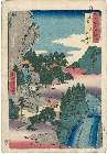
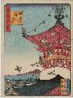
「六十余州名所図会」 「但馬」「岩井谷」「窟観音」

Politische Karte von China : Japan, Korea, China und der Mandschurei / herausgegeben von A. Scobel
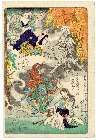
「(狂斎百図)一寸さきはやみ」 「人をいのらば穴二ツ」「まだかはのある内に目とほねを見よ」「深大寺御坊」

Courtiers and attendants crossing bridge from 36 immortal women poets in printed brocades (Nishikizuri onna sanjūrokkasen)

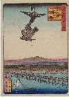
Eastern Asia, showing Japan, Korea, Manchuria and adjoining parts of Siberia and China. 185 miles ...
Naniwahyakkei

「当盛見立人形之内」 「一ツ家之図」

Imperii Russici et Tatariae Universae tam majoris et Asiaticae quam minoris et Europae Tabula . . ...
「三十六花撰」 「東都隅田川八重桜九」

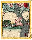
Fujikawa

Meishoedohyakkei
Naniwahyakkei

Mandchourie et Coree de Kharbine a Seoul de Port-Arthur a Vladivostok Traduction de la Carte d'Eta...

Regni Japoniae nova mappa geographica , ex indigenarum observationibus delineata ab Engelberto Kae...
「(狂斎百図)あみ陀の光も金次第」 「正直ノ頭上にかみやとる」

Karte des Ostasiastichen kriegsschauplatzes / von Gustav Richter
「(狂斎百図)行力」
「(狂斎百図)山のいもうばぎニ成」
「(狂斎百図)あたまかくして尻かくさず」
Last Updated:
Uploaded: 2021-07-27