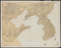
Stanford's map of eastern China, Japan and Korea : the seat of war in 1894
- People
- Time
- Owner Organization
MAP, OF THE SEAT OF WAR BETWEEN CHINA AND JAPAN; (Auckland Star, 22 September 1894)
National Library of New Zealand
DigitalNZ New Zealand API

Special war map of China, Korea, and Japan
Stanford University Libraries
Stanford Libraries SearchWorks

1904 war map of Japan, Korea, and China
Yale University Library
Yale University Library Digital Collections

1904 war map of Russia and the continent of Asia
Yale University Library
Yale University Library Digital Collections

Rand, McNally & Co.'s 1904 war map of Russia and the continent of Asia
Yale University Library
Yale University Library Digital Collections

Bartholomew's special Map of China, Japan and Korea
Bibliothèque nationale de France
Europeana API

Bartholomew's Special Map of China, Japan and Korea
Bibliothèque nationale de France
Europeana API
Stanford's map of China & Japan with the adjacent parts of the Russian Repubcs. India, Burma &c / Stanford's Geographical Establishment
National Library of Australia
Trove: National Library of Australia
Stanford's map of the empires of China and Japan with the adjacent parts of the Russian Empire, India, Burma &c / Stanford's Geogl. Estabt
National Library of Australia
Trove: National Library of Australia

Stanford's map of China and Japan with the adjacents parts of the Russian Rebubcs., India, Burma &...
Stanford University Libraries
Stanford Libraries SearchWorks
Stanford's map of the empires of China and Japan : with the adjacent parts of the Russian Empire, ...
VU University Amsterdam Library
Europeana API
Japan-China War, 1894-5
Yale University Library
Yale University Library Digital Collections
![[Railroads in China, Manchuria, Korea, Japan and the eastern U.S.S.R.] [cartographic material]](https://stacks.stanford.edu/image/iiif/pf710vm7134%2Fpf710vm7134_00_0001/full/!200,200/0/default.jpg)
[Railroads in China, Manchuria, Korea, Japan and the eastern U.S.S.R.] [cartographic material]
Stanford University Libraries
Stanford Libraries SearchWorks
Der Krieg zwischen China und Japan 1894/95. 1 Theil, Das Jahr 1894
Jagiellońska Library Cyfrowa
Europeana API

Korean War 1950-1953 -- Asia, North Korea, South Korea, China, Manchuria, Japan Map / Maps.com(CR)
National Library of Australia
Trove: National Library of Australia
War map : Australia, China, Japan, and the South Pacific / Cyril Dillon
National Library of Australia
Trove: National Library of Australia

CHINA AND JAPAN AT WAR
Auckland Libraries
DigitalNZ New Zealand API
[Album of 46 Views of China, Korea, and Japan]
Metropolitan Museum of Art
The Metropolitan Museum of Art Open Access CSV
![[Russian Map of Northeastern Asia, Japan, Korea, China, Alaska, etc.] ( Summary map of hydrographi...](https://stacks.stanford.edu/image/iiif/pj697kr2558%2F35405/full/!200,200/0/default.jpg)
[Russian Map of Northeastern Asia, Japan, Korea, China, Alaska, etc.] ( Summary map of hydrographi...
Stanford University Libraries
Stanford Libraries SearchWorks
"Daily Mail" map of the war in China / G. Philip & Son
National Library of Australia
Trove: National Library of Australia

(Eastern Part of Asia, including China, Korea, Japan, Philippines : Untitled Globe Gores)
Stanford University Libraries
Stanford Libraries SearchWorks

The war against Japan (Map USSR, China & Australia)
Australian National Maritime Museum
Trove: National Library of Australia

Farmers of forty centuries; or, Permanent agriculture in China, Korea and Japan
Library of Congress
Europeana API
Farmers of forty centuries; or, Permanent agriculture in China, Korea and Japan
Library of Congress
Europeana API

The Japanese empire : with central and southern Manchukuo (Manchuria)
Yale University Library
Yale University Library Digital Collections

Carte réduite de l'Océan Oriental depuis le Cap de Bonne Esperance, jusqu'au Japon : dédiée à l'Ac...
Bibliothèque nationale de France
Europeana API
Gōshū shūikizu : Roppyakumanbun no ichi
National Library of Australia
Trove: National Library of Australia

Map of Chosen (Korea)
Yale University Library
Yale University Library Digital Collections

亜細亜東部略図
Saga Prefectual Library
IIIF Discovery in Japan

Nagasaki
Yale University Library
Yale University Library Digital Collections

The Islands of Japan, by James Wyld,..
Bibliothèque nationale de France
Europeana API
Nanpōken jikyoku shigen seizu
National Library of Australia
Trove: National Library of Australia

Map of Colorado Territory, Compiled from Government Maps & Actual Surveys. Made In 1861
Stanford University Libraries
Stanford Libraries SearchWorks

「大橋村 行事村 宮市村見取図」
行橋市歴史資料館
ADEAC: A System of Digitalization and Exhibition for Archive Collections
Kōgun senka kakudai ikkenzu : (fu) fukin chiten no koji gaisetsu
National Library of Australia
Trove: National Library of Australia
A new & correct chart of the Indian Sea from Cabo Bonea Esperanca to Japan according to Mr. Edward Wrights projection vulgarly called Mercators chart
National Library of Australia
Trove: National Library of Australia

L'Empire de la Chine d'après l'Atlas Chinois avec les Isles du Japon . .
Stanford University Libraries
Stanford Libraries SearchWorks
Kaart van Japan : behoorende tot de, door het Provinciaal Utrechtsch Genootschap bekroonde verhandeling
National Library of Australia
Trove: National Library of Australia
Korea / prepared ... by the Army Map Service, U.S. Army
National Library of Australia
Trove: National Library of Australia

Kaetsunousanshuugunwakeryakuezu
Imizu City Shinminato Museum
ADEAC: A System of Digitalization and Exhibition for Archive Collections
Das Chinesische Reich und das Kaiserthum Japan /
Univerzita Karlova. Mapová sbírka
Europeana API

Mer Orientale, où l'on trouve l'isle de Jedso, de laquelle on doutoit si c'étoit une isle ou non
Bibliothèque nationale de France
Europeana API

Map of Colorado Territory, Compiled from Government Maps & Actual Surveys. Made In 1861
Stanford University Libraries
Stanford Libraries SearchWorks
![Kaisei dai Nihon bizu [carte du Japon] / par Jikôan Mabuchi](https://api.europeana.eu/api/v2/thumbnail-by-url.json?uri=http%3A%2F%2Fgallica.bnf.fr%2Fark%3A%2F12148%2Fbtv1b53066779q.thumbnail.jpg&type=IMAGE)
Kaisei dai Nihon bizu [carte du Japon] / par Jikôan Mabuchi
Bibliothèque nationale de France
Europeana API

Tabula Indiae Orientalis et Regnorum Adjacentium J. Van Braam et G. onder de Linden . .
Stanford University Libraries
Stanford Libraries SearchWorks

A Chart of the Eastermost part of the East Indies and China from Cape Comarin to Japan with the Ad...
Stanford University Libraries
Stanford Libraries SearchWorks

Pas-caart van Zuyd-Zee, tusschen California en ilhas de Ladrones
Stanford University Libraries
Stanford Libraries SearchWorks

佐賀縣管内全圖
Saga Prefectual Library
IIIF Discovery in Japan
Last Updated: 2020-06-05
Uploaded: 2021-07-22