


![東部ニューギニア「フォン」半島及「マダン」地區兵要地誌資料圖 [地図資料]](https://stacks.stanford.edu/image/iiif/ns225gy7512%2Fns225gy7512_00_0001/full/!200,200/0/default.jpg)


![同江附近國境要圖 [地図資料]](https://stacks.stanford.edu/image/iiif/hj843kz4053%2Fhj843kz4053_00_0001/full/!200,200/0/default.jpg)


Map of Chosen (Korea)

Carte Du Kamtchatka . .

「摂州住吉大神社勝景図」 「呼名 摂住吉」
Kaart van Japan ... Van R.G. Bennet en J. Van Wyk R. ... R Van Wyk Jx del
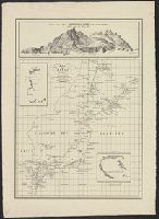
![水路部軍機 [海圖].](https://stacks.stanford.edu/image/iiif/sp648zm5831%2Fsp648zm5831_0001/full/!200,200/0/default.jpg)
水路部軍機 [海圖].

Carte De L'Oceanie Contenant L'Australe, La Polynesie et Les Iles Asiatique [Australia called Nota...

五万分一ラバウル近傍集成圖.

Korea, East China and Japan / The Norris Peters Co., photo-lith

China, Contains 15 Subject Provinces, including the 2 Islands of Hainan Formosa and the Tributary ...

Asia : Coast of China : Ryōtō Kaiwan. Approaches to Ryō Ga Entrance

Japan. (with) Kurile Islands. Letts's popular atlas. Letts, Son & Co Limited, London. (1883)

China - east coast : Hangchow Wan - southeast portion : including the approaches to the Yung Kiang

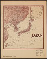
Map of Northern Japan. Map of Southern Japan

Japan, Hokushu _ West Coast. Iwanai Byochi and Approaches
![Tokyo : [base map showing political divisions]](https://stacks.stanford.edu/image/iiif/jw443fg4075%2Fjw443fg4075_00_0001/full/!200,200/0/default.jpg)
Tokyo : [base map showing political divisions]
Japan and adjacent regions / prepared and distributed by Army Information Branch, Army Service Forces

大日本国沿海略図

A new and accurate map of the Empire of Japan. Laid down from the memoirs of the Portuguese and Du...

Iaponia Regnum

Nagasaki

Iaponia Regnum

Japan. (inset) Plan of Yeddo Bay

Asia Concinnata Secundum Observationes Academiae Regalis Scientiarum . .

Carte Des Missions Cathliques au Japan . . . 1898 (China and Formosa related insets)
最終更新日: 2020-04-17
登録日: 2021-09-21