
A new and accurate map of the Empire of Japan. Laid down from the memoirs of the Portuguese and Du...
- Time
- Owner Organization

A new and accurate map of the Empire of Japan : laid down from the memoirs of the Portuguese and Dutch, and ...

A New and Accurate Map of the Empire of Japan Laid down from the Memoirs of the Portugese and Dutc...

Map of Asia

Map of the Empire of Japan

A New and Accurate Map of the Colony of Massachusets Bay, In North America from a Late Survey

A New and Accurate Map of the Colony of Massachusets Bay, In North America from a Late Survey

A New and Accurate Map of the World. Drawn from the best Surveys and regulated by Astronomical Obs...

Map of the Empire of Japan in 1914

A New and Correct Chart of all the Known World Laid down according to Mercator's Projection

A New and Correct Chart of all the Known World Laid down according to Mercator's Projection

A New and Correct Chart of all the Known World Laid down according to Mercator's Projection
1 1/2 sen Map of the Empire of Japan
Stanford's map of the empires of China and Japan : with the adjacent parts of the Russian Empire, ...

Map of the Great Japanese Empire (Dainihon Kokugun Yochi Zenzu)

Geological map of the Japanese Empire on the scale of 1:1,000,000

New map of Kobe

New Map of Japan

A map of the city of Nagasaki, and of the adjacent country; Sorts of money current in the Japanese Empire

A New & Accurate Chart of the Discoveries made by the late Capt. Js. Cook, and other distinguished...

An accurate Map of the British Colonies in North Ameria bordering on the River Ohio (First Appeara...

An Accurate Chart of the World, with the New Discoveries; Also a View of the General & Coasting Tr...

Mendenhall's New Map of Cincinnati .

Map of the Empire of China and Japan. J.W. del. (engraved by) Stockley, Sc London, James Wyld, Cha...
Stanford's map of the empires of China and Japan with the adjacent parts of the Russian Empire, India, Burma &c / Stanford's Geogl. Estabt

Das Chinesische Reich mit den Schutz-Staaten, und Japan: entw. u. gez. v. C.G R.(eichard) 1826. Ge...

Asia distinguished into its principall parts

Empire of Japan. (with) Nagasaki Harbour. Engraved by J. & C. Walker. Published under the superint...

L'Empire Du Japon, Tire Des Cartes Des Japonais

L'Impero del Giapon : diviso in sette principali parti cioe ochio quanto jetsegen jetsen jamaisoit...

Chinesisches Reich und Japan. Entw. u. gez. v. F. Handtke. Druck und Verlag von C Flemming in Glog...

Descripcao nova, e exacta dos Reynos, e Provincias do Japao

Chart of the Discoveries made in 1787, in the Seas of China and Tartary by the Boussole and Astrol...

Descripcion De Las Yndias Ocidentales

Chart of Discoveries, Made in 1787, in the Seas of China and Tartary, by the Boussole and Astrolab...

Japan. (with) Kurile Islands. Letts's popular atlas. Letts, Son & Co Limited, London. (1883)

Descripcao nova, e exacta dos Reynos, e Provincias do Japao

Carte des decouvertes au nord du Japon. Faites en 1643 par les Vaisseaux Hollandais le Kastrikum e...

Japan. (inset) Plan of Yeddo Bay

India Orientalis . . . 1600

Japan. Copyright 1892 by Appleton & Co. (insets) Kurile Islands; Tokyo. (to accompany) The Library...

Imperii Sinarum Nova Descriptio
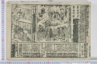
Collection of Thirty-six Kyōka Poems

(Covers to) Picture map of China. Designed by Frank Randolph Southard. Printed in United States of...

China, Contains 15 Subject Provinces, including the 2 Islands of Hainan Formosa and the Tributary ...

The Empire of China and island of Japan, agreeable to modern history. By H Moll Geographer. (Print...

Carte de L'Asie selon le auteurs Anciens enrichie de Remarques Historiques sur les changemens qui ...

China, Contains 15 Subject Provinces, including the 2 Islands of Hainan Formosa and the Tributary ...
Oriawasetsuzurenonishiki
Last Updated: 2020-04-17
Uploaded: 2021-09-21