![Bering Sea, Japanese fishing and associated activities, 1930-1941 [cartographic material]](https://stacks.stanford.edu/image/iiif/kb473nj6517%2Fkb473nj6517_00_0001/full/!200,200/0/default.jpg)
Bering Sea, Japanese fishing and associated activities, 1930-1941 [cartographic material]
![Japan, radiotelephone and radiotelegraph stations [cartographic material] : 1941](https://stacks.stanford.edu/image/iiif/pp234mp0165%2Fpp234mp0165_00_0001/full/!200,200/0/default.jpg)
Japan, radiotelephone and radiotelegraph stations [cartographic material] : 1941
![Hokkaidō agriculture and fishing [cartographic material].](https://stacks.stanford.edu/image/iiif/db438gj7162%2Fdb438gj7162_00_0001/full/!200,200/0/default.jpg)
Hokkaidō agriculture and fishing [cartographic material].
![Japanese fishing, areas and seasons [cartographic material]](https://stacks.stanford.edu/image/iiif/gd847mc5303%2Fgd847mc5303_00_0001/full/!200,200/0/default.jpg)
Japanese fishing, areas and seasons [cartographic material]
![China and Japan [cartographic material]](https://collections.library.yale.edu/iiif/2/15828553/full/!200,200/0/default.jpg)
China and Japan [cartographic material]
![Japanese prisoner of war camps, during World War II, 1941-1945 [cartographic material] : known loc...](https://stacks.stanford.edu/image/iiif/zg928bt5514%2Fzg928bt5514_00_0001/full/!200,200/0/default.jpg)
Japanese prisoner of war camps, during World War II, 1941-1945 [cartographic material] : known loc...
![(A Set of Landform and Outline Maps by Erwin Raisz) [cartographic material].](https://stacks.stanford.edu/image/iiif/vf022zq3993%2F7943001/full/!200,200/0/default.jpg)
(A Set of Landform and Outline Maps by Erwin Raisz) [cartographic material].
![Iapan I [cartographic material]](https://collections.library.yale.edu/iiif/2/16708254/full/!200,200/0/default.jpg)
Iapan I [cartographic material]
![China and Japan [cartographic material] / compiled from G.S.G.S. 4065 and 2957](https://collections.library.yale.edu/iiif/2/15510764/full/!200,200/0/default.jpg)
China and Japan [cartographic material] / compiled from G.S.G.S. 4065 and 2957
![Japan and adjacent regions of Asia and the Pacific Ocean [cartographic material] / compiled and drawn in the...](https://collections.library.yale.edu/iiif/2/15510875/full/!200,200/0/default.jpg)
Japan and adjacent regions of Asia and the Pacific Ocean [cartographic material] / compiled and drawn in the...
![Japan and adjacent regions of Asia and the Pacific Ocean [cartographic material] / compiled and drawn in the...](https://collections.library.yale.edu/iiif/2/15509964/full/!200,200/0/default.jpg)
Japan and adjacent regions of Asia and the Pacific Ocean [cartographic material] / compiled and drawn in the...
![Far East, Japanese occupied area, major railroads [cartographic material] / Board of Economic Warfare, Enemy...](https://collections.library.yale.edu/iiif/2/15510697/full/!200,200/0/default.jpg)
Far East, Japanese occupied area, major railroads [cartographic material] / Board of Economic Warfare, Enemy...
「仮名手本忠臣蔵」 「大序」「師直顔世へ艶書を附く」

「尾陽熱田駅亀足山正覚寺境内図」
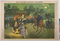
「忠臣義士四十七士」 「教育日本歴史画」

富士山大宮口 四合目之景
「忠臣義士四十七士」 「教育日本歴史画」

鎮海湾要塞加徳方面一万分一圖
![Nagoya [cartographic material] : municipal water supply, distribution](https://stacks.stanford.edu/image/iiif/cx861js2541%2Fcx861js2541_00_0001/full/!200,200/0/default.jpg)
Nagoya [cartographic material] : municipal water supply, distribution

Southern Okinawa

Population densities in Japan
「能楽図絵」 「翁 千歳 三番叟」

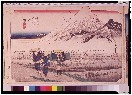
「東海道五拾三次之内」「金谷」「大井川遠岸」
「赤穂城明渡し大石内蔵之介良雄の無念」 「城明渡し」

「京都名所」 「御所御庭之景」
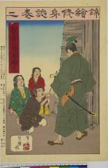
「錦絵修身談」 「巻二」「十三」「幼児身を以て父を購ふ」「十六丁」

「日本歴史画武士道亀鑑」 「赤穂城明渡し」
「教育日本歴史画」 「忠臣義士四十七士」
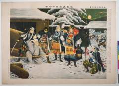
「日立丸之最後須●中佐連隊旗を焼く」

「奈良名所東山一覧之図」

「誠忠義士四十七士」 「泉岳寺霊前ノ手向」

「文永八年辛未歳九月十二日鎌倉竜之口御難之図」

「近世義勇伝」 「森五六郎」
東海道五十三次
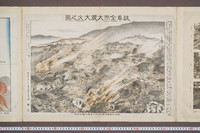
岐阜全市大震大火之図
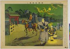
「赤穂城明渡し」 「日本歴史画武士道亀鑑」
最終更新日: 2020-04-17
登録日: 2021-09-21