![Nagoya [cartographic material] : municipal water supply, distribution](https://stacks.stanford.edu/image/iiif/cx861js2541%2Fcx861js2541_00_0001/full/!200,200/0/default.jpg)
Nagoya [cartographic material] : municipal water supply, distribution
- Time
- Owner Organization
![Kōbe [cartographic material] : municipal water supply, distribution](https://stacks.stanford.edu/image/iiif/yk027jw4267%2Fyk027jw4267_00_0001/full/!200,200/0/default.jpg)
Kōbe [cartographic material] : municipal water supply, distribution
Stanford University Libraries
Stanford Libraries SearchWorks
![Nagoya, Aichi prefecture, Honshu [cartographic material].](https://stacks.stanford.edu/image/iiif/ks759rr4464%2Fks759rr4464_0001/full/!200,200/0/default.jpg)
Nagoya, Aichi prefecture, Honshu [cartographic material].
Stanford University Libraries
Stanford Libraries SearchWorks
![[Map of Kyoto] [cartographic material]](https://collections.library.yale.edu/iiif/2/16683048/full/!200,200/0/default.jpg)
[Map of Kyoto] [cartographic material]
Yale University Library
Yale University Library Digital Collections
![Government railroads of Japan [cartographic material].](https://stacks.stanford.edu/image/iiif/kn953gw3179%2Fkn953gw3179_0001/full/!200,200/0/default.jpg)
Government railroads of Japan [cartographic material].
Stanford University Libraries
Stanford Libraries SearchWorks
![Map of Manchuria, Corea & Japan [cartographic material]](https://collections.library.yale.edu/iiif/2/15828540/full/!200,200/0/default.jpg)
Map of Manchuria, Corea & Japan [cartographic material]
Yale University Library
Yale University Library Digital Collections

Eastern Asia
Yale University Library
Yale University Library Digital Collections
![Far East, Japanese occupied area, major railroads [cartographic material]](https://stacks.stanford.edu/image/iiif/zm881nj6799%2Fzm881nj6799_00_0001/full/!200,200/0/default.jpg)
Far East, Japanese occupied area, major railroads [cartographic material]
Stanford University Libraries
Stanford Libraries SearchWorks
![China and Japan [cartographic material]](https://collections.library.yale.edu/iiif/2/15828553/full/!200,200/0/default.jpg)
China and Japan [cartographic material]
Yale University Library
Yale University Library Digital Collections
![Kantō area [cartographic material] : highways and waterways](https://stacks.stanford.edu/image/iiif/gd204cf5107%2Fgd204cf5107_00_0001/full/!200,200/0/default.jpg)
Kantō area [cartographic material] : highways and waterways
Stanford University Libraries
Stanford Libraries SearchWorks
![Hokkaidō agriculture and fishing [cartographic material].](https://stacks.stanford.edu/image/iiif/db438gj7162%2Fdb438gj7162_00_0001/full/!200,200/0/default.jpg)
Hokkaidō agriculture and fishing [cartographic material].
Stanford University Libraries
Stanford Libraries SearchWorks
Japan I
Yale University Library
Yale University Library Digital Collections
![(A Set of Landform and Outline Maps by Erwin Raisz) [cartographic material].](https://stacks.stanford.edu/image/iiif/vf022zq3993%2F7943001/full/!200,200/0/default.jpg)
(A Set of Landform and Outline Maps by Erwin Raisz) [cartographic material].
Stanford University Libraries
Stanford Libraries SearchWorks
[New Zealand tour maps showing railway, coach and horse routes] [cartographic material]
National Library of New Zealand
DigitalNZ New Zealand API
![Japan [cartographic material] : railroads and railroad facilities](https://stacks.stanford.edu/image/iiif/yv242dj2410%2Fyv242dj2410_00_0001/full/!200,200/0/default.jpg)
Japan [cartographic material] : railroads and railroad facilities
Stanford University Libraries
Stanford Libraries SearchWorks
![Japan, radiotelephone and radiotelegraph stations [cartographic material] : 1941](https://stacks.stanford.edu/image/iiif/pp234mp0165%2Fpp234mp0165_00_0001/full/!200,200/0/default.jpg)
Japan, radiotelephone and radiotelegraph stations [cartographic material] : 1941
Stanford University Libraries
Stanford Libraries SearchWorks
![Tokyo and vicinity, showing bombed-out areas [cartographic material]](https://stacks.stanford.edu/image/iiif/jx217xm7539%2Fjx217xm7539_00_0001/full/!200,200/0/default.jpg)
Tokyo and vicinity, showing bombed-out areas [cartographic material]
Stanford University Libraries
Stanford Libraries SearchWorks
![Japan [cartographic material] : industrial concentration by prefectures](https://stacks.stanford.edu/image/iiif/zh931gv1396%2Fzh931gv1396_00_0001/full/!200,200/0/default.jpg)
Japan [cartographic material] : industrial concentration by prefectures
Stanford University Libraries
Stanford Libraries SearchWorks

Nemuro
Yale University Library
Yale University Library Digital Collections
![Exactissima Asiae delineatio, in praecipuas regiones, ceterasq [cartographic material] : partes divisa, et d...](https://collections.library.yale.edu/iiif/2/16618498/full/!200,200/0/default.jpg)
Exactissima Asiae delineatio, in praecipuas regiones, ceterasq [cartographic material] : partes divisa, et d...
Yale University Library
Yale University Library Digital Collections
![Bering Sea, Japanese fishing and associated activities, 1930-1941 [cartographic material]](https://stacks.stanford.edu/image/iiif/kb473nj6517%2Fkb473nj6517_00_0001/full/!200,200/0/default.jpg)
Bering Sea, Japanese fishing and associated activities, 1930-1941 [cartographic material]
Stanford University Libraries
Stanford Libraries SearchWorks
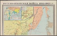
Русско-японская война 1904-1905 гг. / карта составлена Научно-редакционной картосоставительской частью ГУГК ...
Yale University Library
Yale University Library Digital Collections
![Far East, Japanese occupied area, major railroads [cartographic material] / Board of Economic Warfare, Enemy...](https://collections.library.yale.edu/iiif/2/15510697/full/!200,200/0/default.jpg)
Far East, Japanese occupied area, major railroads [cartographic material] / Board of Economic Warfare, Enemy...
Yale University Library
Yale University Library Digital Collections

Central Japan (central and northern Honshū) water supply
Stanford University Libraries
Stanford Libraries SearchWorks
![Accuratissima totius Asiae tabula [cartographic material] : in omnes partes divisa, de nova correcta, ac in ...](https://collections.library.yale.edu/iiif/2/16669381/full/!200,200/0/default.jpg)
Accuratissima totius Asiae tabula [cartographic material] : in omnes partes divisa, de nova correcta, ac in ...
Yale University Library
Yale University Library Digital Collections

Takasaki, Gumma Prefecture, Honshu, Japan
Stanford University Libraries
Stanford Libraries SearchWorks

Tsuruga, Fukui Prefecture, Honshu, Japan
Stanford University Libraries
Stanford Libraries SearchWorks

Hachinohe, Aomori Prefecture, Honshu, Japan
Stanford University Libraries
Stanford Libraries SearchWorks

The Japanese petroleum industry (map no. two)
Stanford University Libraries
Stanford Libraries SearchWorks

Hitoyoshi, Japan, Kumamoto Ken, Kyushu
Stanford University Libraries
Stanford Libraries SearchWorks

Southwest Japan (Kyūshū, Shikoku, and southwest Honshū), telecommunications
Stanford University Libraries
Stanford Libraries SearchWorks

Higashi-iwase, Toyama Prefecture, Honshu, Japan
Stanford University Libraries
Stanford Libraries SearchWorks

Toyama, Toyama Prefecture, Honshu, Japan
Stanford University Libraries
Stanford Libraries SearchWorks

Zentsuji, Kagawa Prefecture, Shikoku, Japan
Stanford University Libraries
Stanford Libraries SearchWorks

Koriyama, Fukushima Prefecture, Honshu, Japan
Stanford University Libraries
Stanford Libraries SearchWorks

Southwest Japan (Kyūshū, Shikoku, and southwest Honshū), cotton spinning, silk and rayon production
Stanford University Libraries
Stanford Libraries SearchWorks

「尾陽熱田駅亀足山正覚寺境内図」
C. V. Starr East Asian Library, University of California, Berkeley
ARC Ukiyo-e Portal Database

Aomori, Aomori Prefecture, Honshu, Japan
Stanford University Libraries
Stanford Libraries SearchWorks

Kariya, Aichi Prefecture, Honshu, Japan
Stanford University Libraries
Stanford Libraries SearchWorks

Hokutō onsen fukinzu = Map of Beitou hot springs and surrounding area
Stanford University Libraries
Stanford Libraries SearchWorks

Yokohama and Vicinity
Stanford University Libraries
Stanford Libraries SearchWorks

徳島市街図
Tokushima Prefectural Archives
ADEAC: A System of Digitalization and Exhibition for Archive Collections

豊橋市地図 縮尺一万分一
Toyohashi City Library
ADEAC: A System of Digitalization and Exhibition for Archive Collections

Town plan of Kōfu
Stanford University Libraries
Stanford Libraries SearchWorks

Akita, Akita Prefecture, Honshu, Japan
Stanford University Libraries
Stanford Libraries SearchWorks

City plan of Kōbe.
Stanford University Libraries
Stanford Libraries SearchWorks
![Town plan of Sendai [cartographic material]](https://stacks.stanford.edu/image/iiif/fv573yp8495%2Ffv573yp8495_00_0001/full/!200,200/0/default.jpg)
Town plan of Sendai [cartographic material]
Stanford University Libraries
Stanford Libraries SearchWorks
![Tōbu nyūginia fon hantō oyobi madan chiku heiyō chishi shiryōzu [cartographic material]](https://stacks.stanford.edu/image/iiif/ns225gy7512%2Fns225gy7512_00_0001/full/!200,200/0/default.jpg)
Tōbu nyūginia fon hantō oyobi madan chiku heiyō chishi shiryōzu [cartographic material]
Stanford University Libraries
Stanford Libraries SearchWorks

Proposed plan of Ujigawa denki kabushiki kwai-sha : From Nango, Ishiyama-Mura, Shiga Prefecture, t...
Stanford University Libraries
Stanford Libraries SearchWorks
Last Updated: 2020-04-17
Uploaded: 2021-09-21