
佐賀県管内図

佐賀県管内図

五十万分一後貝加爾方面素圖.
「白沢之図」

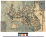
喜久田村全略図

The Japanese empire : with central and southern Manchukuo (Manchuria)
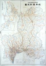
岐阜県新地図

飛騨交通地図(飛濃自働車株式会社定期運転道路)
Korea / prepared ... by the Army Map Service, U.S. Army
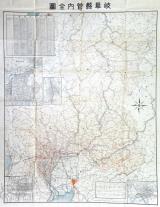
岐阜県管内全図
![[下図]「射水郡中川村兵左衛門組早川村内検地領下絵図」寛政十一年十月](https://adeac.jp/items/imizu-shinminato-mus/catalog/mp102760-15100/3-1-BII182v2.jpg)
[下図]「射水郡中川村兵左衛門組早川村内検地領下絵図」寛政十一年十月
房州図 : 房州図

四川附近五十万分一地誌圖 : 兵要地誌圖

Strategical map of part of Korea and Manchuria / prepared by the Second Division, General Staff (Military In...

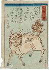
Kubo Cherry Tree at Isazawa (Isazawa no Kubo-zakura)

Military Map of South-Eastern Virginia

佐賀県管内図

群馬縣勢要覽

習志野演習場

Stanford's map of China and Japan with the adjacents parts of the Russian Rebubcs., India, Burma &...
Manshūkoku chizu / Minami Manshū Tetsudō Kabushiki Kaisha chosaku ken hakkō

「泰平大撃剣」
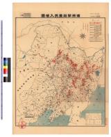
満洲開拓農民入植図 : 満洲開拓農民入植図
最終更新日: 2020-06-05
登録日: 2021-07-22