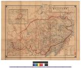
Manshūkoku chizu / Minami Manshū Tetsudō Kabushiki Kaisha chosaku ken hakkō
- Time
- Owner Organization
![Page with drawings of funnel and house flag of Nippon Yushen Kabushiki Kaisha, [NYKK]; Japan Mail SSCo Ltd, Tokyo](https://www.gumtree.com/static/1/resources/assets/rwd/images/orphans/a37b37d99e7cef805f354d47.noimage_thumbnail.png)
Asia and its several islands and regions : according to their most approved divisions with Captain Cooks new discoveries / by Thomas Kitchin, Hydrographer to His Majesty

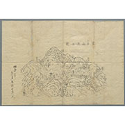
「〔箱根絵図〕」
![Karte von China und Japan den Manen D'Anville's und Klapproth's [cartographic material] / gewidmet Potsdam v...](https://collections.library.yale.edu/iiif/2/15824679/full/!200,200/0/default.jpg)
Karte von China und Japan den Manen D'Anville's und Klapproth's [cartographic material] / gewidmet Potsdam v...
Pas-caert van't Oostelyckste deel van Oost Indien : met alle de Eylanden daer onder gelegen, van Cabo Comorin tot aen Japan / by Hendrick Doncker Boekverkooper en Graadbooghmaacker Inde Nieuwbrughsteegh
![Indo oyobi Seia [cartographic material] : Roppyakmanbun no ichi](https://stacks.stanford.edu/image/iiif/dx650yf2686%2Fdx650yf2686_00_0001/full/!200,200/0/default.jpg)
Indo oyobi Seia [cartographic material] : Roppyakmanbun no ichi
To the Right Honourable William, Lord Cowper, Lord High Chancellor of Great Britain, this map of Asia : according to ye newest and most exact observations is most humbly dedicated / by your Lordship's most humble servant, Herman Moll, geographer
Laurie and Whittle's new chart of the Indian and Pacific Oceans between the Cape of Good Hope, New Holland and Japan : comprehending New Zealand, New Caledonia, New Britain, New Ireland, New Guinea &c., Louisiade and New Georgia; also The Pelew, New Caroline, Ladrone and Philippine Islands &c. with the most remarkable tracks of the English, Spanish, French and Dutch navigators and chiefly the track of the Walpole, EastIndiaman, Captn. Thos. Butler, 1794 from the Cape of Good Hope to Van Diemen's Land and from thence to China, and the track of the Royal Admiral Captn. Henr. Bond in 1792 and 93 from the Cape to Port Jackson and China
東部内蒙古地図 : 蒙古地誌付図
![Sensei-shō gojūmanbun no ichi chishizu [cartographic material]](https://stacks.stanford.edu/image/iiif/wm502tg3204%2Fwm502tg3204_00_0001/full/!200,200/0/default.jpg)
Sensei-shō gojūmanbun no ichi chishizu [cartographic material]
![Shisen fukin gojūmanbun no ichi chishizu [cartographic material] : heiyō chishizu](https://stacks.stanford.edu/image/iiif/nn836py9296%2Fnn836py9296_00_0001/full/!200,200/0/default.jpg)
Shisen fukin gojūmanbun no ichi chishizu [cartographic material] : heiyō chishizu

Magnae Tartariae, Hagni Mongolis Imperii, Japoniae et Chinae nova Descriptio et Tabula..

「〔箱根絵図〕」

Map of Asia
![Gohyakumanbunnoichi sorenpō yochizu [cartographic material]](https://stacks.stanford.edu/image/iiif/vz338tz0647%2Fvz338tz0647_00_0001/full/!200,200/0/default.jpg)
Gohyakumanbunnoichi sorenpō yochizu [cartographic material]

Gojūmanbun no ichi Gobaikaru hōmen sozu
Kasei Biruma Gojūmanbun ichi zu (7 he 501)
Asia with the islands adioyning described, the atire of the people & townes of importance, all of them newly augmented by I.S. Ano dom. 1626 / Sculptum apud Abrahamum Goos

Asia

General map of China and adjacent regions showing treaty ports and railroads / prepared for the Department o...

Laurie and Whittle's New Chart of the Indian and Pacific Oceans Between the Cape of Good Hope, New...

「鎌倉一覧之図」
富士山頂上図(表口、須山口)

(Composite of) A New Chart of The Pacific Ocean, Exhibiting The Western Coast of America, From Cap...
Last Updated: 2020-06-05
Uploaded: 2021-07-22