
Map of Colorado Territory, Compiled from Government Maps & Actual Surveys. Made In 1861
- People
- Time
- Owner Organization

Map of Colorado Territory, Compiled from Government Maps & Actual Surveys. Made In 1861

Map of Colorado Territory, Compiled from Government Maps & Actual Surveys. Made In 1861

Map of Colorado Territory, Compiled from Government Maps & Actual Surveys. Made In 1861

A Correct Map From Actual Surveys And Examinations Embracing A Portion of California Between Monte...

Lloyd's Official Map of the State of Tennessee Compiled From Actual Sureys and Official Documents ...

General map of the Government Railways in Japan

Japan, Gulf of Ösaka, Hiogo and Ösaka compiled from British and French surveys to 1878

Stanford's library Map of Japan / principally compiled from japanese documents, by E. Knipping

Cannon's Map of the Mineral Belt of Colorado Taken from the Records of the Surveyor General's Offi...

map from "The Claims of Japan and Malaysia upon Christendom exhibited in notes of voyages made in ...

map from "The Claims of Japan and Malaysia upon Christendom exhibited in notes of voyages made in ...

Map of China And the Surrounding Regions. Compiled from the latest information by E. Bretscheider....

Japan : South coast of Honshu : Gulf of Tokyo or Yedo. Compiled from Japanese Government, and Brit...

A New and Accurate Map of the World. Drawn from the best Surveys and regulated by Astronomical Obs...

A New and Accurate Map of the Colony of Massachusets Bay, In North America from a Late Survey

A New and Accurate Map of the Colony of Massachusets Bay, In North America from a Late Survey

map from "Japan in Transition. A comparative study of the progress, policy, and methods of the Jap...

map from "Japan in Transition. A comparative study of the progress, policy, and methods of the Jap...
A new map of the empires, states, provinces &c of Asia : including also the Turkish & Russian dominions in Europe & New Holland / compiled from the most authentic observations by Robert Wilkinson ; Walsh script. ; W. Palmer sculpt
The Suma oriental of Tomé Pires : an account of the East from the Red Sea to Japan, written in Malacca and India in 1512-1515; and, The Book of Francisco Rodrigues, rutter of a voyage in the Red Sea, nautical rules, almanack and maps written and drawn in the East before 1515 (Map in pocket of vol.2: The east, from the Red Sea to Japan, as known to Francisco Rodrigques)
Tsunamis in the Pacific Basin, 1900-1983 / map produced by Patricia A. Lockridge, National Geophysical Data Center and Ronald H. Smith, Cooperative Institute for Research in Environmental Sciences ; published by National Geophysical Data Center and World Data Center A for Solid Earth Geophysics with support from Office of U.S. Foreign Disaster Assistance, Agency for International Development in cooperation with Circum-Pacific Council for Energy and Mineral Resources, Map Project
The country trade East-India pilot, for the navigation of the East-Indies and oriental seas, within the limits of the East-India Company, extending from the Cape of Good Hope to China, New Holland and New Zeeland, with the Red Sea, Gulf of Persia, Bay of Bengal, and China Seas / chiefly composed from actual surveys and draughts communicated by experienced officers of the East-India Company, and from the Neptune oriental by M. d'Apres de Mannevillette
Map of Colorado Territory, Compiled from Government Maps & Actual Surveys. Made In 1861
Map of Colorado Territory, Compiled from Government Maps & Actual Surveys. Made In 1861
Map of Colorado Territory, Compiled from Government Maps & Actual Surveys. Made In 1861

Maebashi, Gumma Prefecture, Honshu, Japan

伏見の図

基肄壱郡養父半郡絵図
氷上山之図 : 氷上山神記

大日本帝國全圖

諸送夫勤方取調指上帳控

白石南郷南原田町
![筑後国[西海道図]](https://rmda.kulib.kyoto-u.ac.jp/iiif/RB00020064/RB00020064_00001_0.ptif/full/200,/0/default.jpg)
筑後国[西海道図]
One of 12 drawings
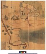
東松浦郡町村図(甲)五反田村
![信濃国[中山道図]](https://rmda.kulib.kyoto-u.ac.jp/iiif/RB00020030/RB00020030_00001_0.ptif/full/200,/0/default.jpg)
信濃国[中山道図]

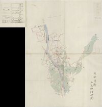
川副下郷小木森村

杵島郡廿治村字名全圖

村絵図(染井・中佐野・東台・大原・井野)

Toshisen ehon: Goshichigon hairitsu (Object)
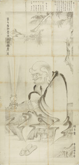
Arhat (Copy)
Stanford's map of eastern China, Japan and Korea : the seat of war in 1894
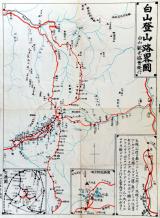
白山登山路畧図

伊勢海及三河湾附近沿岸 : 海軍海図日本総部図付海図目録
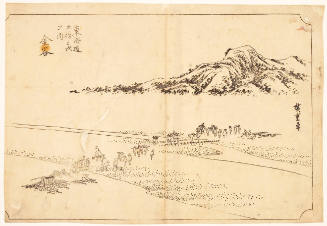
Kanaya, keyblock print (Kanaya Ōigawa Engan, Hanshita-e), series The Fifty-three Stations of the Tōkaidō

小城郡村図長尾村
Last Updated: 2020-04-17
Uploaded: 2021-09-21