
Laurie and Whittle's New Chart of the Indian and Pacific Oceans Between the Cape of Good Hope, New...
- People
- Time
- Owner Organization

Laurie and Whittle's New Chart of the Indian and Pacific Oceans Between the Cape of Good Hope, New...
A New Chart of the Indian and Pacific Oceans Between the Cape of Good Hope, New Holland, and Japan...
A new chart of the Indian and Pacific Oceans between the Cape of Good Hope, New Holland and Japan : comprehending New Zealand, New Caledonia, New Britain, New Ireland, New Guinea &c., also the New Caroline, Ladrone and Philippine Islands : with the tracks of the English, French, Spanish and Dutch discoverers
Laurie and Whittle's new chart of the Indian and Pacific Oceans between the Cape of Good Hope, New Holland, and Japan, comprehending New Zealand, New Caledonia, New Britain, New Ireland, New Guinea,&c., Louisiade and New Georgia; also the Pelew, New Caroline, Ladrone, and Philippine Islands; &c. with the most remarkable tracks of the English, Spanish, French and Dutch navigators: and chiefly the track of the Walpole, Eastindiaman, Captn. Thos. Butler, 1794 from the Cape of Good Hope to Van Diemen's Land and, from thence to China, and the track of the Royal Admiral Captn. Henr. Bond in 1792 and 93, from the Cape to Port Jackson and China
Laurie and Whittle's new chart of the Indian and Pacific Oceans between the Cape of Good Hope, New Holland and Japan : comprehending New Zealand, New Caledonia, New Britain, New Ireland, New Guinea &c., Louisiade and New Georgia; also The Pelew, New Caroline, Ladrone and Philippine Islands &c. with the most remarkable tracks of the English, Spanish, French and Dutch navigators and chiefly the track of the Walpole, EastIndiaman, Captn. Thos. Butler, 1794 from the Cape of Good Hope to Van Diemen's Land and from thence to China, and the track of the Royal Admiral Captn. Henr. Bond in 1792 and 93 from the Cape to Port Jackson and China

A new chart of the Indian and Pacific Oceans between the Cape of Good Hope, New Holland and Japan : comprehending New Zealand, New Caledonia, New Britain, New Ireland, New Guinea &c., Louisade and New Georgia ; also the Pellew, New Caroline, Ladrone and Philippine Islands; with all these which have been discovered in the year 1788; & the tracks of the English, French, Spanish and Dutch discoverers

JAPANESE SHIPS DESTROYED BY BOMBERS IN PACIFIC AND INDIAN OCEANS

A New Chart of The Pacific Ocean, Exhibiting The Western Coast of America from Cape Horn to Beerin...

A New Chart of The Pacific Ocean, Exhibiting The Western Coast of America, From Cape Horn To Beeri...

A New Chart of The Pacific Ocean, Exhibiting The Western Coast of America, From Cape Horn To Beeri...
A New Chart of The Pacific Ocean, Exhibiting The Western Coast of America, From Cape Horn To Beeri...
A Chart of the Eastern Ocean from C. Good Hope to the Islands of Japan [Material cartográfico]
Study of seasonal transport processes between the Pacific and Indian Oceans by the Indonesian throughflow

ALLIED BATTLESHIPS AND CARRIERS MASS IN PACIFIC AND INDIAN OCEANS FOR WAR AGAINST JAPAN
A New & Correct Chart of the Indian Sea From Cabo Bonea Esperanca to Japan [Material cartográfico]...

(Composite of) A New Chart of The Pacific Ocean, Exhibiting The Western Coast of America, From Cap...

A new chart of the Pacific Ocean - with courses plotted on it of the whaling ships LEVI STARBUCK, MARCIA and WILLIAM ROTCH

A new & correct chart of the Indian sea from Cabo Bonea Esperanca to Japan : according to Mr Edwar...

DOMINION CRUISER ACHILLES AND BRITISH SUBMARINES REFIT AFTER BEING IN ACTION IN PACIFIC OR INDIAN OCEANS: FI...
A Chart of the eastern ocean from C. Good Hope to the Islands of Japan / drawn from the journals and remarks - M. d'Après de Mannevillette
The Oriental navigator, or, Directions for sailing to, from, and upon the coasts of, the East-Indies, China, Australia...To the work are prefixed a series of ... tables of the determined positions of all the principle points and places from the British seas to Cape Horn, the Cape of Good Hope, and thence to the islands of Japan, by John Purdy. (Plan of Chatham Island, &c. Whittle & Laurie, London, 1815.)
A new & correct chart of the Indian Sea from Cabo Bonea Esperanca to Japan according to Mr. Edward Wrights projection vulgarly called Mercators chart

A Chart of the Eastermost part of the East Indies and China from Cape Comarin to Japan with the Ad...

A Chart of the Eastermost part of the East Indies and China from Cape Comarin to Japan with the Ad...
A new chart of the Indian and Pacific Oceans between the Cape of Good Hope, New Holland and Japan : comprehending New Zealand, New Caledonia, New Britain, New Ireland, New Guinea &c., also the New Caroline, Ladrone and Philippine Islands : with the tracks of the English, French, Spanish and Dutch discoverers
Laurie and Whittle's new chart of the Indian and Pacific Oceans between the Cape of Good Hope, New Holland and Japan : comprehending New Zealand, New Caledonia, New Britain, New Ireland, New Guinea &c., Louisiade and New Georgia; also The Pelew, New Caroline, Ladrone and Philippine Islands &c. with the most remarkable tracks of the English, Spanish, French and Dutch navigators and chiefly the track of the Walpole, EastIndiaman, Captn. Thos. Butler, 1794 from the Cape of Good Hope to Van Diemen's Land and from thence to China, and the track of the Royal Admiral Captn. Henr. Bond in 1792 and 93 from the Cape to Port Jackson and China
Laurie and Whittle's New Chart of the Indian and Pacific Oceans Between the Cape of Good Hope, New...

(Southeast Asia, China &c.)

A Correct Sea Chart of the Whole World, According to Wright's, Commonly Called Mercator's, Project...
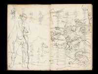
Kuniyoshi's preparatory drawings, no.48

「西国三十三所順拝地図」
Australien / wolfenbuttel bei C. H. Hartmann

Carte réduite de l'Ocean Oriental depuis le Cap de Bonne Espérance jusqu'au Japon / dressée sur le...
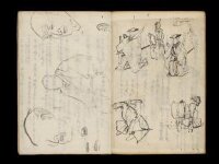
Kuniyoshi's preparatory drawings, no.39
A chart of the eastermost part of the East Indies with all the adjacent islands from Cape Comorin to Iapan / by Iohn Seller, Hydrographer to the King

Nieuwe Paskaart van het Noordelijkste Gedeelte van de Golf van Bengalen Vertoonende de Custen van ...

Exacta & accurata delineatio cum orarum maritimarum tum etiam locorum terrestrium quae in regionibus China, ...

Map of Colorado Territory, Compiled from Government Maps & Actual Surveys. Made In 1861
禽虫之図

Map of Colorado Territory, Compiled from Government Maps & Actual Surveys. Made In 1861
Picture Book: Chrysanthemum : [volumes 2-3]

Exacta & accurata delineatio cum orarum maritimarum tum etiam locorum terrestrium quae in regionibus China, ...

Pas-caart van Zuyd-Zee, tusschen California en ilhas de Ladrones

Carte réduite de l'océan septentrional compris entre l'Asie et l'Amérique ... Par le Sr. Bellin ..

Tabula Indiae Orientalis et Regnorum Adjacentium J. Van Braam et G. onder de Linden . .

Karte von Australien oder Polynesien, nach den Zeichnungen, Reisebe Schreibungen und Tagebucher de...
Pas-caert van't Oostelyckste deel van Oost Indien : met alle de Eylanden daer onder gelegen, van Cabo Comorin tot aen Japan / by Hendrick Doncker Boekverkooper en Graadbooghmaacker Inde Nieuwbrughsteegh
Encyclopedia of Western Art : [volume 4]
Last Updated: 2020-04-17
Uploaded: 2021-09-21