
Islands of Japan. Korea. Formosa

Plate 3. Japan and Korea. Extension to Formosa and Lu-Chu Islands

Figures and descriptions of the fishes of Japan : including Riukiu Islands, Bonin Islands, Formosa...
Figures and descriptions of the fishes of Japan : including Riukiu Islands, Bonin Islands, Formosa...

The latest map of Manchuria, Korea, Formosa, and Saghalien

Japan (with Formosa Island Inset)
The island of Formosa
Travelers' map of Japan, Chosen (Korea), Taiwan (Formosa) : with brief descriptions of the principal tourist points in Japan (front)

Islands of Japan. (with) Japan, Mandshuria, (Showing the Course of the Amur River) The Kurile Isle...
Japan a Korea
![China--Japan, North Korea--South Korea--Russia, Sea of Japan [electronic resource]](https://www.gumtree.com/static/1/resources/assets/rwd/images/orphans/a37b37d99e7cef805f354d47.noimage_thumbnail.png)
China--Japan, North Korea--South Korea--Russia, Sea of Japan [electronic resource]

Travel views of Japan and Korea

Travel views of Japan and Korea

Travel views of Japan and Korea

Travel views of Japan and Korea

Travel views of Japan and Korea

Travel views of Japan and Korea

Travel views of Japan and Korea

Travel views of Japan and Korea

Travel views of Japan and Korea

Travel views of Japan and Korea

Travel views of Japan and Korea

Travel views of Japan and Korea

Travel views of Japan and Korea

Travel views of Japan and Korea

Peking (Beijing). Tokio (Tokyo)

Japan and Korea. (with) The Japanese Empire. (with) Port Arthur and Adjacent Territory. (with) For...

Asia (Eastern Sheet)

Japan. Masstab 1:5,000,000. Sept. 1905. (insets: nebenkarten) Riu-Kiu In. I, Tsubu Schoto II, Namb...

Tartariae Imperium
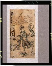
「風流三幅対右」 「やまとちや」

Map of Japan

Tokyo City center 1, Japan. (to accompany) Shomitsu Nippon chizu. (Atlas of Japan) Nippon Shoin. (...

The Japanese empire : with central and southern Manchukuo (Manchuria)

Japan. Carte 42. Dresse par G. Bagge et D. Aitoff. Imp. Dufrenoy 12-35 Librarie Hachette. Grave pa...

Tabula Tartariae et majoris partis regni Chinae / edita a F. de Wit ; Lhuilier fecit

Tartariae Sive Magni Chami Regni typus

「末広五十三次」 「吉田」

Japan. (with) Kurile Islands. Letts's popular atlas. Letts, Son & Co Limited, London. (1883)

Map of Asia Showing its Gt. Political Divisions, and, also, the Various routes of Travel Between L...

Japan. Copyright 1892 by Appleton & Co. (insets) Kurile Islands; Tokyo. (to accompany) The Library...

Empire of Japan, Yedo ... Meaco. (insets) Nagasaki Harbour. Eastern Point of Yeso

Map of Chosen (Korea)

Chinae, olim Sinarum regionis nova descriptio auctore Ludovico Georgio . . . 1584

Map of Asia showing its Gt. Political Divisions, and, also, the Various routes of travel between L...
Plate 3. Japan and Korea. Extension to Formosa and Lu-Chu Islands

Rand, McNally & Co.'s 1904 war map of Japan, Korea, and China ; Rand, McNally & Co.'s 1904 war map of Russia...

Korea, East China and Japan / The Norris Peters Co., photo-lith

77. Japan
最終更新日: 2020-04-17
登録日: 2021-09-21