
Asia (Eastern Sheet)
- People
- Time
- Owner Organization

Eastern Asia
![Sea fisheries of eastern Asia [cartographic material]](https://stacks.stanford.edu/image/iiif/mr870gt3467%2Fmr870gt3467_00_0001/full/!200,200/0/default.jpg)
Sea fisheries of eastern Asia [cartographic material]
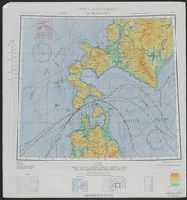
East Asia and North Pacific 1:4,350,000: South China Sea (Sheet 6)

(Eastern Part of Asia, including China, Korea, Japan, Philippines : Untitled Globe Gores)
The phoenix - a monthly magazine for China, Japan & Eastern Asia
Nemuro
Northeast Asia
Northeast Asia

Sheet

Sheet

Sheet 13. Tokyo

Asia

Asia

Asia

Asia

Asia

Asia

Asia

Asia

Prunus mume Siebold & Zucc. Rosaceae Chinese Plum, Japanese Apricot. Distribution: Eastern Asia. T...

Nemuro

Christianographie (Asia)
![[Map of East Asia]](https://stacks.stanford.edu/image/iiif/kg150vx7689%2F41423/full/!200,200/0/default.jpg)
[Map of East Asia]
Chart of east Asia

Map Of Asia Showing its Gt. Political Divisions, and also the Various Routes of Travel Between Lon...

Tartariae Sive Magni Chami Regni typus

Map of Asia showing its gt. political divisions, and also various routes of travel between London ...

China, Contains 15 Subject Provinces, including the 2 Islands of Hainan Formosa and the Tributary ...

China and Japan

Tartariae Sive Magni Chami Regni typus

Chinese Empire and Japan

Japan and Korea. (with) The Japanese Empire. (with) Port Arthur and Adjacent Territory. (with) For...

Map of Asia showing its Gt. Political Divisions, and, also, the Various routes of travel between L...

Map of Asia showing its gt. political divisions, and also various routes of travel between London ...

Empire Chinois et Japan

「紫式部げんじかるた」 「行幸」

Map of Asia showing its gt. political divisions, and also the various routes of travel between Lon...

Map of Asia Showing its Gt. Political Divisions, and, also, the Various routes of Travel Between L...

China, Contains 15 Subject Provinces, including the 2 Islands of Hainan Formosa and the Tributary ...

Carte de L'Empire Chinois et du Japon

「新板植木つくし」

Asiae Nova Descriptio

Map Of Asia Showing its Gt. Political Divisions, and also the Various Routes of Travel Between Lon...

Carte Generale de l'Empire Chinois et du Japon. Dresse par A. Brue, Geographe Reoue par E. Levasse...

A New Map of Great Tartary and China, with the adjoyning Parts of Asia, Taken from Mr. De Fer's Ma...

Tartariae Sive Magni Chami Regni typus

Japan

Japanese Empire - political. The Edinburgh Geographical Institute, John Bartholomew & Son, Ltd. "T...
Last Updated: 2020-04-17
Uploaded: 2021-09-21