
National school board serie : No. 8 : India

National school board serie: No. 2 : Africa
京都大学吉田南総合図書館
IIIF Discovery in Japan

National school board series : No. 4 : Asia
京都大学吉田南総合図書館
IIIF Discovery in Japan
School Board - General
国立国会図書館デジタルコレクション
国立国会図書館デジタルコレクション
School Board - Wakayama
国立国会図書館デジタルコレクション
国立国会図書館デジタルコレクション
School Board - Shiga
国立国会図書館デジタルコレクション
国立国会図書館デジタルコレクション
School Board - Kyoto
国立国会図書館デジタルコレクション
国立国会図書館デジタルコレクション
Cabinet Board - 3rd National Diet
国立国会図書館デジタルコレクション
国立国会図書館デジタルコレクション
091: India, No. 1
国立国会図書館デジタルコレクション
国立国会図書館デジタルコレクション

National Highway No. 188
ヒューストン美術館
ヒューストン美術館コレクション
National Patriotic Fund Board parcels for distribution to NZ troops in Western Desert
アレクサンダー・ターンブル図書館
デジタル・ニュージーランドAPI
Court Exh. No. 865: "Outline of Fundamental National Policies." (Planning Board). Outline for the establishment of a population policy
国立国会図書館デジタルコレクション
国立国会図書館デジタルコレクション
Court Exh. No. 865: "Outline of Fundamental National Policies." (Planning Board). Outline for the establishment of a population policy
国立国会図書館デジタルコレクション
国立国会図書館デジタルコレクション
Board of Officers (Primary MOS NO)
国立国会図書館デジタルコレクション
国立国会図書館デジタルコレクション
No.8
東京都現代美術館
東京ミュージアムコレクション
PL.8 MÉCANIQUE No.8
東京大学総合文化研究科・教養学部
東京大学学術資産等アーカイブズポータル
Records of the National Planning Board for Mobilization: Labor mobilisation plans (1941). Report No. 42a(1)(c), USSBS Index Section 2
国立国会図書館デジタルコレクション
国立国会図書館デジタルコレクション
Intelligence Instruction at the Kempeitai School at Nakano Ku, Tokyo, Serial No. 452. Report No. 2-s, USSBS Index Section 8
国立国会図書館デジタルコレクション
国立国会図書館デジタルコレクション
Intelligence Instruction at the kempeitai School at Nakako Ku, Tokyo, Serial No. 452. Report No. 2-t, USSBS Index Section 8
国立国会図書館デジタルコレクション
国立国会図書館デジタルコレクション
Sketches No. 8
ハーバード美術館
ハーバード美術館API
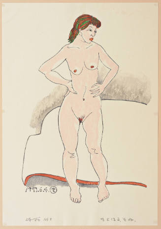
Nude- No. 8
ホノルル美術館
ホノルル美術館コレクション

Peninsular: No. 8
ニューヨーク近代美術館
ニューヨーク近代美術館コレクション
No. 8 Nagao
ヒューストン美術館
ヒューストン美術館コレクション
Kamaitachi No 8
ヴィクトリア・アンド・アルバート博物館
ヴィクトリア・アンド・アルバート博物館API
アルマNo.8
京都国立近代美術館
国立美術館所蔵作品総合目録

Europa im Anfange des sechsten Jahrhunderts
京都大学吉田南総合図書館
IIIF Discovery in Japan

Europa im achtzehnten Jahrhundert, von 1700 bis 1789
京都大学吉田南総合図書館
IIIF Discovery in Japan

Europa zur Zeit der Kreuzzüge
京都大学吉田南総合図書館
IIIF Discovery in Japan

Europa zur Zeit der Reformation
京都大学吉田南総合図書館
IIIF Discovery in Japan

General map of China and adjacent regions, showing treaty ports and railways
スタンフォード大学図書館
スタンフォード大学図書館SearchWorks
![Tokyo and vicinity, showing bombed-out areas [cartographic material]](https://stacks.stanford.edu/image/iiif/jx217xm7539%2Fjx217xm7539_00_0001/full/!200,200/0/default.jpg)
Tokyo and vicinity, showing bombed-out areas [cartographic material]
スタンフォード大学図書館
スタンフォード大学図書館SearchWorks

大日本帝國豊後全國豊前國東南部土性圖
京都大学吉田南総合図書館
IIIF Discovery in Japan

karta, Karta, map@eng
スウェーデン民族学博物館
ヨーロピアナAPI

Europa am Ende des vierzehnten Jahrhunderts
京都大学吉田南総合図書館
IIIF Discovery in Japan

大日本帝国播磨但馬淡路全国摂津国西部丹波国西南部兵庫県管内土性図
京都大学吉田南総合図書館
IIIF Discovery in Japan

佐賀県管内全図
佐賀県立図書館
IIIF Discovery in Japan

Hitome de wakaru shina jihen to nisso kankei e chizu. (Drawn by) Eisuke Ishida. Showa 12 (1937). (...
スタンフォード大学図書館
スタンフォード大学図書館SearchWorks
Hitome de wakaru shina jihen to nisso kankei e chizu. (Drawn by) Eisuke Ishida. Showa 12 (1937). (...
スタンフォード大学図書館
スタンフォード大学図書館SearchWorks

最新上海地圖
スタンフォード大学図書館
スタンフォード大学図書館SearchWorks

佐賀県管内図
佐賀県立図書館
IIIF Discovery in Japan
最終更新日: 2020-04-16
登録日: 2021-07-27