![Tokyo and vicinity, showing bombed-out areas [cartographic material]](https://stacks.stanford.edu/image/iiif/jx217xm7539%2Fjx217xm7539_00_0001/full/!200,200/0/default.jpg)
Tokyo and vicinity, showing bombed-out areas [cartographic material]
- Time
- Owner Organization

Tokyo and vicinity, showing bombed-out areas. (Regional map on verso)
Tokyo and vicinity : showing bombed-out areas / prepared ... by Nippon Map Co
![Japanese fishing, areas and seasons [cartographic material]](https://stacks.stanford.edu/image/iiif/gd847mc5303%2Fgd847mc5303_00_0001/full/!200,200/0/default.jpg)
Japanese fishing, areas and seasons [cartographic material]
![Tokyo [cartographic material] : [showing rail, subway and tram lines of the metropolitan area].](https://stacks.stanford.edu/image/iiif/ys971pn1490%2Fys971pn1490_0001/full/!200,200/0/default.jpg)
Tokyo [cartographic material] : [showing rail, subway and tram lines of the metropolitan area].
[New Zealand tour maps showing railway, coach and horse routes] [cartographic material]
![[Map of Kyoto] [cartographic material]](https://collections.library.yale.edu/iiif/2/16683048/full/!200,200/0/default.jpg)
[Map of Kyoto] [cartographic material]
![China and Japan [cartographic material]](https://collections.library.yale.edu/iiif/2/15828553/full/!200,200/0/default.jpg)
China and Japan [cartographic material]
![Japan, radiotelephone and radiotelegraph stations [cartographic material] : 1941](https://stacks.stanford.edu/image/iiif/pp234mp0165%2Fpp234mp0165_00_0001/full/!200,200/0/default.jpg)
Japan, radiotelephone and radiotelegraph stations [cartographic material] : 1941

Manchuria. Korea. Japan. (insets) (Vicinity of Osaka and Tokyo)
![(A Set of Landform and Outline Maps by Erwin Raisz) [cartographic material].](https://stacks.stanford.edu/image/iiif/vf022zq3993%2F7943001/full/!200,200/0/default.jpg)
(A Set of Landform and Outline Maps by Erwin Raisz) [cartographic material].
![Bering Sea, Japanese fishing and associated activities, 1930-1941 [cartographic material]](https://stacks.stanford.edu/image/iiif/kb473nj6517%2Fkb473nj6517_00_0001/full/!200,200/0/default.jpg)
Bering Sea, Japanese fishing and associated activities, 1930-1941 [cartographic material]
Map of Kyoto and vicinity / Miyako Hotel
![Japan and adjacent regions of Asia and the Pacific Ocean [cartographic material] / compiled and drawn in the...](https://collections.library.yale.edu/iiif/2/15510875/full/!200,200/0/default.jpg)
Japan and adjacent regions of Asia and the Pacific Ocean [cartographic material] / compiled and drawn in the...
![Japan and adjacent regions of Asia and the Pacific Ocean [cartographic material] / compiled and drawn in the...](https://collections.library.yale.edu/iiif/2/15509964/full/!200,200/0/default.jpg)
Japan and adjacent regions of Asia and the Pacific Ocean [cartographic material] / compiled and drawn in the...
New railway map of Tokyo and vicinity. Published by Japan Guide Map Co., Ltd. Compiled and printed...
![China and Japan [cartographic material] / compiled from G.S.G.S. 4065 and 2957](https://collections.library.yale.edu/iiif/2/15510764/full/!200,200/0/default.jpg)
China and Japan [cartographic material] / compiled from G.S.G.S. 4065 and 2957
Map showing New Britain and the town of Rabaul, which has been bombed by Japanese aircraft. (Evening Post, 0...
Railway map of Tokyo & vicinity. U.S. Army Map Service, Far East -58-102 - 10/57.1M.
Seismicity of the Earth, 1900-2007 [electronic resource] : Japan and vicinity

(Shikotsu, Toya and vicinity). (to accompany) Shomitsu Nippon chizu. (Atlas of Japan). Nippon Shoi...

Erie Railway and connections. (inset) Map of New York City & vicinity issued by N.Y.L.E. & W. R.R....
China Divided into its Great Provinces and the Isles of Japan [Material cartográfico]

Hyakumanbun no ichi Heiyō chiri chōsazu

Europe showing the general direction of the Barbarian inroads on the fall of the Roman Empire

Europe in the time of Charles the great 814

Carte de la Route par terre depuis Jokaitz jusqu'à Fammamatz; Particuliere Reis Kaartte Land strek...

Ōso sangyō shigenzu

General map of China and adjacent regions, showing treaty ports and railways

徳島市街全図

Carte de l'isle de Ieso et de ses environs pour servir à concilier les différentes idées que l'on ...

Nemuro

Northwestern America Showing The Territory Ceded By Russia To The United States Compiled For The D...

New Map of Japan

日本交通分縣地圖 第二十九 佐賀縣

Japan and South Manchuria : Railway and steamer connections

徳島市街全図

佐賀県管内図

Kankoku kōutsū zenzu; Tōyō tetsudō oyobi kōro renrakuzu
![Japan, Yamaguchi-ken [cartographic material]](https://stacks.stanford.edu/image/iiif/zc849tw9296%2Fzc849tw9296_00_0001/full/!200,200/0/default.jpg)
Japan, Yamaguchi-ken [cartographic material]
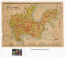
岡山県児島郡地図

豊橋市街図 二万八千分の一 昭和13年

Carte des Isles du Iapon : esquelles est remarqve la Route tant par Mer que par Terre que tiennent les Holla...
![A New & Exact Map of Asia . . . [Shows Mythical De Gama's Land!]](https://stacks.stanford.edu/image/iiif/cw440qc5018%2F33939/full/!200,200/0/default.jpg)
A New & Exact Map of Asia . . . [Shows Mythical De Gama's Land!]
![Manshūkoku yochizu [cartographic material] : hyakumanbun no ichi](https://stacks.stanford.edu/image/iiif/dc116hp3130%2Fdc116hp3130_00_0001/full/!200,200/0/default.jpg)
Manshūkoku yochizu [cartographic material] : hyakumanbun no ichi

Europa : end of 7th century. 695

Koriyama, Fukushima Prefecture, Honshu, Japan
Last Updated: 2020-04-17
Uploaded: 2021-09-21