
Saishin shinkyou chizu
NDL Digital Collections
NDL Digital Collections
Saishin mouko chizu
NDL Digital Collections
NDL Digital Collections

Saishin mankan chizu
NDL Digital Collections
NDL Digital Collections

Bisan shin chizu : saishin sokuryou
NDL Digital Collections
NDL Digital Collections

Saishin kamataku meisai chizu
NDL Digital Collections
NDL Digital Collections

Saishin chuugoku nijuuisshou chizu
NDL Digital Collections
NDL Digital Collections

Nagoyashi higashiku saishin chizu
NDL Digital Collections
NDL Digital Collections

Saishin nihon meishou ritei chizu
NDL Digital Collections
NDL Digital Collections

Saishin aichiken shousai chizu
NDL Digital Collections
NDL Digital Collections

Fuzanbou saishin nihon chizu
NDL Digital Collections
NDL Digital Collections

Saishin sekai gensei zen chizu
NDL Digital Collections
NDL Digital Collections

Saishin sekai gensei zen chizu
NDL Digital Collections
NDL Digital Collections

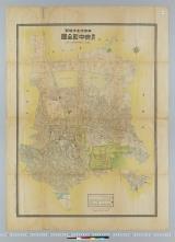
Saishin banchiiri toukyoushi kuwake chizu
NDL Digital Collections
NDL Digital Collections

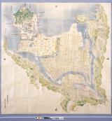
Saishin hokkaidou zenzu
NDL Digital Collections
NDL Digital Collections

Saishin nihon chishitsuzu
NDL Digital Collections
NDL Digital Collections

Maebashi shigai meisai chizu : saishin sakuintsuki eigyou annai
NDL Digital Collections
NDL Digital Collections

Hamamatsu shigai meisai chizu : saishin sakuintsuki eigyou annai
NDL Digital Collections
NDL Digital Collections

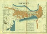
Saishin koube shigai shinchizu
NDL Digital Collections
NDL Digital Collections

Saishin sowēto renpou chizu : keizaiteki chihou kukaku chizu minzoku jichi kuiki chizu
NDL Digital Collections
NDL Digital Collections

Shanhai shigaizu
NDL Digital Collections
NDL Digital Collections
Ooita kensei no tenbou : fu saishin chizu
NDL Digital Collections
NDL Digital Collections
Ooita kensei no tenbou : fu saishin chizu
NDL Digital Collections
NDL Digital Collections

Saishin chousen kannai chishitsuzu
NDL Digital Collections
NDL Digital Collections

Shinsen chizu
NDL Digital Collections
NDL Digital Collections
![[Map of Korea] Karta Korei, nyne Yaponskago General-Gubernatorstva Tsiosen, s Yaponskimi Geografic...](https://stacks.stanford.edu/image/iiif/wm529gv6020%2F36877/full/!200,200/0/default.jpg)
[Map of Korea] Karta Korei, nyne Yaponskago General-Gubernatorstva Tsiosen, s Yaponskimi Geografic...
Stanford University Libraries
Stanford Libraries SearchWorks
萩絵図
Yamaguchi Prefecture Archives
ADEAC: A System of Digitalization and Exhibition for Archive Collections

水戸市全地図
水戸市立中央図書館
ADEAC: A System of Digitalization and Exhibition for Archive Collections
水戸市全地図
水戸市立博物館
ADEAC: A System of Digitalization and Exhibition for Archive Collections

Miyazaki, Miyazaki Prefecture, Kyushu, Japan
Stanford University Libraries
Stanford Libraries SearchWorks

A map of China : Published by K. Saito. Osaka Japan. Sole agent T. Kishida & Co. Shanghai. (inset ...
Stanford University Libraries
Stanford Libraries SearchWorks
A map of China : Published by K. Saito. Osaka Japan. Sole agent T. Kishida & Co Shanghai. (inset m...
Stanford University Libraries
Stanford Libraries SearchWorks
![[Shina] Hyakumanbunnoichi Kōkūzu](https://stacks.stanford.edu/image/iiif/sy476vd8533%2Fsy476vd8533_00_0001/full/!200,200/0/default.jpg)
[Shina] Hyakumanbunnoichi Kōkūzu
Stanford University Libraries
Stanford Libraries SearchWorks

滿洲歴史地理. : 第壹巻附図 : 三国時代満洲図 (220-265)・西晋時代満洲図 (265-316)
Yoshida-South Library, Kyoto University
IIIF Discovery in Japan

朝鮮全圖
Yoshida-South Library, Kyoto University
IIIF Discovery in Japan

Kyōto-fu kannai chizu
Stanford University Libraries
Stanford Libraries SearchWorks

Chinese Empire (including Trans Oceanic Cables to Hong Kong,etc.)
Stanford University Libraries
Stanford Libraries SearchWorks

General map of China and adjacent regions, showing treaty ports and railways
Stanford University Libraries
Stanford Libraries SearchWorks

東亜現勢地図
Yoshida-South Library, Kyoto University
IIIF Discovery in Japan

1904 war map of Russia and the continent of Asia
Yale University Library
Yale University Library Digital Collections
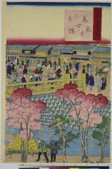
Toukyoumeishonouchi、yorozuyobashi
Nationaal Museum van Wereldculturen (Rijksmuseum Volkenkunde, Leiden)
ARC Ukiyo-e Portal Database

Tiefenkarte des Japanischen Binnenmeeres : Setouchi / von Dr. N. Yamasaki
Yale University Library
Yale University Library Digital Collections
A new map of the empires, states, provinces &c of Asia : including also the Turkish & Russian dominions in Europe & New Holland / compiled from the most authentic observations by Robert Wilkinson ; Walsh script. ; W. Palmer sculpt
National Library of Australia
Trove: National Library of Australia

滿洲歴史地理. : 第壹巻附図 : 後漢時代満洲図(西紀二五-二二〇年)
Yoshida-South Library, Kyoto University
IIIF Discovery in Japan

滿洲歴史地理. : 第壹巻附図 : 後魏時代満洲図 (439-550)
Yoshida-South Library, Kyoto University
IIIF Discovery in Japan
東京都北多摩郡 最新府中町詳細全図
Tamashin Chiiki Bunka Zaidan
ADEAC: A System of Digitalization and Exhibition for Archive Collections

滿洲歴史地理. : 第壹巻附図 : 隋代及唐初満洲図(西暦五八九年-六六八年)
Yoshida-South Library, Kyoto University
IIIF Discovery in Japan
![Settsu no Kuni meisho ōezu [cartographic material] : zen](https://stacks.stanford.edu/image/iiif/jy281rj3743%2Fjy281rj3743_0001/full/!200,200/0/default.jpg)
Settsu no Kuni meisho ōezu [cartographic material] : zen
Stanford University Libraries
Stanford Libraries SearchWorks

滿洲歴史地理. : 第壹巻附図 : 前漢時代満洲図 西紀二〇二-西紀二五年
Yoshida-South Library, Kyoto University
IIIF Discovery in Japan
Last Updated: 2020-04-17
Uploaded: 2021-09-21