A catalogue of Coleoptera from the Japanese archipelago

Map of the Japanese telegraph system
![[Taisho Japanese map of the world. Taisho Japanese map of Japan and Korea]. [9 insets].](https://stacks.stanford.edu/image/iiif/yj892bp5625%2F11670000/full/!200,200/0/default.jpg)
[Taisho Japanese map of the world. Taisho Japanese map of Japan and Korea]. [9 insets].

Map of Japanese Homeland Island

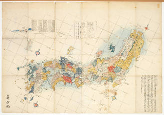
Map of the Great Japanese Empire (Dainihon Kokugun Yochi Zenzu)

(Composite Map of) Map of the Island of Japan, Kurile &c. with the Adjacent Coasts of the Chinese ...

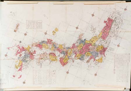
Geological map of the Japanese Empire on the scale of 1:1,000,000

Map of the Empire of Japan

The railway map of Japan

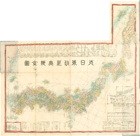
Dai Nihon zenzu (The picture of the Great Whole Map of Japan; Provinces in the Japanese Empire, in...
![[Map of part of Samar, Philippines, in Japanese.]](https://collections.library.yale.edu/iiif/2/15251561/full/!200,200/0/default.jpg)
[Map of part of Samar, Philippines, in Japanese.]
[Japanese map of World War II]
[Japanese map of World War ll]
Map showing Green Islands, to the north of Biika. Several of the Japanese bases marked on the map 1 have sin...
![[Map of Marinduque, Philippines, in Japanese.]](https://collections.library.yale.edu/iiif/2/15251559/full/!200,200/0/default.jpg)
[Map of Marinduque, Philippines, in Japanese.]

Map of Northern Japan. Map of Southern Japan

Map - Japan, Trust Territory of the Pacific Islands

Map of the Empire of Japan in 1914

Map of Japan

Map of Japan
Map of Japan

Map of Japan
Map of Japan
Map of Japan


(新刻)日本與地路程全図
改正日本輿地路程全図

基肄壱郡養父半郡絵図
銅刻 大日本増補輿地全図

小城郡村図多久原村

東松浦郡町村図(甲)石志村、山本村
陸奥 松島 仙台

小城郡村図池上苅
Hokkaido, Japan : Special airfield relief map / prepared and reproduced in the United States Department of the Interior Geological Survey
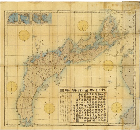
大日本沿海略図

Map of Colorado Territory, Compiled from Government Maps & Actual Surveys. Made In 1861

其七 我兵牙山ヲ分捕ル
![山城国[畿内図]](https://rmda.kulib.kyoto-u.ac.jp/iiif/RB00020007/RB00020007_00001_0.ptif/full/200,/0/default.jpg)
山城国[畿内図]

東松浦郡町村図(乙)見借村
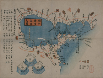
相州浦賀海辺之図
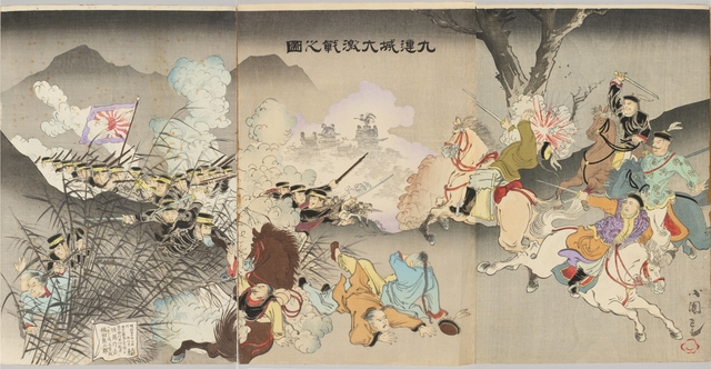
日清韓戦争実記(外題) (ウラ)九連城大激戦之図

小城郡村図長尾村

東松浦郡町村図(乙)大良村
![淡路国[南海道図]](https://rmda.kulib.kyoto-u.ac.jp/iiif/RB00020058/RB00020058_00001_0.ptif/full/200,/0/default.jpg)
淡路国[南海道図]

小城郡村図上砥川村

小城郡村図下古賀村
平塚市民センター食堂
![伊勢国[東海道図]](https://rmda.kulib.kyoto-u.ac.jp/iiif/RB00020013/RB00020013_00001_0.ptif/full/200,/0/default.jpg)
伊勢国[東海道図]
最終更新日: 2020-09-29
登録日: 2021-12-21