


An Accurate Chart of the World, with the New Discoveries; Also a View of the General & Coasting Tr...
![Nagoya, Aichi prefecture, Honshu [cartographic material].](https://stacks.stanford.edu/image/iiif/ks759rr4464%2Fks759rr4464_0001/full/!200,200/0/default.jpg)
Nagoya, Aichi prefecture, Honshu [cartographic material].

Carte réduite de l'Océan oriental depuis le Cap de Espérance jusqu'au Japon / Par Mr. d'Après de M...
![Tokyo city proper [cartographic material]](https://stacks.stanford.edu/image/iiif/vj067cj0650%2Fvj067cj0650_00_0001/full/!200,200/0/default.jpg)
Tokyo city proper [cartographic material]
松鶴人物図

一万分一地形圖新京近傍.

(Composite of) A New Chart of The Pacific Ocean, Exhibiting The Western Coast of America, From Cap...

Laurie and Whittle's New Chart of the Indian and Pacific Oceans Between the Cape of Good Hope, New...

十万分一圖呼倫貝爾.

Carte Physique & Politique. : No. 16 : l'Asie

Asia

Karte von Australien oder Polynesien, nach den Zeichnungen, Reisebe Schreibungen und Tagebucher de...

Tabula Indiae Orientalis et Regnorum Adjacentium J. Van Braam et G. onder de Linden . .

北樺太二万五千分一圖.

Asia : Coast of China : Ryōtō Kaiwan. Approaches to Ryō Ga Entrance
![印度百万分一圖東部周域 [地図資料]](https://stacks.stanford.edu/image/iiif/wr290sd1084%2Fwr290sd1084_00_0001/full/!200,200/0/default.jpg)
印度百万分一圖東部周域 [地図資料]
公余探勝図

Carte réduite de l'Océan Oriental depuis le Cap de Bonne Esperance, jusqu'au Japon : dédiée à l'Ac...
蘭亭曲水図屏風
片田景図(模本)

Carte De La Louisiane Colonie Francaise avec le Cours du Fleuve St Louis…1757
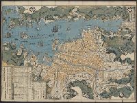
Map of Nagasaki

冨士山東口須走(登山案内図)

印度五十万分一圖
最終更新日: 2020-04-17
登録日: 2021-09-21