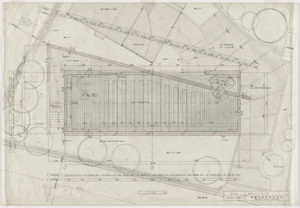

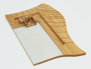
Church of the Light, Ibaraki, Osaka, Japan (Plan)

Church of the Light, Ibaraki, Osaka, Japan, Plan
Church of the Light, Ibaraki, Osaka, Japan (Interior perspective)
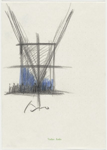
Church of the Light, Ibaraki, Osaka, Japan, Interior perspective
Church of the Light, Ibaraki, Osaka, Japan

Church of the Light, Ibaraki, Japan, Perspective
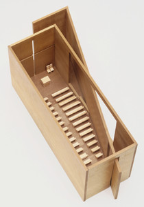
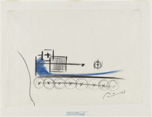
Church on the Water, Tomamu, Hokkaido, Japan (Elevation and plan)
Church on the Water, Tomamu, Hokkaido, Japan, Plan and sketch
Osaka; Osaka, Japan [1 of 2]
Osaka; Osaka, Japan [2 of 2]
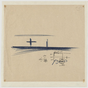
Church on the Water, Tomamu, Hokkaido, Japan, Elevation and plan, sketch

Hitachi, Ibaraki Prefecture, Honshu, Japan

Mito, Ibaraki-ken, Honshū, Japan
Methodist Church of Australasia : the Church overseas
Plan Of Nakanoshima Project, Osaka, Japan

Town plan of Otomari : Japan: Karafuto
Church on the Water, Hokkaido, Japan

Town plan of Toyohara : Japan: Karafuto

Japan. (inset) Plan of Yeddo Bay

Japan series: Osaka

Japan series: Osaka

Japan Series: Osaka

Japan Series: Osaka

Japan Series: Osaka
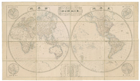
重訂万国全図
View of Gotenyama (and Shinagawa Bay), Print from Keyblock
![[歴民カード_考古] 土師器 壷形土器](https://khirin-i.rekihaku.ac.jp/iiif/nmjh_rekimin_a/23348056_02.tif/full/200,/0/default.jpg)
[歴民カード_考古] 土師器 壷形土器

Bust of a Woman
![[歴民カード_考古] 斧形鋳鉄(2)](http://khirin-i.rekihaku.ac.jp/iiif/nmjh_rekimin_a/23347002_02.tif/full/200,/0/default.jpg)
[歴民カード_考古] 斧形鋳鉄(2)
![[歴民カード_考古] 鉄鏃(42)](https://khirin-i.rekihaku.ac.jp/iiif/nmjh_rekimin_a/23347290_02.tif/full/200,/0/default.jpg)
[歴民カード_考古] 鉄鏃(42)

Carte générale d'une partie d'Afrique et d'Asie depuis le détroit de Gibraltar jusqu'aux isles du ...
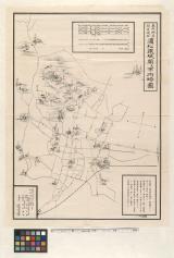
東照神君開運城跡浜松鉄城閣及市街略図
Fujikawa, 38th of 53 Stations of the Tōkaidō (Tōkaidō gojūsan-tsugi no uchi: Fujikawa)
〔成田参詣案内図〕

Carte des découvertes au Nord du Japon faites en 1643 par les vaisseaux hollandais le Kastrikum et...

栗橋幸手杉戸近郊洪水之図
![[Spanish Chart of the Philippines, China, Japan, Korea, Kamtchatka, Western Pacific]](https://stacks.stanford.edu/image/iiif/nk348cb2252%2F42187sh/full/!200,200/0/default.jpg)
[Spanish Chart of the Philippines, China, Japan, Korea, Kamtchatka, Western Pacific]

北海道地質鑛産圖
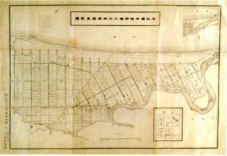
石狩国石狩郡樽川花畔原野区画図
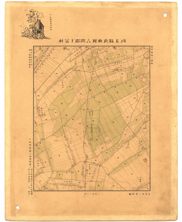
埼玉縣武蔵國入間郡下冨村
![[歴民カード_考古] 斧形鋳鉄(4)](https://khirin-i.rekihaku.ac.jp/iiif/nmjh_rekimin_a/23347004_02.tif/full/200,/0/default.jpg)
[歴民カード_考古] 斧形鋳鉄(4)

map from "Yedo and Peking. A narrative of a journey to the capitals of Japan and China. With notic...

map from "Japan: travels and researches ... Translated from the German, etc"
Fujisawa, 7th of 53 Stations of the Tōkaidō (Tōkaidō gojūsan-tsugi no uchi: Fujisawa)

仁比山村城原字二本杉全図

A New & Accurate Chart of the Discoveries made by the late Capt. Js. Cook, and other distinguished...
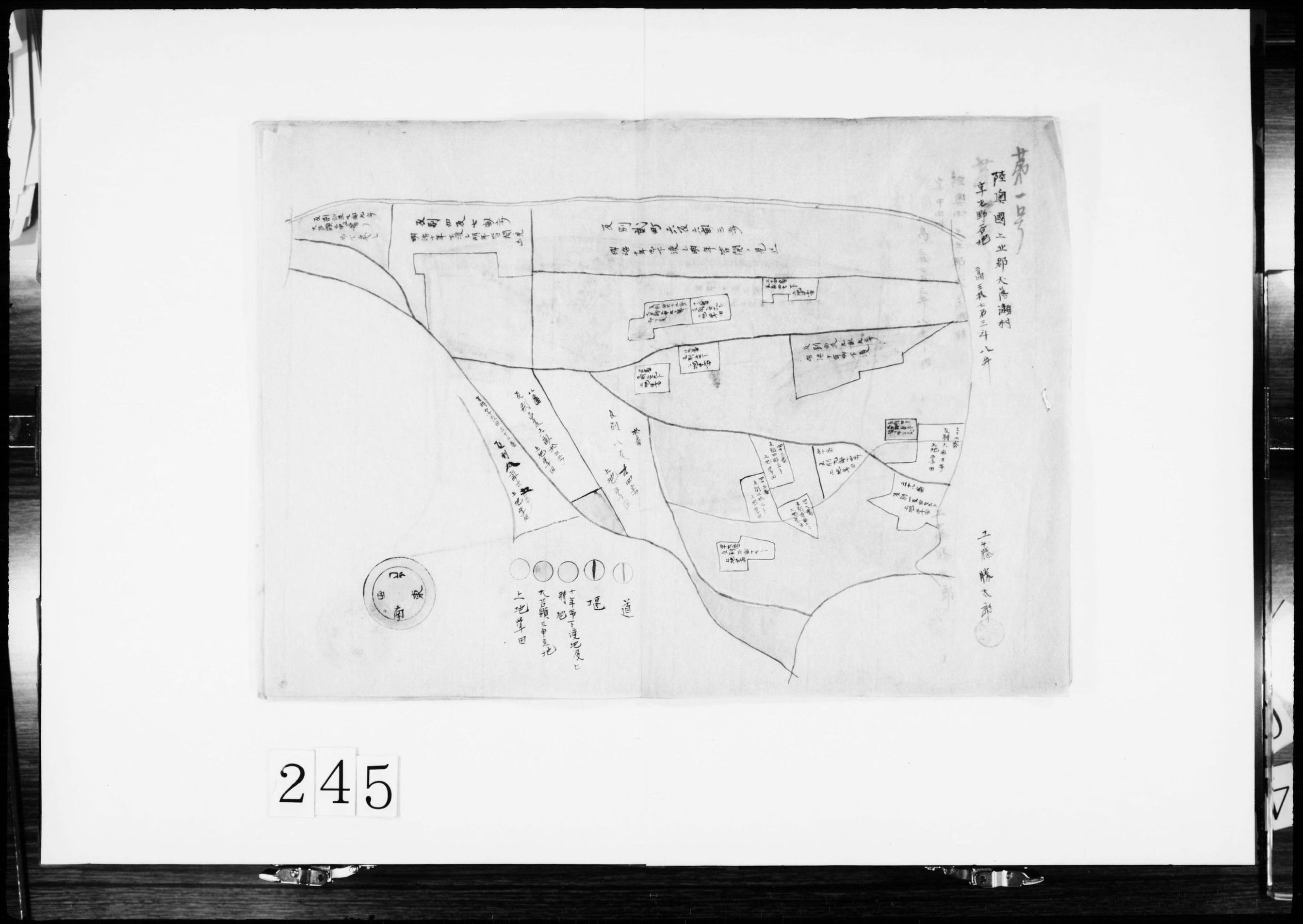
(開墾地及び予定地絵図)
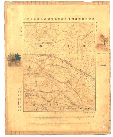
神奈川縣武蔵國北多摩郡石原驛南多摩郡長沼村
最終更新日: 2020-04-16
登録日: 2021-07-22