![[Spanish Chart of the Philippines, China, Japan, Korea, Kamtchatka, Western Pacific]](https://stacks.stanford.edu/image/iiif/nk348cb2252%2F42187sh/full/!200,200/0/default.jpg)
[Spanish Chart of the Philippines, China, Japan, Korea, Kamtchatka, Western Pacific]
- People
- Time
- Owner Organization

(Eastern Part of Asia, including China, Korea, Japan, Philippines : Untitled Globe Gores)
Stanford University Libraries
Stanford Libraries SearchWorks
The 'Western Pacific, showing the geographical relationship of Japan, French Indo-China, the Netherlands Eas...
National Library of New Zealand
DigitalNZ New Zealand API

Maury's Wind and Current Chart, North Pacific Series A. No. 6 (China, Korea, Hong Kong, Japan, Phi...
Stanford University Libraries
Stanford Libraries SearchWorks

Chart of the coast of China and of the Japan islands including the Marianes and part of the Philippines
Boston Public Library
DPLA API

China. Japan. Korea
Stanford University Libraries
Stanford Libraries SearchWorks

(Composite of) A New Chart of The Pacific Ocean, Exhibiting The Western Coast of America, From Cap...
Stanford University Libraries
Stanford Libraries SearchWorks

A New Chart of The Pacific Ocean, Exhibiting The Western Coast of America from Cape Horn to Beerin...
Stanford University Libraries
Stanford Libraries SearchWorks
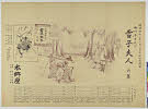
![[Album of 46 Views of China, Korea, and Japan]](https://www.gumtree.com/static/1/resources/assets/rwd/images/orphans/a37b37d99e7cef805f354d47.noimage_thumbnail.png)
[Album of 46 Views of China, Korea, and Japan]
Metropolitan Museum of Art
The Metropolitan Museum of Art Open Access CSV

A New Chart of The Pacific Ocean, Exhibiting The Western Coast of America, From Cape Horn To Beeri...
Stanford University Libraries
Stanford Libraries SearchWorks

A New Chart of The Pacific Ocean, Exhibiting The Western Coast of America, From Cape Horn To Beeri...
Stanford University Libraries
Stanford Libraries SearchWorks
A New Chart of The Pacific Ocean, Exhibiting The Western Coast of America, From Cape Horn To Beeri...
Stanford University Libraries
Stanford Libraries SearchWorks
China--Japan, North Korea--South Korea--Russia, Sea of Japan [electronic resource]
Stanford University Libraries
Stanford Libraries SearchWorks

WARFARE IN THE WESTERN PACIFIC: AMERICAN NAVY CONTESTS POSSESSION OF WATERS NEAR JAPAN
Auckland Libraries
DigitalNZ New Zealand API

Bartholomew's special Map of China, Japan and Korea
Bibliothèque nationale de France
Europeana API

Bartholomew's Special Map of China, Japan and Korea
Bibliothèque nationale de France
Europeana API

Special war map of China, Korea, and Japan
Stanford University Libraries
Stanford Libraries SearchWorks
War map : Australia, China, Japan, and the South Pacific / Cyril Dillon
National Library of Australia
Trove: National Library of Australia

Terza Tavola (China, Southeast Asia, Philippines and Japan)
Stanford University Libraries
Stanford Libraries SearchWorks
A New Chart of the Indian and Pacific Oceans Between the Cape of Good Hope, New Holland, and Japan...
Biblioteca Nacional de España
Europeana API

Map - Japan, Trust Territory of the Pacific Islands
Museum of Transport and Technology Auckland
DigitalNZ New Zealand API

Reported Dangers to navigation in the Pacific Ocean, inclusive of the China and Japan Seas and the...
Bavarian State Library
Europeana API
Chart of the Kuro Siwo or Japan Stream of the Pacific : analogous to the Gulf Stream of the Atlantic, as investigated by the Officers of the U.S. Japan Expedition in 1854
National Library of Australia
Trove: National Library of Australia
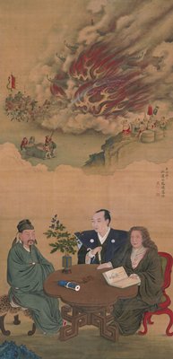
A Meeting of Japan, China, and the West
Minneapolis Institute of Arts
Minneapolis Institute of Art API
Asia, China--South Korea--Japan, Yellow Sea, including the East China Sea and Korea Strait [electr...
Stanford University Libraries
Stanford Libraries SearchWorks
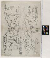
志古丹島測量原図
Tokyo National Museum
Integrated Collections Database of the National Museums, Japan

Carta General para las Navegaciones a la India Oriental por el Mar del Sur y el Grande Oceano que ...
Stanford University Libraries
Stanford Libraries SearchWorks

Japan, political divisions
Stanford University Libraries
Stanford Libraries SearchWorks

Carte des Isles du Japon et la Presqu Isle de Coree Avec les Costes de la Chine. Depuis Pekin Jusqu'a Canton...
Yale University Library
Yale University Library Digital Collections

A New & Accurate Chart of the Discoveries made by the late Capt. Js. Cook, and other distinguished...
Stanford University Libraries
Stanford Libraries SearchWorks

Rice areas in Japan
Stanford University Libraries
Stanford Libraries SearchWorks

Japan, acreage of rice by prefectures, 1939. Japan, acreage of wheat by prefectures, 1939
Stanford University Libraries
Stanford Libraries SearchWorks

North West Pacific Ocean : Including Yellow, Japan & Okhotsk Seas, the Kuril Islands and Kamchatka
Stanford University Libraries
Stanford Libraries SearchWorks

Carte réduite de l'océan septentrional compris entre l'Asie et l'Amérique ... Par le Sr. Bellin ..
Yale University Library
Yale University Library Digital Collections

Carte générale d'une partie d'Afrique et d'Asie depuis le détroit de Gibraltar jusqu'aux isles du ...
Bibliothèque nationale de France
Europeana API

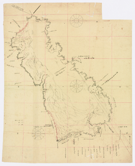
Durville Island and Approaches
Stanford University Libraries
Stanford Libraries SearchWorks
房州之畧図
Funabashi-shi Western Library
ADEAC: A System of Digitalization and Exhibition for Archive Collections
![Hailaerh fukin zu [cartographic material]](https://stacks.stanford.edu/image/iiif/nc103dh1915%2Fnc103dh1915_00_0001/full/!200,200/0/default.jpg)
Hailaerh fukin zu [cartographic material]
Stanford University Libraries
Stanford Libraries SearchWorks
A new & correct chart of the Indian Sea from Cabo Bonea Esperanca to Japan according to Mr. Edward Wrights projection vulgarly called Mercators chart
National Library of Australia
Trove: National Library of Australia

Skizze des weges von Tokio nach Yumotto (Nikko Berge) nach eigenen Aufzeichnungen / von E. Knippin...
Bibliothèque nationale de France
Europeana API
![[Japan] (Published in Manila!)](https://stacks.stanford.edu/image/iiif/gv355sq3352%2F37869hs/full/!200,200/0/default.jpg)
[Japan] (Published in Manila!)
Stanford University Libraries
Stanford Libraries SearchWorks

Manshū Gomanbun no ichi Haisen Kokusan fukin
Stanford University Libraries
Stanford Libraries SearchWorks

map from "Japan: travels and researches ... Translated from the German, etc"
British Library
Europeana API

Ryōtō Kaiwan : Daitzu Shan to Fuchou Chao
Stanford University Libraries
Stanford Libraries SearchWorks

Guide to Tokyo City
Yale University Library
Yale University Library Digital Collections
Yukikofujin、touryuuhachinoki
Shochiku Otani Library
ARC Banzuke (Playbills) Portal Database

Central Japan (central and northern Honshū) distribution of population
Stanford University Libraries
Stanford Libraries SearchWorks
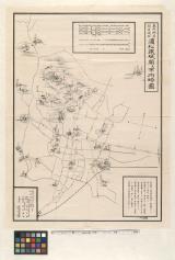
東照神君開運城跡浜松鉄城閣及市街略図
Hamamatsu City Central Library
ADEAC: A System of Digitalization and Exhibition for Archive Collections

[Carte de la Tartarie chinoise et des îles du Japon pour servir à la lettre de Mr. d'Anville au Mr...
Bibliothèque nationale de France
Europeana API
Last Updated: 2020-04-17
Uploaded: 2021-09-21