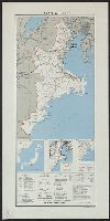
Islands of Japan
- People
- Time
- Owner Organization
Japan, Mandshuria (showing the course of the Amur river), the Kurile Isles &c. : according to the ...
VU University Amsterdam Library
Europeana API

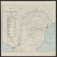
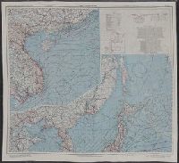
Japan, Mandshuria (Showing The Course of the Amur River) The Kurile Isles &c. Accroding to the Bri...
Stanford University Libraries
Stanford Libraries SearchWorks

Japan, Mandshuria (Showing The Course of the Amur River) The Kurile Isles &c. Accroding to the Bri...
Stanford University Libraries
Stanford Libraries SearchWorks

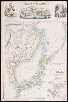
Islands of Japan. (with) Japan, Mandshuria, (Showing the Course of the Amur River) The Kurile Isle...
Stanford University Libraries
Stanford Libraries SearchWorks

(Upper Sheet to) Map of the Island of Japan, Kurile &c. with the Adjacent Coasts of the Chinese Do...
Stanford University Libraries
Stanford Libraries SearchWorks

Map of the Island of Japan, Kurile &c. with the Adjacent Coasts of the Chinese Dominions and a Ske...
Stanford University Libraries
Stanford Libraries SearchWorks

Map of the Island of Japan, Kurile &c. with the Adjacent Coasts of the Chinese Dominions and a Ske...
Stanford University Libraries
Stanford Libraries SearchWorks
(Lower Sheet to) Map of the Island of Japan, Kurile &c. with the Adjacent Coasts of the Chinese Do...
Stanford University Libraries
Stanford Libraries SearchWorks
China Divided into its Great Provinces and the Isles of Japan [Material cartográfico]
Biblioteca Nacional de España
Europeana API

China divided into its great provinces and the Isles of Japan by Samuel Dunn
Yale University Library
Yale University Library Digital Collections
The Oriental navigator, or, Directions for sailing to, from, and upon the coasts of, the East-Indies, China, Australia...To the work are prefixed a series of ... tables of the determined positions of all the principle points and places from the British seas to Cape Horn, the Cape of Good Hope, and thence to the islands of Japan, by John Purdy. (Plan of Chatham Island, &c. Whittle & Laurie, London, 1815.)
National Library of Australia
Trove: National Library of Australia
To the Right Honourable William, Lord Cowper, Lord High Chancellor of Great Britain, this map of Asia : according to ye newest and most exact observations is most humbly dedicated / by your Lordship's most humble servant, Herman Moll, geographer
National Library of Australia
Trove: National Library of Australia
Asia and its islands according to Danville : divided into empires, kingdoms, states, regions &ca. with the European possessions and settlements in the East Indies and an exact delineation of all the discoveries made in the Eastern parts by the English under Captn. Cook
State Library of New South Wales
Trove: National Library of Australia
A Chart of the eastern ocean from C. Good-Hope to the Islands of Japan / drawn from the journals and remarks of the most skilful navigators more especially from those of M. d'Apres de Mannevillette
National Library of Australia
Trove: National Library of Australia

A new chart of the Pacific Ocean : exhibiting the western coast of America, from Cape Horn to Beerings Strait, the eastern shores of Asia including Japan, China and Australia and all the numerous islands and known dangers situated in Polynesia and Australasia / correctly drawn and regulated according to the most approved and modern surveys and astronomical observations by J.W. Norie
State Library of New South Wales
Trove: National Library of Australia
[A Russian woman is having a nightmare showing disasterous defeats of the Russian army and navy on all fronts in the war against Japan; she is being attended to by a doctor who is taking her pulse, two maids, and a member of the clergy, possibly a bishop]
Library of Congress
Trove: National Library of Australia

Nara, Yamada, Koyasan, & environs
Yale University Library
Yale University Library Digital Collections
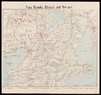
Nara, Yamada, Koyasan, & environs
Yale University Library
Yale University Library Digital Collections
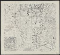
Japan, Aichi-ken
Yale University Library
Yale University Library Digital Collections

Ise Bay - North :
Yale University Library
Yale University Library Digital Collections
![Gohyakumanbunnoichi sorenpō yochizu [cartographic material]](https://stacks.stanford.edu/image/iiif/vz338tz0647%2Fvz338tz0647_00_0001/full/!200,200/0/default.jpg)
Gohyakumanbunnoichi sorenpō yochizu [cartographic material]
Stanford University Libraries
Stanford Libraries SearchWorks

General map of China and adjacent regions showing treaty ports and railroads / prepared for the Department o...
Yale University Library
Yale University Library Digital Collections
Unzen and neighbourhood
Yale University Library
Yale University Library Digital Collections
Kūchū shashin sokuryō yōzu Sumatora gomanbun no ichi zu: シデイギナン (Sheet 6亻176-53)
National Library of Australia
Trove: National Library of Australia
Map and guide of Hakone and neighbourhood
Yale University Library
Yale University Library Digital Collections
Kyoto South : Kyoto Prefecture, Honshu, Japan
Yale University Library
Yale University Library Digital Collections
![[2 Maps of Korea:] Karte von der Koraischen Halbinsel... Nach einem japanischen Originale. 1840 [a...](https://stacks.stanford.edu/image/iiif/qt462tg9589%2F34409/full/!200,200/0/default.jpg)
[2 Maps of Korea:] Karte von der Koraischen Halbinsel... Nach einem japanischen Originale. 1840 [a...
Stanford University Libraries
Stanford Libraries SearchWorks

Mandchourie et Coree de Kharbine a Seoul de Port-Arthur a Vladivostok Traduction de la Carte d'Eta...
Stanford University Libraries
Stanford Libraries SearchWorks

Nagasaki
Yale University Library
Yale University Library Digital Collections
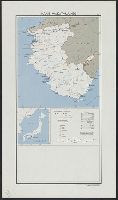
Japan, Wakayama-ken
Yale University Library
Yale University Library Digital Collections

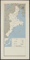
Japan, Yamaguchi-ken
Yale University Library
Yale University Library Digital Collections

Japan, Oita-ken
Yale University Library
Yale University Library Digital Collections
Japan, Mie-ken
Yale University Library
Yale University Library Digital Collections
Tokyo city bus routes : June, 1948 / compiled and reproduced by the 64th Engineer Base Topographic Bn
National Library of Australia
Trove: National Library of Australia
Japan, the islands of Loochoo & Formosa, and the maritime provinces of China with the tract of the Morrison's voyage in 1837 / J. Arrowsmith, Lith
National Library of Australia
Trove: National Library of Australia

Rand, McNally & Co.'s 1904 war map of Russia and the continent of Asia
Yale University Library
Yale University Library Digital Collections
Japan, Mie-ken
Yale University Library
Yale University Library Digital Collections

阿州全図
Tokushima Prefectural Archives
ADEAC: A System of Digitalization and Exhibition for Archive Collections
Japan and South China Seas / prepared at the direction of the commanding general, Army Air Forces, for the A...
Yale University Library
Yale University Library Digital Collections
「第十二回兵式野外演習心得」
University of Tokyo Graduate School of Arts and Sciences / College of Liberal Arts
UTokyo Academic Archives Portal
Last Updated: 2021-01-30
Uploaded: 2021-07-29