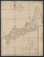
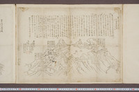
![Fuji-mi jūsan-shū yochi zenzu [Map of the 13 provinces around Mt. Fuji]](https://collections.library.yale.edu/iiif/2/15510837/full/!200,200/0/default.jpg)
Fuji-mi jūsan-shū yochi zenzu [Map of the 13 provinces around Mt. Fuji]
- Time
- Owner Organization
Postcards of the famous spots around Mt. Fuji
National Gallery of Victoria
Trove: National Library of Australia
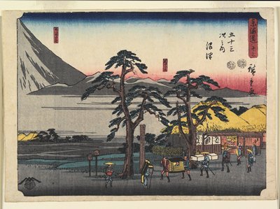
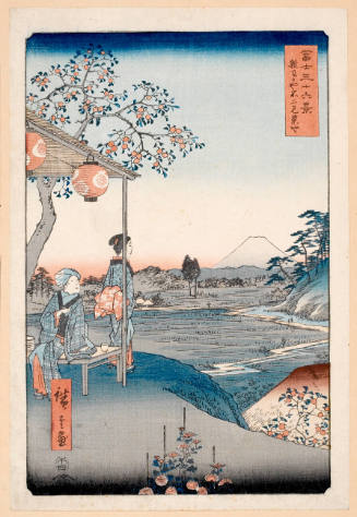
13 Numazu: The Ashigara Mountains and the Foot of Mt. Fuji
Minneapolis Institute of Arts
Minneapolis Institute of Art API

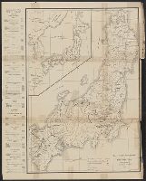
Map of the Great Japanese Empire (Dainihon Kokugun Yochi Zenzu)
Honolulu Museum of Art
Honolulu Museum of Art Collection
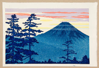
Mt. Fuji in the Evening (Fuji Yūgure)
Honolulu Museum of Art
Honolulu Museum of Art Collection

Mt. Fuji and the Sea of Clouds
Freer and Sackler
DPLA API

Mt. Fuji and the Sea of Clouds
Freer and Sackler
DPLA API

Dai Nihon zenzu (The picture of the Great Whole Map of Japan; Provinces in the Japanese Empire, in...
Stanford University Libraries
Stanford Libraries SearchWorks
After the hunt at the foothills of Mt. Fuji
National Gallery of Victoria
Trove: National Library of Australia
After the hunt at the foothills of Mt. Fuji
National Gallery of Victoria
Trove: National Library of Australia
View of Mt. Fuji from the Hakone mountains.
Honolulu Museum of Art
Honolulu Museum of Art Collection

Pilgrims' map of Mount Fuji and surrounding temples
Freer and Sackler
DPLA API
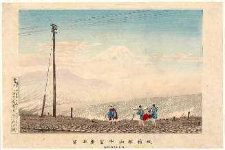
Korean Suprised at the View of Mt. Fuji
Minneapolis Institute of Arts
Minneapolis Institute of Art API
A Hunting at the Foot of Mt. Fuji (Fuji no Makigari)
Honolulu Museum of Art
Honolulu Museum of Art Collection
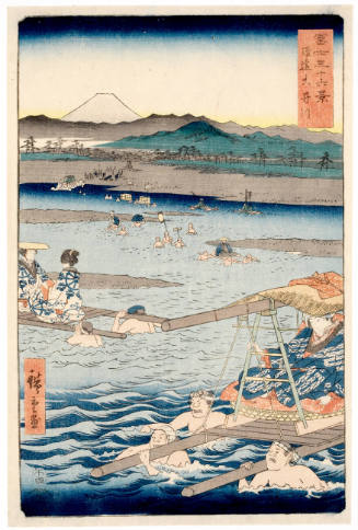
The ōi River between Suruga and Tōtōmi Provinces, series Thirty-six Views of Mt. Fuji
Honolulu Museum of Art
Honolulu Museum of Art Collection
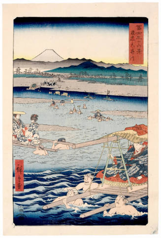
The ōi River between Suruga and Tōtōmi Provinces, series Thirty-six Views of Mt. Fuji
Honolulu Museum of Art
Honolulu Museum of Art Collection
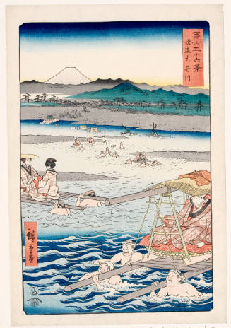
The ōi River between Suruga and Tōtōmi Provinces, series Thirty-six Views of Mt. Fuji
Honolulu Museum of Art
Honolulu Museum of Art Collection
Ocean by Kanagawa from the series "36 Views of Mt. Fuji"
Minneapolis Institute of Arts
Minneapolis Institute of Art API
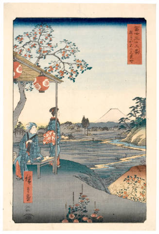
The Teahouse with the View of Mt. Fuji at Zoshigaya, series Thirty-six Views of Mt. Fuji
Honolulu Museum of Art
Honolulu Museum of Art Collection
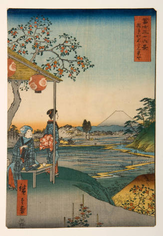
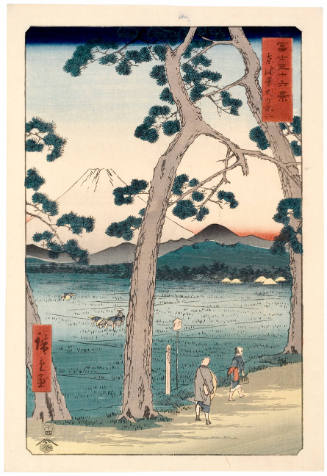
The Teahouse with the View of Mt. Fuji at Zōshigaya, series Thirty-six Views of Mt. Fuji
Honolulu Museum of Art
Honolulu Museum of Art Collection
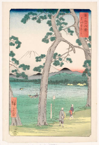
The Teahouse with the View of Mt. Fuji at Zōshigaya, series Thirty-six Views of Mt. Fuji
Honolulu Museum of Art
Honolulu Museum of Art Collection
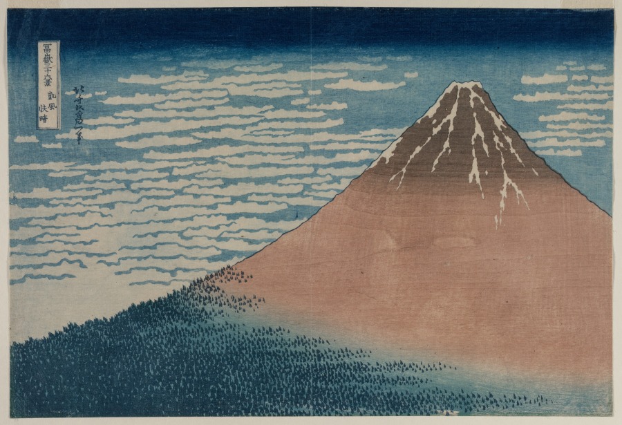
Fuji in Clear Weather, from the series Thirty-six Views of Mt. Fuji
Cleveland Museum of Art
The Cleveland Museum of Art Open Access API
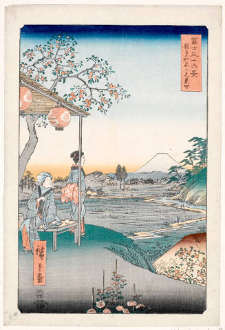
The Teahouse with the View of Mt. Fuji at Zōshigaya, series Thirty-six Views of Mt. Fuji
Honolulu Museum of Art
Honolulu Museum of Art Collection
Mt. Fuji on the Left on the Tōkaidō (Tōkaidō Hidarifuji), series Thirty-six Views of Mt. Fuji
Honolulu Museum of Art
Honolulu Museum of Art Collection
Mt. Fuji on the Left on the Tōkaidō (Tōkaidō Hidarifuji), series Thirty-six Views of Mt. Fuji
Honolulu Museum of Art
Honolulu Museum of Art Collection

習志野演習場
Funabashi-shi Western Library
ADEAC: A System of Digitalization and Exhibition for Archive Collections
Zouhokaisei kawachisaikenzu zen
Geospatial Information Authority of Japan
FishPix

佐賀県管内図
Saga Prefectual Library
IIIF Discovery in Japan
Carte de L'Empire du Japon ..
Yale University Library
Yale University Library Digital Collections

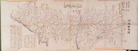
Kaetsunousanshuugunwakeryakuezu
Imizu City Shinminato Museum
ADEAC: A System of Digitalization and Exhibition for Archive Collections

「大橋村 行事村 宮市村見取図」
行橋市歴史資料館
ADEAC: A System of Digitalization and Exhibition for Archive Collections
A New & Correct Chart of the Indian Sea From Cabo Bonea Esperanca to Japan [Material cartográfico]...
Biblioteca Nacional de España
Europeana API

道灌山虫聴
National Diet Library
ADEAC: A System of Digitalization and Exhibition for Archive Collections
Stanford's map of eastern China, Japan and Korea : the seat of war in 1894
National Library of Australia
Trove: National Library of Australia
Map of the missionary districts of north Tokyo & Kyoto : under the jurisdiction of the Bishop of Tokyo 1895
Yale University Library
Yale University Library Digital Collections

Hyakumanbun no ichi Nanpō kōkūzu
Stanford University Libraries
Stanford Libraries SearchWorks
![Sekitan no seisan narabi ryūdō ryakuzu [cartographic material]](https://stacks.stanford.edu/image/iiif/dj862yn2265%2Fdj862yn2265_00_0001/full/!200,200/0/default.jpg)
Sekitan no seisan narabi ryūdō ryakuzu [cartographic material]
Stanford University Libraries
Stanford Libraries SearchWorks

Map of Colorado Territory, Compiled from Government Maps & Actual Surveys. Made In 1861
Stanford University Libraries
Stanford Libraries SearchWorks
Ehon Azuma Kagami, Vol. I
Brooklyn Museum
Brooklyn Museum API
![Tsurigitsunehananokakewana、[nanakusayosooisoga]](http://mfas3.s3.amazonaws.com/styles/grid-2_thumbnail_retina/s3/objects/SC209762.jpg)
Tsurigitsunehananokakewana、[nanakusayosooisoga]
Museum of Fine Arts, Boston
ARC Banzuke (Playbills) Portal Database
Etchuunokunizu
Geospatial Information Authority of Japan
FishPix
![Sanjūmanbun no ichi Shina engan rikukai hengōzu [cartographic material]](https://stacks.stanford.edu/image/iiif/cn019rx5665%2Fcn019rx5665_00_0001/full/!200,200/0/default.jpg)
Sanjūmanbun no ichi Shina engan rikukai hengōzu [cartographic material]
Stanford University Libraries
Stanford Libraries SearchWorks
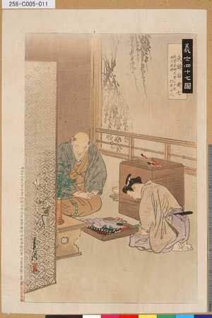
「義士四十七図矢頭右衛七近習長助之男二十石五人扶持行年十八」 「義士四十七図」「岡野金右衛門他」
Tokyo Metropolitan Central Library
ARC Ukiyo-e Portal Database

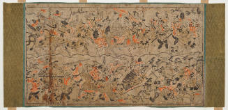
Part 5, Volume 2 of Picture book of the exploits of Toyotomi Hideyoshi (Ehon Toyotomi kunkōki gohen ni)
The Chester Beatty Library
Chester Beatty's Digital Collections
日本総部(海図第128号)
Geospatial Information Authority of Japan
FishPix
谷文晁像
Tokyo National Museum
ARC Ukiyo-e Portal Database
楼閣山水図屏風
Tokyo National Museum
ARC Ukiyo-e Portal Database
Illustrated Book on Agriculture (Seisei zusetsu), Satsuma-edition, Part II, Vol. 17
Harvard Art Museums
Harvard Art Museums API
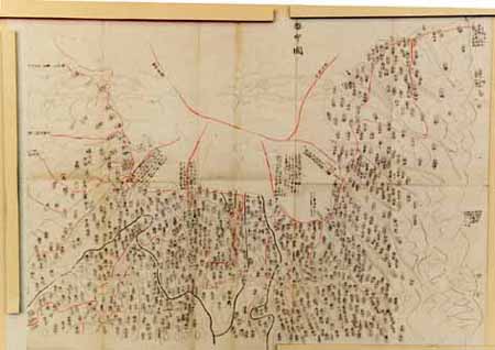
富士山頂上八峯内院并諸国遠見図
University of Tokyo General Library
UTokyo Academic Archives Portal
Last Updated: 2021-01-30
Uploaded: 2021-07-29