![[3 maps of Leyte Island, Philippines, in Japanese.]](https://collections.library.yale.edu/iiif/2/15251299/full/!200,200/0/default.jpg)
[3 maps of Leyte Island, Philippines, in Japanese.]
- Time
- Owner Organization
![[4 maps of Luzon, Philippines, in Japanese.]](https://collections.library.yale.edu/iiif/2/15251546/full/!200,200/0/default.jpg)
[4 maps of Luzon, Philippines, in Japanese.]
![[Map of Marinduque, Philippines, in Japanese.]](https://collections.library.yale.edu/iiif/2/15251559/full/!200,200/0/default.jpg)
[Map of Marinduque, Philippines, in Japanese.]
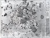
![[Map of part of Samar, Philippines, in Japanese.]](https://collections.library.yale.edu/iiif/2/15251561/full/!200,200/0/default.jpg)
[Map of part of Samar, Philippines, in Japanese.]

SPECTACULAR EXPLOSION ON JAPANESE WARSHIP CAUGHT BY ALLIED BOMBER OFF LEYTE ISLAND IN THE PHILIPPINES
The ruins of Ormoc, one of the larger towns on Leyte Island, in the Philippines, after it had been won from ...

Map of Japanese Homeland Island
The northern part of Luzon Island, in the Philippines, where a large Japanese force is reported to be attemp...

CAPITAL OF THE PHILIPPINES RUTHLESSLY BOMBED BY JAPANESE
Book: Maps of China

WAR PICTURES FROM THE PHILIPPINES: RUTHLESS JAPANESE BOMBENG OF MANILA

WRITHING IN VAIN: JAPANESE AIRCRAFT-CARRIERS SUNK OFF THE PHILIPPINES IN OCTOBER, 1944
The Harbor of Love: On the Island of Women, vol. 2 of 3
![[Salisbury Collection of World Maps]](https://collections.library.yale.edu/iiif/2/15248723/full/!200,200/0/default.jpg)
[Salisbury Collection of World Maps]

CAPITAL OF PHILIPPINES RETAKEN BY AMERICAN FORCES AFTER THREE YEARS OF JAPANESE OCCUPATION: VIEWS OF LIBERAT...
Fukuoka(consisting of 3 envelopes): Maps(part Japanese). Report No. 58b(3)(j), USSBS Index Section 2
Japanese trapped north of Garapan, on Saipan Island, in the Marianas, attempted to flee by means of boats in...

"Japanese Island Sea. Kobe"

Japanese Prisoner, Mono Island

Map of Colorado Territory, Compiled from Government Maps & Actual Surveys. Made In 1861

Map of Colorado Territory, Compiled from Government Maps & Actual Surveys. Made In 1861

Map of Colorado Territory, Compiled from Government Maps & Actual Surveys. Made In 1861

Map of Colorado Territory, Compiled from Government Maps & Actual Surveys. Made In 1861
Sabang Harbour, on the island of Pulo Way, at the northern tip of Japanese-held Sumatra, in the Netherlands ...

IN FORMER JAPANESE-OCCUPIED TERRITORY: PART OF A ROYAL NEW ZEALAND AIR FORCE CAMP ON GUADALCANAR ISLAND IN T...

「大橋村 行事村 宮市村見取図」
Carte de L'Empire du Japon ..
Carta particolare dello stretto di Iezo fra l'America è l'isola Iezo / AF: Lucini fece
弘前惣御絵図 : 延宝5~元禄15
Ezokoukyouyochizenzu

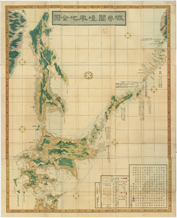
大日本國全圖
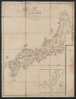
![Orientation, Philippines to Japan [cartographic material]](https://stacks.stanford.edu/image/iiif/nh916xd2027%2Fnh916xd2027_00_0001/full/!200,200/0/default.jpg)
Orientation, Philippines to Japan [cartographic material]
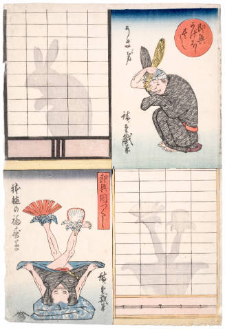
Rabbit and Potted Adonis (Usagi to Hachiue no Fukujusō), series Collection of Shadow Games
Japan. 陸軍. 参謀本部

Carta General Para Las Navegaciones a la India Oriental Por El Mar Del Sur Y el grande Oceano que ...

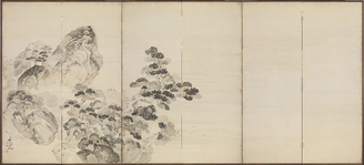
南宗寺地割之図

「即興かげほし尽し」
West Lake in Spring, High Tide at Qiantang

Akashi, Hyogo-Ken, Honshu, Japan

紙本淡彩西湖春景銭塘観湖図〈池野大雅筆/六曲屏風〉

map from "Notes on the late expedition against the Russian settlements in Eastern Siberia; and of ...
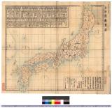
日本府県略図 : 日本府県略図
![Sanjūmanbun no ichi Shina engan rikukai hengōzu [cartographic material]](https://stacks.stanford.edu/image/iiif/cn019rx5665%2Fcn019rx5665_00_0001/full/!200,200/0/default.jpg)
Sanjūmanbun no ichi Shina engan rikukai hengōzu [cartographic material]
「即興かげぼし尽し」 「こんろにきびせう」「かんちろり」
Shoji, vägg: skjutvägg, shoji
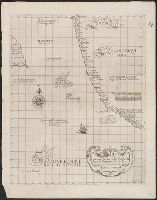
![East India Archipelago [Eastern Passages to China and Japan] [Chart No. 7] . . . 1868 (Taiwan, Nor...](https://stacks.stanford.edu/image/iiif/xy078vp9272%2F34545/full/!200,200/0/default.jpg)
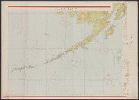
East India Archipelago [Eastern Passages to China and Japan] [Chart No. 7] . . . 1868 (Taiwan, Nor...

drawing

The Ninth Month (Kugatsu), from an untitled series of genre scenes in the twelve months, with kyoka poems

Genjigumo ukiyo e-awase Hahakigi
Last Updated: 2021-01-30
Uploaded: 2021-07-29