Laurie and Whittle's new chart of the Indian and Pacific Oceans between the Cape of Good Hope, New Holland, and Japan, comprehending New Zealand, New Caledonia, New Britain, New Ireland, New Guinea,&c., Louisiade and New Georgia; also the Pelew, New Caroline, Ladrone, and Philippine Islands; &c. with the most remarkable tracks of the English, Spanish, French and Dutch navigators: and chiefly the track of the Walpole, Eastindiaman, Captn. Thos. Butler, 1794 from the Cape of Good Hope to Van Diemen's Land and, from thence to China, and the track of the Royal Admiral Captn. Henr. Bond in 1792 and 93, from the Cape to Port Jackson and China
- Time
- Owner Organization
Laurie and Whittle's new chart of the Indian and Pacific Oceans between the Cape of Good Hope, New Holland and Japan : comprehending New Zealand, New Caledonia, New Britain, New Ireland, New Guinea &c., Louisiade and New Georgia; also The Pelew, New Caroline, Ladrone and Philippine Islands &c. with the most remarkable tracks of the English, Spanish, French and Dutch navigators and chiefly the track of the Walpole, EastIndiaman, Captn. Thos. Butler, 1794 from the Cape of Good Hope to Van Diemen's Land and from thence to China, and the track of the Royal Admiral Captn. Henr. Bond in 1792 and 93 from the Cape to Port Jackson and China

Laurie and Whittle's New Chart of the Indian and Pacific Oceans Between the Cape of Good Hope, New...

Laurie and Whittle's New Chart of the Indian and Pacific Oceans Between the Cape of Good Hope, New...
A New Chart of the Indian and Pacific Oceans Between the Cape of Good Hope, New Holland, and Japan...
A new chart of the Indian and Pacific Oceans between the Cape of Good Hope, New Holland and Japan : comprehending New Zealand, New Caledonia, New Britain, New Ireland, New Guinea &c., also the New Caroline, Ladrone and Philippine Islands : with the tracks of the English, French, Spanish and Dutch discoverers
The Oriental navigator, or, Directions for sailing to, from, and upon the coasts of, the East-Indies, China, Australia...To the work are prefixed a series of ... tables of the determined positions of all the principle points and places from the British seas to Cape Horn, the Cape of Good Hope, and thence to the islands of Japan, by John Purdy. (Plan of Chatham Island, &c. Whittle & Laurie, London, 1815.)

A new chart of the Indian and Pacific Oceans between the Cape of Good Hope, New Holland and Japan : comprehending New Zealand, New Caledonia, New Britain, New Ireland, New Guinea &c., Louisade and New Georgia ; also the Pellew, New Caroline, Ladrone and Philippine Islands; with all these which have been discovered in the year 1788; & the tracks of the English, French, Spanish and Dutch discoverers
A Chart of the Eastern Ocean from C. Good Hope to the Islands of Japan [Material cartográfico]
The country trade East-India pilot, for the navigation of the East-Indies and oriental seas, within the limits of the East-India Company, extending from the Cape of Good Hope to China, New Holland and New Zeeland, with the Red Sea, Gulf of Persia, Bay of Bengal, and China Seas / chiefly composed from actual surveys and draughts communicated by experienced officers of the East-India Company, and from the Neptune oriental by M. d'Apres de Mannevillette

A New Chart of The Pacific Ocean, Exhibiting The Western Coast of America, From Cape Horn To Beeri...

A New Chart of The Pacific Ocean, Exhibiting The Western Coast of America, From Cape Horn To Beeri...
A New Chart of The Pacific Ocean, Exhibiting The Western Coast of America, From Cape Horn To Beeri...
A Chart of the eastern ocean from C. Good Hope to the Islands of Japan / drawn from the journals and remarks - M. d'Après de Mannevillette

A Chart of the Eastermost part of the East Indies and China from Cape Comarin to Japan with the Ad...

A Chart of the Eastermost part of the East Indies and China from Cape Comarin to Japan with the Ad...

A New Chart of The Pacific Ocean, Exhibiting The Western Coast of America from Cape Horn to Beerin...
A Chart of the eastern ocean from C. Good-Hope to the Islands of Japan / drawn from the journals and remarks of the most skilful navigators more especially from those of M. d'Apres de Mannevillette
![A particular map of the road from Osacca [Osaca] to Miaco [Miyako-shi], and from thence to Fammamatz [Hamama...](https://dp.la/thumb/f741e82fc81a962d8a2a6c5659d34013)
A particular map of the road from Osacca [Osaca] to Miaco [Miyako-shi], and from thence to Fammamatz [Hamama...

A New Map of India & China From the latest Observations
![A particular map of the voyage from Kokura to Simonoseki [Shimonoseki-shi], and thence to Osacca [Osaca]](https://dp.la/thumb/253a40138432c08b8025bf838a11d00b)
A particular map of the voyage from Kokura to Simonoseki [Shimonoseki-shi], and thence to Osacca [Osaca]

map from "Yedo and Peking. A narrative of a journey to the capitals of Japan and China. With notic...

map from "Yedo and Peking. A narrative of a journey to the capitals of Japan and China. With notic...
A new map of India & China from the latest observations / by I. Senex
A chart of the northern part of the China Sea shewing the passage from Formosa to Japan : with the eastern coast of China and the Lekeyo Islands
A new chart of the Indian and Pacific Oceans between the Cape of Good Hope, New Holland and Japan : comprehending New Zealand, New Caledonia, New Britain, New Ireland, New Guinea &c., also the New Caroline, Ladrone and Philippine Islands : with the tracks of the English, French, Spanish and Dutch discoverers

Shiina shimogou ezu shitagaki
![[Carte hollandaise manuscrite de la côte orientale du Japon et de la terre de Jeso]](https://api.europeana.eu/api/v2/thumbnail-by-url.json?uri=http%3A%2F%2Fgallica.bnf.fr%2Fark%3A%2F12148%2Fbtv1b5963173g.thumbnail.jpg&type=IMAGE)
[Carte hollandaise manuscrite de la côte orientale du Japon et de la terre de Jeso]

A Correct Map From Actual Surveys And Examinations Embracing A Portion of California Between Monte...
近世職人尽絵詞
Australien / wolfenbuttel bei C. H. Hartmann

「西国三十三所順拝地図」
Jūmanbun no ichi Ranryō Boruneo : Barikkupapan fukin: XXIX/62 (16)
Laurie and Whittle's new chart of the Indian and Pacific Oceans between the Cape of Good Hope, New Holland and Japan : comprehending New Zealand, New Caledonia, New Britain, New Ireland, New Guinea &c., Louisiade and New Georgia; also The Pelew, New Caroline, Ladrone and Philippine Islands &c. with the most remarkable tracks of the English, Spanish, French and Dutch navigators and chiefly the track of the Walpole, EastIndiaman, Captn. Thos. Butler, 1794 from the Cape of Good Hope to Van Diemen's Land and from thence to China, and the track of the Royal Admiral Captn. Henr. Bond in 1792 and 93 from the Cape to Port Jackson and China

(Composite of) A New Chart of The Pacific Ocean, Exhibiting The Western Coast of America, From Cap...

Seconde partie de la carte d'Asie contenant la Chine, et partie de la Tartarie, l'Inde au-delà du ...
Manshūkoku chizu / Minami Manshū Tetsudō Kabushiki Kaisha chosaku ken hakkō

Niikawagunbungenezu
Chūko fukin dai jūni shidan no sentō san-gatsu jūroku-nichi
雨雪山水図屏風
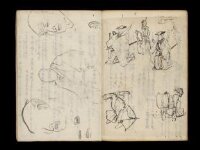
Kuniyoshi's preparatory drawings, no.39

A Correct Sea Chart of the Whole World, According to Wright's, Commonly Called Mercator's, Project...

「箱根七温泉図」
![Sensei-shō gojūmanbun no ichi chishizu [cartographic material]](https://stacks.stanford.edu/image/iiif/wm502tg3204%2Fwm502tg3204_00_0001/full/!200,200/0/default.jpg)
Sensei-shō gojūmanbun no ichi chishizu [cartographic material]
「隅田川之景」

「〔箱根絵図〕」

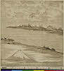
「下総銚子之図」
珺玉集

■
Last Updated: 2020-06-05
Uploaded: 2021-07-22