Karkar, New Guinea
Markham, New Guinea
Wewak, New Guinea
Port Moresby, New Guinea
Vanimo, New Guinea
![[Jamna Island, New Guinea 1944.]](https://api.europeana.eu/api/v2/thumbnail-by-url.json?uri=http%3A%2F%2Fwww.beeldbankwo2.nl%2Fcgi-bin%2Ffrsiserver.dll%2Fthumbnail%2F51361-thumb.jpg%3Ffrskey%3D51361&type=IMAGE)
[Jamna Island, New Guinea 1944.]
![[Jamna Island, New Guinea 1944.]](https://api.europeana.eu/api/v2/thumbnail-by-url.json?uri=http%3A%2F%2Fwww.beeldbankwo2.nl%2Fcgi-bin%2Ffrsiserver.dll%2Fthumbnail%2F51362-thumb.jpg%3Ffrskey%3D51362&type=IMAGE)
[Jamna Island, New Guinea 1944.]
Schetskaart van "New Guinea" (Nederlandsch Gebied) Nyūginia

New Guinea - South Coast. Freshwater Bay to C. Blackwood

Plans in south eastern part of New Guinea

New Guinea - South-East Coast. Approaches to Dedele

Plans in the south-eastern part of New Guinea

New Guinea - N. E. Coast. C. Ward Hunt to C. Nelson
![[Dutch New Guinea - Hollandia.]](https://api.europeana.eu/api/v2/thumbnail-by-url.json?uri=http%3A%2F%2Fwww.beeldbankwo2.nl%2Fcgi-bin%2Ffrsiserver.dll%2Fthumbnail%2F51688-thumb.jpg%3Ffrskey%3D51688&type=IMAGE)
[Dutch New Guinea - Hollandia.]

Plans on the north-eastern coast of New Guinea

Photographs from Papua New Guinea, mainly New Britain and New Ireland

WITH THE AUSTRALIANS IN TARAKAN AND NEW GUINEA: JAPANESE GARRISONS BEING REDUCED

Pacific Ocean, Approaches to south east part of New Guinea
NZ troops preparing for commando raid on Nissan Island, New Guinea
NZ troops preparing for commando raid on Nissan Island, New Guinea
New Guinea - Celebes and other areas

South Pacific Ocean, British New Guinea - South Coast. Orangerie Bay to Round Head

JAPANESE TRAPPED IN MILNE BAY AREA: ALLIES' SOUTH-EAST NEW GUINEA SUCCESS

FRUITS OF TREACHERY After Pearl Harbour Malaya, the East Indies, New Guinea and New Britain fell like ninepi...
Wewak, New Guinea
「唐一行禅師旅行撰日図」
Chimōru gojūman bun no ichi zu (Chimōru-tō tōbu [Timor east] チモール島東部)
![[Carte de l'Asie orientale] / [par Shihei Hayashi]](https://api.europeana.eu/api/v2/thumbnail-by-url.json?uri=http%3A%2F%2Fgallica.bnf.fr%2Fark%3A%2F12148%2Fbtv1b55000052n.thumbnail.jpg&type=IMAGE)
[Carte de l'Asie orientale] / [par Shihei Hayashi]
Nanpōken jikyoku shigen seizu
Karkar, New Guinea
![[下図]「石川郡分間絵図」文政五年](https://adeac.jp/items/imizu-shinminato-mus/catalog/mp105870-15100/3-1-C85v2.jpg)
[下図]「石川郡分間絵図」文政五年
![[清図]「加越能三州郡分略絵図」天保六年一月](https://adeac.jp/items/imizu-shinminato-mus/catalog/mp101160-15100/3-1-A17v2.jpg)
[清図]「加越能三州郡分略絵図」天保六年一月
「紫式部 けんじかるた」」
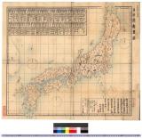
日本府県略図 : 日本府県略図

A new & correct chart of the Indian sea from Cabo Bonea Esperanca to Japan : according to Mr Edwar...

島田糸仕立方改正通知
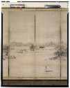
山水図屏風

Iles Kouriles, Yeso et Sakhaline

「西国第十八番京都六角堂項法寺観音平面図」「他(畳物)」
伝源頼朝像(模本)

多摩川水力電気株式会社株式募集 : 多摩川水力地点一覧図
名区小景 初編之下 : 巻3

各時代各地アクセント比較対照表

Partie du Japon. Asie no. 62. (Dresse par Ph. Vandermaelen, lithographie par H Ode. Deuxieme parti...
![Kaisei dai Nihon bizu [carte du Japon] / par Jikôan Mabuchi](https://api.europeana.eu/api/v2/thumbnail-by-url.json?uri=http%3A%2F%2Fgallica.bnf.fr%2Fark%3A%2F12148%2Fbtv1b53066779q.thumbnail.jpg&type=IMAGE)
Kaisei dai Nihon bizu [carte du Japon] / par Jikôan Mabuchi

筑後川改修図
![[下図]「能美郡分間絵図」文政五年](https://adeac.jp/items/imizu-shinminato-mus/catalog/mp105910-15100/3-1-C120v2.jpg)
[下図]「能美郡分間絵図」文政五年

千葉県治全図 安房上総一円下総八郡之内
最終更新日: 2020-06-05
登録日: 2021-07-22