Karkar, New Guinea
Markham, New Guinea
Samarai, New Guinea
Port Moresby, New Guinea
Vanimo, New Guinea
[Aerial photographs relating to the Japanese occupation of Wewak, Papua New Guinea, 1943]
![[Jamna Island, New Guinea 1944.]](https://api.europeana.eu/api/v2/thumbnail-by-url.json?uri=http%3A%2F%2Fwww.beeldbankwo2.nl%2Fcgi-bin%2Ffrsiserver.dll%2Fthumbnail%2F51361-thumb.jpg%3Ffrskey%3D51361&type=IMAGE)
[Jamna Island, New Guinea 1944.]
![[Jamna Island, New Guinea 1944.]](https://api.europeana.eu/api/v2/thumbnail-by-url.json?uri=http%3A%2F%2Fwww.beeldbankwo2.nl%2Fcgi-bin%2Ffrsiserver.dll%2Fthumbnail%2F51362-thumb.jpg%3Ffrskey%3D51362&type=IMAGE)
[Jamna Island, New Guinea 1944.]
[Aerial photographs relating to the Japanese occupation of Wewak, Papua New Guinea, 1943] (111)
[Aerial photographs relating to the Japanese occupation of Wewak, Papua New Guinea, 1943] (112)
Schetskaart van "New Guinea" (Nederlandsch Gebied) Nyūginia

Plans in south eastern part of New Guinea

New Guinea - South-East Coast. Approaches to Dedele

Plans in the south-eastern part of New Guinea

New Guinea - South Coast. Freshwater Bay to C. Blackwood
![[Dutch New Guinea - Hollandia.]](https://api.europeana.eu/api/v2/thumbnail-by-url.json?uri=http%3A%2F%2Fwww.beeldbankwo2.nl%2Fcgi-bin%2Ffrsiserver.dll%2Fthumbnail%2F51688-thumb.jpg%3Ffrskey%3D51688&type=IMAGE)
[Dutch New Guinea - Hollandia.]

Plans on the north-eastern coast of New Guinea

Pacific Ocean, Approaches to south east part of New Guinea

New Guinea - N. E. Coast. C. Ward Hunt to C. Nelson

Photographs from Papua New Guinea, mainly New Britain and New Ireland
New Guinea - Celebes and other areas
Intelligence staff from 2nd New Zealand Expeditionary Force (in the Pacific), on Nissan Island, New Guinea, ...
NZ troops preparing for commando raid on Nissan Island, New Guinea
NZ troops preparing for commando raid on Nissan Island, New Guinea
Samarai, New Guinea
Nanpōken jikyoku shigen seizu

Kaetsunousanshuugunwakeryakuezu
Karkar, New Guinea

官許飛騨国中全図
Nihyakuman-bun-no-ichi Taiheiyō shūiki (nambu) yochizu. (3)
Gōshū shūikizu : Roppyakumanbun no ichi

南側ゟ見図

寛永十年巡見使国絵図 美濃国図

山領村ノ内字五本松全図
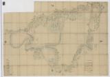
Nijūgomanbun no ichi Papua-tō Sepikku-gawa ryūiki zu (Sheet 1)
西南海瀕略図

Kaetsunousanshuugunwakeryakuezu

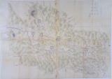
Gojūmanbunnoichi tōbu papuatō heiyō chishizu

Firefly Hunting and Thunderbolt
Rikuroaga-san / (Kūchū shashin sokuzu Rikuchi Sokuryōbu) Sanbō Honbu

「西国第十八番京都六角堂項法寺観音平面図」「他(畳物)」

小城郡村図上砥川村

貞亨三年裁許図(石橋家)
寛永十年巡見使国絵図 信濃国図

筑後川改修図
Mariana Shotō ichimei Radorōn Shotō : Kita Taiheiyō
![「[暦]」](https://archive.library.metro.tokyo.lg.jp/da/download/?id=0000000015-00215225&size=thumb&type=image&file=/浮世絵/P42-001.jpg)
「[暦]」
[Nimangosenbun no ichi chikeizu] : [Chōsen] (NJ51-2-12-4)
Last Updated: 2020-06-05
Uploaded: 2021-07-22