A new chart of the Pacific Ocean : exhibiting the western coast of America, from Cape Horn to Beerings Strait, the eastern shores of Asia including Japan, China and Australia and all the numerous islands and known dangers situated in Polynesia and Australasia / correctly drawn and regulated according to the most approved and modern surveys and astronomical observations by J.W. Norie
- Time
- Owner Organization

A New and Accurate Map of the World. Drawn from the best Surveys and regulated by Astronomical Obs...

A New Chart of The Pacific Ocean, Exhibiting The Western Coast of America, From Cape Horn To Beeri...

A New Chart of The Pacific Ocean, Exhibiting The Western Coast of America, From Cape Horn To Beeri...
A New Chart of The Pacific Ocean, Exhibiting The Western Coast of America, From Cape Horn To Beeri...

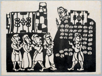
The sisters Matsukaze and Murasame on the shores of Suma

A New Chart of The Pacific Ocean, Exhibiting The Western Coast of America from Cape Horn to Beerin...

A New and Correct Chart of all the Known World Laid down according to Mercator's Projection

A New and Correct Chart of all the Known World Laid down according to Mercator's Projection

A New and Correct Chart of all the Known World Laid down according to Mercator's Projection
Asia and its several islands and regions : according to their most approved divisions with Captain Cooks new discoveries / by Thomas Kitchin, Hydrographer to His Majesty

Japan : Nipon, Kiusiu and Sikok, and a part of the coast of Korea / according to Krusenstern's Chart of 1827 ; J & C Walker sculpt

(Composite of) A New Chart of The Pacific Ocean, Exhibiting The Western Coast of America, From Cap...
Stanford's London atlas of universal geography exhibiting the physical and political divisions of the various countries of the world
The Oriental navigator, or, Directions for sailing to, from, and upon the coasts of, the East-Indies, China, Australia...To the work are prefixed a series of ... tables of the determined positions of all the principle points and places from the British seas to Cape Horn, the Cape of Good Hope, and thence to the islands of Japan, by John Purdy. (Plan of Chatham Island, &c. Whittle & Laurie, London, 1815.)

A New Map of the Whole World According To The New Observations by Moll Geographer

A Correct Sea Chart of the Whole World, According to Wright's, Commonly Called Mercator's, Project...

A Correct Sea Chart of the Whole World, According to Wright's, Commonly Called Mercator's, Project...

A new & correct chart of the Indian sea from Cabo Bonea Esperanca to Japan : according to Mr Edwar...

Johnson's China and Japan Published by A. J. Johnson, New York. 114. 115 Entered according to the ...
Samson Lifted the Doors of the Gate and Carried Them to the Top of a Hill
A new & correct chart of the Indian Sea from Cabo Bonea Esperanca to Japan according to Mr. Edward Wrights projection vulgarly called Mercators chart
The country trade East-India pilot, for the navigation of the East-Indies and oriental seas, within the limits of the East-India Company, extending from the Cape of Good Hope to China, New Holland and New Zeeland, with the Red Sea, Gulf of Persia, Bay of Bengal, and China Seas / chiefly composed from actual surveys and draughts communicated by experienced officers of the East-India Company, and from the Neptune oriental by M. d'Apres de Mannevillette
Asia and its islands according to Danville : divided into empires, kingdoms, states, regions &ca. with the European possessions and settlements in the East Indies and an exact delineation of all the discoveries made in the Eastern parts by the English under Captn. Cook

Attack made by the forts at Jih island and the south-eastern head of Liukung island and the Chinese men-of-war upon the already captured Lukeutsuy forts on the E. coast of Wei-Hai-Wei, and the Japanese army on land
Last Updated: 2020-06-05
Uploaded: 2021-07-22