China and Japan / drawn and engraved for Dr. Playfair's Geography; engraved by H. Cooper, 28 Chancery Lane

China and Japan. Drawn and Engraved for Dr. Playfair's Geography. Engraved by H. Cooper, 28 Chance...

Japan & Corea. The Illustrations by H. Warren & Engraved by J.H Kernot. The Map Drawn & Engraved b...

Japan & Corea. The Illustrations by H. Warren & Engraved by J.H Kernot. The Map Drawn & Engraved b...

China and Japan. London: Published by Henry Teesdale & Co. Drawn & Engraved by J. Dower, Pentonvil...

China and Japan. Drawn & engraved by J. Dower. London, Published by Henry Teesdale & Co. (to accom...

Corea and Japan. J. & G. Menzies sculpt., Edinr. Drawn & engraved for Thomson's New general atlas,...
A new & accurate map of Asia : drawn from the most approved modern maps & charts / by Thos. Bowen ; engraved for Middletons complete system of geography
North Pacific Ocean / compiled & drawn by J.W. Appleton ; engraved by Homewood & Son

Japan. Drawn by A. Arrowsmith. Engraved by Sidy. Hall. Published, 1817, by A Constable & Co. Edinb...
Map of Japan / by the Welcome Society ; engraved by H. Kobayashi

China and Japan by Keith Johnston, F.R.S.E. (with) Islands of Japan. Engraved & printed by W. & A....
Abel Tasman and his journal... / [by Dr. Hocken]

China, Engraved Expressly for the Standard World Atlas. (inset) Japan or Nippon

Map of the Empire of China and Japan. J.W. del. (engraved by) Stockley, Sc London, James Wyld, Cha...
The harbor of Hakodadi, Yesso Id. Japan / surveyed by order of Commodore M.C. Perry U.S.N. by Lieuts. W.L. Maury and G.H. Preble, S. Nicholson & A. Barbot in 1854 ; drawn by Edward Sels ; engraved by S. Siebert

The world. compiled and drawn by the American Geographical Society for the Department of State ; lith. A. Hoen & Co., Inc
Shah Bay, Lew Chew I. surveyed by order of Commodore M.C. Perry U.S.N. / by Lieut. W.B. Whiting and Alph. Barbot of the U.S. Ship Vandalia, J. Pope Commr. ; engraved by Selmar Siebert ; drawn by S. Bent
Western shore of the Bay of Yedo / surveyed by order of Commodore M.C. Perry U.S.N. by Lieut. Wm. L. Maury and other officers of the Japan Expedition 1854 ; drawn by Edward Sels ; engraved by Selmar Siebert

Rubbing of a transcription engraved on stone of a poem by Su Shih and purportedly written by him.(?)

The Empire of China and island of Japan, agreeable to modern history. By H Moll Geographer. (Print...
Members of 28 (Maori) Battalion in line for patriotic parcels, near Tripoli - Photograph taken by Dr C N D'A...
Cemetery containing 28 (Maori) Battalion graves, Takrouna - Photograph taken by Dr C N D'Arcy

Geographical and Statistical Map of China. China and the Tributary Kingdom of Corea. For the Eluci...
Pacific Ocean / compiled and drawn in the Cartographic Section of the National Geographic Society for the National geographic magazine ; Gilbert Grosvenor, editor ; Albert H. Bumstead, chief cartographer ; culture by James M. Darley ; physiography by Charles E. Riddiford

山梨県管内全図

Empire De La Chine, rme, De Coree et Isles Du Japon

L'empire du Japon divisé en sept principales parties, et subdivisé en soixante et six royaumes / p...

Carte D'Asie dressee pour l'usage du Roy . . . 1772 (Shows Juan de Gama Land!)

A New Map of Chinese & Independent Tartary, From The Latest Authorities . . . 1806
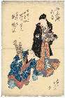
「七間人」 「たまや たかそて」
「東都八景」 「隅田川」
L'empire de la Chine : d'après l'atlas Chinois, avec les isles du Japon / par M. Bonne, Membre de la Societʹe Litteraire Militre. Ingenieur Gʹeographe &c
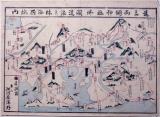
遠三両国神社佛閣道法並休泊所案内
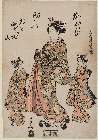
「(遊女道中)」

China and Japan

Das Chinesische Reich mit seinen Schutzstaaten (den Ländern der Mandschu und Mongolen, Ost Turkist...

Momo no eda to nigyō de asobu otokonoko

Asiae Nova Descriptio
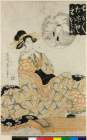
「御名残狂言」 「七役之内」「母栄妙」「岩井紫若」「五十崎久助」「嵐璃寛(初代岩井紫若(いわいしじゃく)の母栄妙(ははえいみょう)・二代嵐璃寛(あらしりかん)の五百崎(いおさき)久吉)」

L'Empire de la Chine d'après l'Atlas Chinois avec les Isles du Japon . .
Asia divided into its principall regions in which may be seen the extent of the empires, monarchies, kingdoms and states which at present divide Asia / described by Sanson ; corrected and amended by William Berry

甲斐国全図

山梨県管内全図

「〔箱根絵図〕」

Asiae Nova Descriptio

山梨県総合開発計画図

「調市長吉 尾上菊五郎」
![A New & Exact Map of Asia . . . [Shows Mythical De Gama's Land!]](https://stacks.stanford.edu/image/iiif/cw440qc5018%2F33939/full/!200,200/0/default.jpg)
A New & Exact Map of Asia . . . [Shows Mythical De Gama's Land!]
最終更新日: 2020-06-05
登録日: 2021-07-22