
Japan. Drawn by A. Arrowsmith. Engraved by Sidy. Hall. Published, 1817, by A Constable & Co. Edinb...
- People
- Time
- Owner Organization

China and Japan. London: Published by Henry Teesdale & Co. Drawn & Engraved by J. Dower, Pentonvil...
Stanford University Libraries
Stanford Libraries SearchWorks

China and Japan. Drawn & engraved by J. Dower. London, Published by Henry Teesdale & Co. (to accom...
Stanford University Libraries
Stanford Libraries SearchWorks

Japan & Corea. The Illustrations by H. Warren & Engraved by J.H Kernot. The Map Drawn & Engraved b...
Stanford University Libraries
Stanford Libraries SearchWorks

Japan & Corea. The Illustrations by H. Warren & Engraved by J.H Kernot. The Map Drawn & Engraved b...
Stanford University Libraries
Stanford Libraries SearchWorks
China and Japan / drawn and engraved for Dr. Playfair's Geography; engraved by H. Cooper, 28 Chancery Lane
National Library of Australia
Trove: National Library of Australia
North Pacific Ocean / compiled & drawn by J.W. Appleton ; engraved by Homewood & Son
National Library of Australia
Trove: National Library of Australia

China and Japan. Drawn and Engraved for Dr. Playfair's Geography. Engraved by H. Cooper, 28 Chance...
Stanford University Libraries
Stanford Libraries SearchWorks

Japan. (Published by John Conrad & Co., Philadelphia. 1804)
Stanford University Libraries
Stanford Libraries SearchWorks

China and Japan by Keith Johnston, F.R.S.E. (with) Islands of Japan. Engraved & printed by W. & A....
Stanford University Libraries
Stanford Libraries SearchWorks

A map of China : Published by K. Saito. Osaka Japan. Sole agent T. Kishida & Co. Shanghai. (inset ...
Stanford University Libraries
Stanford Libraries SearchWorks
A map of China : Published by K. Saito. Osaka Japan. Sole agent T. Kishida & Co Shanghai. (inset m...
Stanford University Libraries
Stanford Libraries SearchWorks

Johnson's China and Japan Published by Alvin J. Johnson & Co., New York 114. 115. Entered accordin...
Stanford University Libraries
Stanford Libraries SearchWorks
The harbor of Hakodadi, Yesso Id. Japan / surveyed by order of Commodore M.C. Perry U.S.N. by Lieuts. W.L. Maury and G.H. Preble, S. Nicholson & A. Barbot in 1854 ; drawn by Edward Sels ; engraved by S. Siebert
National Library of Australia
Trove: National Library of Australia
Map of Japan / by the Welcome Society ; engraved by H. Kobayashi
National Library of Australia
Trove: National Library of Australia
Craigie's map of South Australia showing towns, roads & railways / compiled, drawn & published by Kenneth Craigie & Co
National Library of Australia
Trove: National Library of Australia

Corea and Japan. J. & G. Menzies sculpt., Edinr. Drawn & engraved for Thomson's New general atlas,...
Stanford University Libraries
Stanford Libraries SearchWorks

Empire of Japan. (with) Nagasaki Harbour. Engraved by J. & C. Walker. Published under the superint...
Stanford University Libraries
Stanford Libraries SearchWorks

Rubbing of a transcription engraved on stone of a poem by Su Shih and purportedly written by him.(?)
Freer and Sackler
DPLA API
Western shore of the Bay of Yedo / surveyed by order of Commodore M.C. Perry U.S.N. by Lieut. Wm. L. Maury and other officers of the Japan Expedition 1854 ; drawn by Edward Sels ; engraved by Selmar Siebert
National Library of Australia
Trove: National Library of Australia
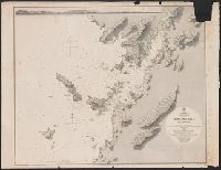
Japan Kiusiu Island, West Coast. Nagasaki Harbour, 1861 / engraved by Davies & Powell
Yale University Library
Yale University Library Digital Collections

New railway map of Tokyo and vicinity. Published by Japan Guide Map Co., Ltd. Compiled and printed...
Stanford University Libraries
Stanford Libraries SearchWorks
A new & accurate map of Asia : drawn from the most approved modern maps & charts / by Thos. Bowen ; engraved for Middletons complete system of geography
National Library of Australia
Trove: National Library of Australia
Shah Bay, Lew Chew I. surveyed by order of Commodore M.C. Perry U.S.N. / by Lieut. W.B. Whiting and Alph. Barbot of the U.S. Ship Vandalia, J. Pope Commr. ; engraved by Selmar Siebert ; drawn by S. Bent
National Library of Australia
Trove: National Library of Australia
Simoda Harbor, I. of Nippon / surveyed by order of Commodore M.C. Perry U.S.N. by Lieut. W.L. Maury, Lieut. Bent, Lieut. S. Nicholson, Act. Lieut. A. Barbot, Act. Mr. G.V. Denniston, Pd. Mdn. T.T. Houston in 1854 ; drawn by Edward Sels ; engraved by S. Siebert, lettering by C.A. Knight
National Library of Australia
Trove: National Library of Australia

Japan. London, Published Jany. 4.1825 by A. & S. Arrowsmith, No.10 Soho Square
Stanford University Libraries
Stanford Libraries SearchWorks

[Carte de la Tartarie chinoise et des îles du Japon pour servir à la lettre de Mr. d'Anville au Mr...
Bibliothèque nationale de France
Europeana API

Gomanbun no ichi Nikobaru Shotō rikukai hengōzu
Stanford University Libraries
Stanford Libraries SearchWorks
![佐渡国[北陸道図]](https://rmda.kulib.kyoto-u.ac.jp/iiif/RB00020040/RB00020040_00001_0.ptif/full/200,/0/default.jpg)
佐渡国[北陸道図]
Kyoto University Library
IIIF Discovery in Japan
![淡路国[南海道図]](https://rmda.kulib.kyoto-u.ac.jp/iiif/RB00020058/RB00020058_00001_0.ptif/full/200,/0/default.jpg)
淡路国[南海道図]
Kyoto University Library
IIIF Discovery in Japan

Gomanbunnoichi chikeizu Kaimondake
Stanford University Libraries
Stanford Libraries SearchWorks

Sheet 16. Ryukyu
Stanford University Libraries
Stanford Libraries SearchWorks

Japan. Masstab 1:5,000,000. Sept. 1905. (insets: nebenkarten) Riu-Kiu In. I, Tsubu Schoto II, Namb...
Stanford University Libraries
Stanford Libraries SearchWorks
![[歴民カード_考古] 鉄鎌](http://khirin-i.rekihaku.ac.jp/iiif/nmjh_rekimin_a/21148027_02.tif/full/200,/0/default.jpg)
[歴民カード_考古] 鉄鎌
National Museum of Japanese History
IIIF Discovery in Japan
A map of China : Published by K. Saito. Osaka Japan. Sole agent T. Kishida & Co. Shanghai. (inset ...
Stanford University Libraries
Stanford Libraries SearchWorks
A map of China : Published by K. Saito. Osaka Japan. Sole agent T. Kishida & Co Shanghai. (inset m...
Stanford University Libraries
Stanford Libraries SearchWorks
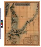
蝦夷闔境輿地全図 : 蝦夷闔境輿地全図
Iwase Bunko Libray
ADEAC: A System of Digitalization and Exhibition for Archive Collections

Carte des isles du Iapon esquelles est remarqué la route tant par mer que par terre que tiennent l...
Bibliothèque nationale de France
Europeana API

Japan. (inset) Plan of Yeddo Bay
Stanford University Libraries
Stanford Libraries SearchWorks
![Japan [cartographic material] : Kyushu north coast](https://stacks.stanford.edu/image/iiif/gy001xy3796%2Fgy001xy3796_00_0001/full/!200,200/0/default.jpg)
Japan [cartographic material] : Kyushu north coast
Stanford University Libraries
Stanford Libraries SearchWorks
![[歴民カード_歴史] 鳥居絵馬](https://khirin-i.rekihaku.ac.jp/iiif/nmjh_rekimin_h/10748019_02.tif/full/200,/0/default.jpg)
[歴民カード_歴史] 鳥居絵馬
National Museum of Japanese History
IIIF Discovery in Japan
![[歴民カード_考古] 岩偶](http://khirin-i.rekihaku.ac.jp/iiif/nmjh_rekimin_a/24649011_02.tif/full/200,/0/default.jpg)
[歴民カード_考古] 岩偶
National Museum of Japanese History
IIIF Discovery in Japan

Tō "So" jūmanbun no ichizu
Stanford University Libraries
Stanford Libraries SearchWorks

Japan
Stanford University Libraries
Stanford Libraries SearchWorks
![Yōzu (kūchū shashin sokuryō) Naka Shina gomanbun no ichi [cartographic material]](https://stacks.stanford.edu/image/iiif/dc571mm1897%2Fdc571mm1897_00_0001/full/!200,200/0/default.jpg)
Yōzu (kūchū shashin sokuryō) Naka Shina gomanbun no ichi [cartographic material]
Stanford University Libraries
Stanford Libraries SearchWorks

Japan distribution of waterworks
Stanford University Libraries
Stanford Libraries SearchWorks
The entrance of Nangasacqui the chief port of the island of Kiusiu in the Kingdom of Japan from the manuscript chart of the Dutch East India Company
National Library of Australia
Trove: National Library of Australia
![Japan [cartographic material] : railroads and railroad facilities](https://stacks.stanford.edu/image/iiif/yv242dj2410%2Fyv242dj2410_00_0001/full/!200,200/0/default.jpg)
Japan [cartographic material] : railroads and railroad facilities
Stanford University Libraries
Stanford Libraries SearchWorks
Otogibanashihakatanoimaori
University of Tokyo Graduate School of Arts and Sciences / College of Liberal Arts
UTokyo Academic Archives Portal
Last Updated: 2020-04-17
Uploaded: 2021-09-21